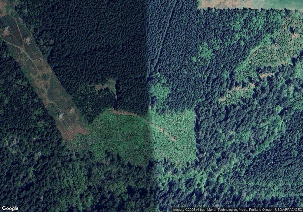
8599 SE Groce Rd Corbett, OR 97019
Estimated Value: $423,000 - $1,000,005
2
Beds
--
Bath
640
Sq Ft
$1,115/Sq Ft
Est. Value
About This Home
This home is located at 8599 SE Groce Rd, Corbett, OR 97019 and is currently estimated at $713,335, approximately $1,114 per square foot. 8599 SE Groce Rd is a home located in Clackamas County with nearby schools including Firwood Elementary School, Cedar Ridge Middle School, and Sandy High School.
Ownership History
Date
Name
Owned For
Owner Type
Purchase Details
Closed on
Dec 13, 2024
Sold by
Witt Marliss Aldene and Lockwood Larry Milton
Bought by
Diamond L Tree Farm Llc
Current Estimated Value
Purchase Details
Closed on
Nov 12, 2024
Sold by
Witt Marliss Aldene
Bought by
Marliss L Witt Trust and Witt
Purchase Details
Closed on
Jul 16, 2024
Sold by
Lockwood Daniel Ralph
Bought by
Lockwood Elise N
Purchase Details
Closed on
Jan 28, 2014
Sold by
Witt Marliss Aldene and Lockwood Larry Milton
Bought by
Witt Marliss Aldene and Lockwood Larry Milton
Create a Home Valuation Report for This Property
The Home Valuation Report is an in-depth analysis detailing your home's value as well as a comparison with similar homes in the area
Home Values in the Area
Average Home Value in this Area
Purchase History
| Date | Buyer | Sale Price | Title Company |
|---|---|---|---|
| Diamond L Tree Farm Llc | -- | None Listed On Document | |
| Diamond L Tree Farm Llc | -- | None Listed On Document | |
| Marliss L Witt Trust | -- | None Listed On Document | |
| Lockwood Elise N | -- | None Listed On Document | |
| Witt Marliss Aldene | -- | None Available |
Source: Public Records
Tax History Compared to Growth
Tax History
| Year | Tax Paid | Tax Assessment Tax Assessment Total Assessment is a certain percentage of the fair market value that is determined by local assessors to be the total taxable value of land and additions on the property. | Land | Improvement |
|---|---|---|---|---|
| 2024 | $1,241 | $77,704 | -- | -- |
| 2023 | $1,241 | $75,573 | $0 | $0 |
| 2022 | $1,083 | $73,466 | $0 | $0 |
| 2021 | $1,064 | $71,394 | $0 | $0 |
| 2020 | $1,011 | $69,414 | $0 | $0 |
| 2019 | $1,038 | $67,535 | $0 | $0 |
| 2018 | $980 | $65,752 | $0 | $0 |
| 2017 | $972 | $63,926 | $0 | $0 |
| 2016 | $943 | $62,188 | $0 | $0 |
| 2015 | $920 | $60,479 | $0 | $0 |
| 2014 | $895 | $58,864 | $0 | $0 |
Source: Public Records
Map
Nearby Homes
- 9080 SE Bull Run Rd
- 11495 SE Lusted Rd
- 11010 SE Green Valley Rd
- 40805 SE Latigo Ln
- 44001 SE Trout Creek Rd
- 38631 SE Hudson Rd
- 37330 SE Dodge Park Blvd
- 0 SE Gordon Creek Rd
- 44750 SE Phelps Rd
- 10827 SE 362nd Ave
- 11261 SE 362nd Ave
- 10625 SE 362nd Ave Unit B-7
- 0 SE Herrick Rd Unit 104416805
- 36280 SE Hauglum Rd
- 43144 SE Deverell Rd
- 2536 SE Mannthey Rd
- 35649 SE Lusted Rd
- 2524 SE Mannthey Rd
- 14950 SE Bluff Rd
- 35319 SE Hauglum Rd
- 8585 SE Groce Rd
- 8510 SE Groce Rd
- 8245 SE Groce Rd
- 8421 SE Groce Rd
- 8310 SE Groce Rd
- 8415 SE Groce Rd
- 15180 SE Kampa Ln
- 0 SE Groce Rd
- 8221 SE Groce Rd
- 42400 SE Gordon Creek Rd
- 8521 SE Bull Run Rd
- 41770 SE Gordon Creek Rd
- 42100 SE Gordon Creek Rd
- 42211 SE Gordon Creek Rd
- 42401 SE Gordon Creek Rd
- 42711 SE Hogue Mill Rd
- 41800 SE Gordon Creek Rd
- 43003 SE Gordon Creek Rd
- 41532 SE Gordon Creek Rd
- 42745 SE Elsner Rd
