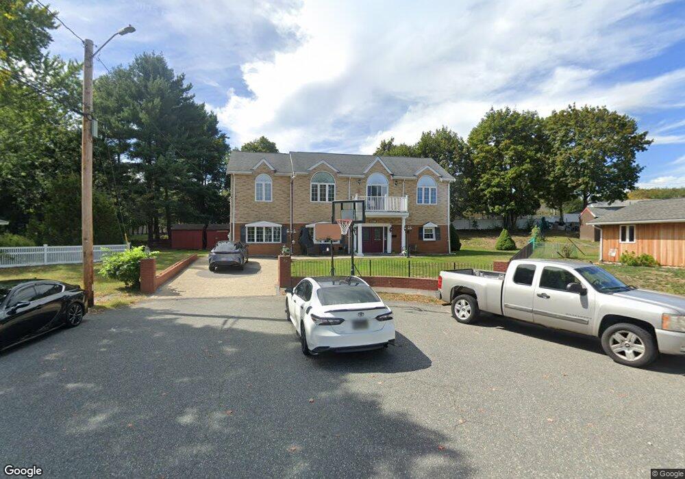
86 Alfred Rd Braintree, MA 02184
North Braintree NeighborhoodEstimated Value: $863,000 - $1,149,000
5
Beds
4
Baths
3,040
Sq Ft
$334/Sq Ft
Est. Value
About This Home
This home is located at 86 Alfred Rd, Braintree, MA 02184 and is currently estimated at $1,015,592, approximately $334 per square foot. 86 Alfred Rd is a home located in Norfolk County with nearby schools including Braintree High School, Sacred Heart Elementary School, and South Shore SDA School.
Ownership History
Date
Name
Owned For
Owner Type
Purchase Details
Closed on
Aug 1, 2008
Sold by
Battles Carol E and Nardone Nancy F
Bought by
Khan Naseem and Khan Zohra
Current Estimated Value
Home Financials for this Owner
Home Financials are based on the most recent Mortgage that was taken out on this home.
Original Mortgage
$240,000
Interest Rate
6.47%
Mortgage Type
Purchase Money Mortgage
Purchase Details
Closed on
Jun 28, 1996
Sold by
Simpson Mark J and Simpson Lisa M
Bought by
Gray Robert G and Gray Nancy M
Purchase Details
Closed on
Jun 7, 1991
Sold by
Ursino Francesco S and Ursino Vincenza M
Bought by
Simpson Mark J and Simpson Lisa M
Purchase Details
Closed on
Mar 24, 1989
Sold by
Est Frye William H
Bought by
Ursino Francesco S
Create a Home Valuation Report for This Property
The Home Valuation Report is an in-depth analysis detailing your home's value as well as a comparison with similar homes in the area
Home Values in the Area
Average Home Value in this Area
Purchase History
| Date | Buyer | Sale Price | Title Company |
|---|---|---|---|
| Khan Naseem | $300,000 | -- | |
| Gray Robert G | $162,500 | -- | |
| Simpson Mark J | $155,000 | -- | |
| Ursino Francesco S | $145,000 | -- | |
| Khan Naseem | $300,000 | -- | |
| Gray Robert G | $162,500 | -- | |
| Simpson Mark J | $155,000 | -- | |
| Ursino Francesco S | $145,000 | -- |
Source: Public Records
Mortgage History
| Date | Status | Borrower | Loan Amount |
|---|---|---|---|
| Open | Ursino Francesco S | $239,000 | |
| Closed | Khan Naseem | $240,000 |
Source: Public Records
Tax History
| Year | Tax Paid | Tax Assessment Tax Assessment Total Assessment is a certain percentage of the fair market value that is determined by local assessors to be the total taxable value of land and additions on the property. | Land | Improvement |
|---|---|---|---|---|
| 2025 | $8,337 | $835,400 | $360,200 | $475,200 |
| 2024 | $7,465 | $787,400 | $327,000 | $460,400 |
| 2023 | $7,121 | $729,600 | $293,800 | $435,800 |
| 2022 | $6,977 | $701,200 | $265,400 | $435,800 |
| 2021 | $6,478 | $651,100 | $239,800 | $411,300 |
| 2020 | $6,205 | $629,300 | $218,000 | $411,300 |
| 2019 | $5,788 | $573,600 | $208,500 | $365,100 |
| 2018 | $5,692 | $540,000 | $189,600 | $350,400 |
| 2017 | $5,540 | $515,800 | $180,100 | $335,700 |
| 2016 | $5,343 | $486,600 | $170,600 | $316,000 |
| 2015 | $4,937 | $446,000 | $142,200 | $303,800 |
| 2014 | $3,433 | $300,600 | $136,500 | $164,100 |
Source: Public Records
Map
Nearby Homes
- 29 Joseph Rd
- 87 Walnut St
- 63 Dickerman Ln
- 491 Washington St Unit 1
- 469-471 Washington St
- 15 Calvin St
- 20 Blossom Rd
- 9 Independence Ave Unit 102
- 9 Independence Ave Unit 307
- 7 Del's Way
- 47 Addison St
- 20 Vine St
- 17 White Rd
- 21 Totman St Unit 205
- 21 Totman St Unit 409
- 21 Totman St Unit 203
- 21 Totman St Unit 403
- 21 Totman St Unit 301
- 21 Totman St Unit 208
- 21 Totman St Unit PH-405
Your Personal Tour Guide
Ask me questions while you tour the home.