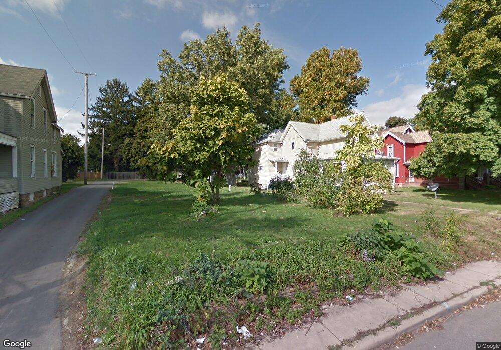
86 Bartley Ave Mansfield, OH 44906
Estimated Value: $143,000 - $170,000
Studio
1
Bath
--
Sq Ft
9,496
Sq Ft
About This Home
This home is located at 86 Bartley Ave, Mansfield, OH 44906 and is currently estimated at $155,333. 86 Bartley Ave is a home located in Richland County with nearby schools including Goal Digital Academy, St. Peter's Elementary/Montessori School, and Discovery School.
Ownership History
Date
Name
Owned For
Owner Type
Purchase Details
Closed on
Oct 21, 2014
Sold by
Richland County Land Reutilization Corpo
Bought by
Saprano Sue Ann
Current Estimated Value
Purchase Details
Closed on
Sep 9, 2014
Sold by
State Of Ohio
Bought by
Richland County Land Reutilization Corpo
Purchase Details
Closed on
Aug 13, 2004
Sold by
Parsons Ronald K and Parsons Wendy A
Bought by
Fisher Brian J and Fisher Kelly
Home Financials for this Owner
Home Financials are based on the most recent Mortgage that was taken out on this home.
Original Mortgage
$15,600
Interest Rate
6.1%
Mortgage Type
Purchase Money Mortgage
Create a Home Valuation Report for This Property
The Home Valuation Report is an in-depth analysis detailing your home's value as well as a comparison with similar homes in the area
Home Values in the Area
Average Home Value in this Area
Purchase History
| Date | Buyer | Sale Price | Title Company |
|---|---|---|---|
| Saprano Sue Ann | -- | None Available | |
| Richland County Land Reutilization Corpo | -- | None Available | |
| Fisher Brian J | $26,000 | Park Place Title Agency |
Source: Public Records
Mortgage History
| Date | Status | Borrower | Loan Amount |
|---|---|---|---|
| Previous Owner | Fisher Brian J | $15,600 |
Source: Public Records
Tax History
| Year | Tax Paid | Tax Assessment Tax Assessment Total Assessment is a certain percentage of the fair market value that is determined by local assessors to be the total taxable value of land and additions on the property. | Land | Improvement |
|---|---|---|---|---|
| 2024 | $78 | $1,630 | $1,630 | $0 |
| 2023 | $78 | $1,630 | $1,630 | $0 |
| 2022 | $76 | $1,330 | $1,330 | $0 |
| 2021 | $76 | $1,330 | $1,330 | $0 |
| 2020 | $78 | $1,330 | $1,330 | $0 |
| 2019 | $87 | $1,330 | $1,330 | $0 |
| 2018 | $86 | $1,330 | $1,330 | $0 |
| 2017 | $87 | $1,330 | $1,330 | $0 |
| 2016 | $91 | $1,410 | $1,410 | $0 |
| 2015 | $91 | $1,410 | $1,410 | $0 |
| 2014 | $240 | $4,030 | $4,030 | $0 |
| 2012 | $818 | $18,050 | $5,310 | $12,740 |
Source: Public Records
Map
Nearby Homes
- 31 Bartley Ave
- 30 Douglas Ave
- 158 Vennum Ave
- 133 Stewart Ave S
- 108 Stewart Ave S
- 116 Stewart Ave S
- 24 Stewart Ave S
- 189 Westwood Ave
- 487 Davey Ave
- 119 Carpenter Rd
- 458 W West Dickson Ave
- 81 Penn Ave
- 455 Marion Ave
- 135 Wood St
- 282 Vennum Ave
- 131 Sturges Ave
- 129 Fairlawn Ave
- 135 Fairlawn Ave
- 143 Fairlawn Ave
- 212 Penn Ave
- 90 Bartley Ave
- 82 Bartley Ave
- 87 Bartley Ave
- 280 Marion Ave
- 1 Constance Ct
- 272 Marion Ave
- 288 Marion Ave
- 282 Marion Ave
- 70 Bartley Ave
- 81 Bartley Ave
- 73 Bartley Ave
- 75 Bartley Ave
- 66 Bartley Ave
- 64 Bartley Ave Unit 66
- 89 Sherman Ave
- 67 Bartley Ave Unit 69
- 99 Sherman Ave
- 256 Marion Ave
- 65 Bartley Ave
- 254 Marion Ave
Your Personal Tour Guide
Ask me questions while you tour the home.