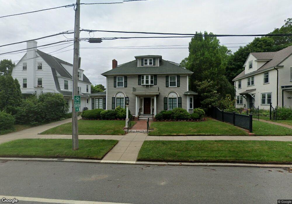
86 Blackstone Blvd Providence, RI 02906
Blackstone NeighborhoodEstimated Value: $1,106,000 - $1,449,000
4
Beds
3
Baths
2,196
Sq Ft
$567/Sq Ft
Est. Value
About This Home
This home is located at 86 Blackstone Blvd, Providence, RI 02906 and is currently estimated at $1,244,444, approximately $566 per square foot. 86 Blackstone Blvd is a home located in Providence County with nearby schools including Asa Messer Elementary School, Charles N. Fortes Elementary School, and Robert L. Bailey IV Elementary.
Ownership History
Date
Name
Owned For
Owner Type
Purchase Details
Closed on
Oct 30, 2023
Sold by
John E Corrigan T E and John Corrigan
Bought by
Corrigan John E
Current Estimated Value
Purchase Details
Closed on
Jan 24, 2013
Sold by
Corrigan John E
Bought by
John E Corrigan T E and John Corrigan
Create a Home Valuation Report for This Property
The Home Valuation Report is an in-depth analysis detailing your home's value as well as a comparison with similar homes in the area
Home Values in the Area
Average Home Value in this Area
Purchase History
| Date | Buyer | Sale Price | Title Company |
|---|---|---|---|
| Corrigan John E | -- | None Available | |
| John E Corrigan T E | -- | -- |
Source: Public Records
Tax History Compared to Growth
Tax History
| Year | Tax Paid | Tax Assessment Tax Assessment Total Assessment is a certain percentage of the fair market value that is determined by local assessors to be the total taxable value of land and additions on the property. | Land | Improvement |
|---|---|---|---|---|
| 2025 | $11,085 | $1,319,700 | $797,700 | $522,000 |
| 2024 | $16,671 | $908,500 | $396,800 | $511,700 |
| 2023 | $16,671 | $908,500 | $396,800 | $511,700 |
| 2022 | $16,171 | $908,500 | $396,800 | $511,700 |
| 2021 | $17,204 | $700,500 | $296,000 | $404,500 |
| 2020 | $17,204 | $700,500 | $296,000 | $404,500 |
| 2019 | $17,204 | $700,500 | $296,000 | $404,500 |
| 2018 | $19,818 | $620,100 | $254,100 | $366,000 |
| 2017 | $19,818 | $620,100 | $254,100 | $366,000 |
| 2016 | $19,818 | $620,100 | $254,100 | $366,000 |
| 2015 | $19,503 | $589,200 | $269,100 | $320,100 |
| 2014 | $19,886 | $589,200 | $269,100 | $320,100 |
| 2013 | $19,886 | $589,200 | $269,100 | $320,100 |
Source: Public Records
Map
Nearby Homes
- 234 President Ave Unit 16
- 184 Irving Ave Unit 1
- 141 Elton St
- 134 Irving Ave
- 189 Laurel Ave Unit 189
- 160 Slater Ave
- 188 Blackstone Blvd
- 22 Miles Ave Unit 1
- 537 Angell St Unit 3
- 125 Taber Ave
- 80 Clarendon Ave
- 30 S Angell St Unit 2
- 140 Freeman Pkwy
- 19 S Angell St Unit 2
- 41 Taber Ave
- 228 Medway St
- 20 Taber Ave
- 294 Cole Ave
- 296 Cole Ave
- 201 Arlington Ave
- 560 Lloyd Ave
- 90 Blackstone Blvd
- 43 Slater Ave
- 94 Blackstone Blvd
- 548 Lloyd Ave
- 47 Slater Ave
- 102 Blackstone Blvd Unit 2
- 102 Blackstone Blvd Unit 3
- 102 Blackstone Blvd Unit 4
- 102 Blackstone Blvd Unit 6
- 102 Blackstone Blvd Unit 5
- 102 Blackstone Blvd Unit 1
- 102 Blackstone Blvd Unit 1024
- 51 Slater Ave
- 555 Lloyd Ave
- 553 Lloyd Ave
- 553 Lloyd Ave Unit 2
- 61 Slater Ave Unit 11
- 61 Slater Ave Unit 7
- 61 Slater Ave