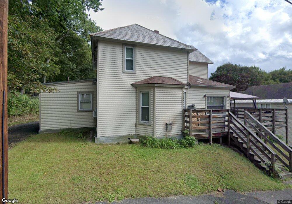
86 Cady St North Adams, MA 01247
Estimated Value: $212,000 - $251,000
3
Beds
1
Bath
1,416
Sq Ft
$164/Sq Ft
Est. Value
About This Home
This home is located at 86 Cady St, North Adams, MA 01247 and is currently estimated at $232,306, approximately $164 per square foot. 86 Cady St is a home located in Berkshire County with nearby schools including Greylock Elementary School and Drury High School.
Ownership History
Date
Name
Owned For
Owner Type
Purchase Details
Closed on
Jun 22, 2006
Sold by
Hebert Todd M
Bought by
Hebert Nancy A and Hebert Todd M
Current Estimated Value
Purchase Details
Closed on
Aug 31, 2001
Sold by
Wlodyka Linda C
Bought by
Hebert Todd M
Home Financials for this Owner
Home Financials are based on the most recent Mortgage that was taken out on this home.
Original Mortgage
$15,600
Interest Rate
7.06%
Mortgage Type
Purchase Money Mortgage
Create a Home Valuation Report for This Property
The Home Valuation Report is an in-depth analysis detailing your home's value as well as a comparison with similar homes in the area
Home Values in the Area
Average Home Value in this Area
Purchase History
| Date | Buyer | Sale Price | Title Company |
|---|---|---|---|
| Hebert Nancy A | -- | -- | |
| Hebert Todd M | $78,000 | -- | |
| Hebert Nancy A | -- | -- | |
| Hebert Todd M | $78,000 | -- |
Source: Public Records
Mortgage History
| Date | Status | Borrower | Loan Amount |
|---|---|---|---|
| Open | Hebert Todd M | $40,000 | |
| Previous Owner | Hebert Todd M | $15,600 | |
| Previous Owner | Hebert Todd M | $15,000 |
Source: Public Records
Tax History Compared to Growth
Tax History
| Year | Tax Paid | Tax Assessment Tax Assessment Total Assessment is a certain percentage of the fair market value that is determined by local assessors to be the total taxable value of land and additions on the property. | Land | Improvement |
|---|---|---|---|---|
| 2025 | $3,454 | $206,700 | $34,300 | $172,400 |
| 2024 | $3,243 | $189,200 | $31,400 | $157,800 |
| 2023 | $3,133 | $177,300 | $31,400 | $145,900 |
| 2022 | $2,835 | $153,000 | $31,400 | $121,600 |
| 2021 | $2,633 | $141,500 | $29,000 | $112,500 |
| 2020 | $2,523 | $135,500 | $28,900 | $106,600 |
| 2019 | $2,349 | $122,900 | $28,900 | $94,000 |
| 2018 | $2,253 | $122,600 | $30,400 | $92,200 |
| 2017 | $2,145 | $121,400 | $30,100 | $91,300 |
| 2016 | $2,080 | $119,600 | $30,100 | $89,500 |
| 2015 | $2,014 | $120,700 | $31,100 | $89,600 |
Source: Public Records
Map
Nearby Homes
- 50 1/2 Williams St
- 24 Bryant St
- 166 Houghton St
- 0 River St
- 137 Bracewell Ave
- 70-72 Chase Ave
- 16 Forrest St
- 51 Bracewell Ave
- 333 Eagle St
- 33-35 Hall St
- 26 Charles St
- 19 Fairgrounds Ave
- 450 N Eagle St
- 24 Franklin St
- 22 Marietta St
- 54 Marietta St
- 20 Marietta St
- 19 N Church St Unit 12
- 19 N Church St Unit 14
- 19 N Church St Unit 11