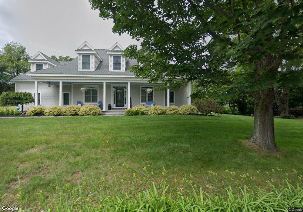
86 Carleton Rd Millbury, MA 01527
Estimated Value: $999,815 - $1,322,000
4
Beds
3
Baths
2,240
Sq Ft
$514/Sq Ft
Est. Value
About This Home
This home is located at 86 Carleton Rd, Millbury, MA 01527 and is currently estimated at $1,151,454, approximately $514 per square foot. 86 Carleton Rd is a home located in Worcester County with nearby schools including Elmwood Street Elementary School, Raymond E. Shaw Elementary School, and Millbury Junior/Senior High School.
Ownership History
Date
Name
Owned For
Owner Type
Purchase Details
Closed on
Dec 26, 2012
Sold by
Walter J Koza Ret
Bought by
Doyle Kevin M and Doyle Sharon L
Current Estimated Value
Home Financials for this Owner
Home Financials are based on the most recent Mortgage that was taken out on this home.
Original Mortgage
$330,000
Outstanding Balance
$229,557
Interest Rate
3.38%
Mortgage Type
New Conventional
Estimated Equity
$921,897
Purchase Details
Closed on
Aug 17, 2011
Sold by
Fhlmc
Bought by
Koza Walter
Purchase Details
Closed on
Oct 21, 2005
Sold by
Robbins Eleanor E and Cronan Wendy A
Bought by
Cronan Dorcas A and Cronan Glen H
Purchase Details
Closed on
Sep 24, 2001
Sold by
Robbins Eleanor E
Bought by
Cronan Glen H and Cronan Dorcas A
Create a Home Valuation Report for This Property
The Home Valuation Report is an in-depth analysis detailing your home's value as well as a comparison with similar homes in the area
Home Values in the Area
Average Home Value in this Area
Purchase History
| Date | Buyer | Sale Price | Title Company |
|---|---|---|---|
| Doyle Kevin M | $555,000 | -- | |
| Koza Walter | $92,500 | -- | |
| Cronan Dorcas A | $5,000 | -- | |
| Cronan Glen H | $100,000 | -- |
Source: Public Records
Mortgage History
| Date | Status | Borrower | Loan Amount |
|---|---|---|---|
| Open | Cronan Glen H | $100,000 | |
| Open | Doyle Kevin M | $330,000 | |
| Previous Owner | Cronan Glen H | $15,200 |
Source: Public Records
Tax History
| Year | Tax Paid | Tax Assessment Tax Assessment Total Assessment is a certain percentage of the fair market value that is determined by local assessors to be the total taxable value of land and additions on the property. | Land | Improvement |
|---|---|---|---|---|
| 2025 | $13,462 | $1,005,400 | $139,200 | $866,200 |
| 2024 | $12,377 | $935,500 | $129,100 | $806,400 |
| 2023 | $11,242 | $778,000 | $91,300 | $686,700 |
| 2022 | $10,905 | $727,000 | $91,300 | $635,700 |
| 2021 | $0 | $683,500 | $91,300 | $592,200 |
| 2020 | $5,889 | $663,100 | $91,300 | $571,800 |
| 2019 | $10,605 | $669,100 | $90,800 | $578,300 |
| 2018 | $0 | $779,000 | $90,800 | $688,200 |
| 2017 | $0 | $606,900 | $94,700 | $512,200 |
| 2016 | $8,625 | $586,100 | $94,700 | $491,400 |
| 2015 | $9,534 | $579,200 | $100,400 | $478,800 |
| 2014 | $8,668 | $506,900 | $100,400 | $406,500 |
Source: Public Records
Map
Nearby Homes
- 303 W Main St
- 0 Auburn Rd
- 196 Horne Way Unit 196
- 100 Horne Way
- 6 George St
- 61 School St
- 0 W Main St
- 37 Sutton Rd
- 11 Laurel Dr
- 152 W Main St Unit A
- 29 Winwood Rd
- 751 Washington St Unit 43A
- 38 W Main St
- 634 Oxford St S
- 2 Victoria Dr Unit 1
- 0 Worcester Providence Turnpike
- 124 Worcester Providence Turnpike
- 128 Worcester Providence Turnpike
- 168 Burbank Rd
- 8 Sycamore Cir
Your Personal Tour Guide
Ask me questions while you tour the home.