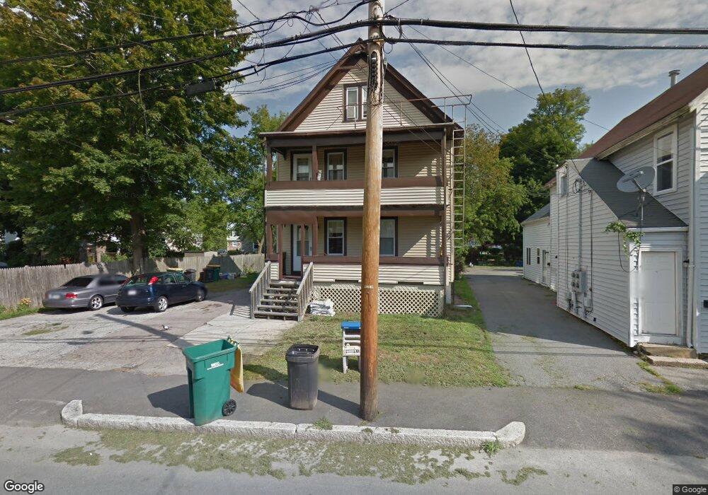
86 Fisher St North Attleboro, MA 02760
North Attleboro NeighborhoodEstimated Value: $494,000 - $596,000
5
Beds
3
Baths
1,888
Sq Ft
$294/Sq Ft
Est. Value
About This Home
This home is located at 86 Fisher St, North Attleboro, MA 02760 and is currently estimated at $555,333, approximately $294 per square foot. 86 Fisher St is a home located in Bristol County with nearby schools including North Attleboro High School.
Ownership History
Date
Name
Owned For
Owner Type
Purchase Details
Closed on
Oct 9, 2001
Sold by
N High Rt
Bought by
Kusimo Segun
Current Estimated Value
Home Financials for this Owner
Home Financials are based on the most recent Mortgage that was taken out on this home.
Original Mortgage
$205,498
Outstanding Balance
$80,439
Interest Rate
6.89%
Mortgage Type
Purchase Money Mortgage
Estimated Equity
$474,894
Purchase Details
Closed on
Jun 30, 1999
Sold by
Cooper Darlene M
Bought by
North High Rt
Home Financials for this Owner
Home Financials are based on the most recent Mortgage that was taken out on this home.
Original Mortgage
$105,600
Interest Rate
7.19%
Mortgage Type
Purchase Money Mortgage
Create a Home Valuation Report for This Property
The Home Valuation Report is an in-depth analysis detailing your home's value as well as a comparison with similar homes in the area
Home Values in the Area
Average Home Value in this Area
Purchase History
| Date | Buyer | Sale Price | Title Company |
|---|---|---|---|
| Kusimo Segun | $187,500 | -- | |
| North High Rt | $132,000 | -- |
Source: Public Records
Mortgage History
| Date | Status | Borrower | Loan Amount |
|---|---|---|---|
| Open | North High Rt | $205,498 | |
| Previous Owner | North High Rt | $105,600 |
Source: Public Records
Tax History Compared to Growth
Tax History
| Year | Tax Paid | Tax Assessment Tax Assessment Total Assessment is a certain percentage of the fair market value that is determined by local assessors to be the total taxable value of land and additions on the property. | Land | Improvement |
|---|---|---|---|---|
| 2025 | $4,264 | $361,700 | $109,000 | $252,700 |
| 2024 | $4,174 | $361,700 | $109,000 | $252,700 |
| 2023 | $4,361 | $341,000 | $109,000 | $232,000 |
| 2022 | $4,083 | $293,100 | $103,600 | $189,500 |
| 2021 | $4,073 | $285,400 | $98,100 | $187,300 |
| 2020 | $3,288 | $229,100 | $92,700 | $136,400 |
| 2019 | $3,183 | $223,500 | $84,200 | $139,300 |
| 2018 | $2,916 | $218,600 | $79,300 | $139,300 |
| 2017 | $2,632 | $199,100 | $74,300 | $124,800 |
| 2016 | $2,787 | $210,800 | $99,100 | $111,700 |
| 2015 | $2,636 | $200,600 | $99,100 | $101,500 |
| 2014 | $2,614 | $197,400 | $93,000 | $104,400 |
Source: Public Records
Map
Nearby Homes
- 68 Fisher St
- 188 Smith St
- 8 Al Pace Dr Unit 8
- 212 Fisher St Unit A5
- 0 Landry 2nd Unit 73350867
- 880 Landry Ave Unit 2
- 217 Fisher St
- 64 Smith St
- 9 Leonard St
- 42 2nd Ave Unit 24
- 19 Church St Unit A5
- 16 Richards Ave Unit 106
- 32 Richards Ave
- 20 South St
- 20 Holbrook Ave
- 85 Richards Ave
- 58 Jay St
- 35-R Whiting St
- 711 Mount Hope St Unit 7
- 711 Mount Hope St Unit 6
- 86 Fisher St Unit 1
- 90 Fisher St
- 76 Fisher St
- 92-94 Fisher St
- 94 Fisher St Unit 2
- 94 Fisher St
- 92-94 Fisher St Unit 3
- 92-94 Fisher St Unit 2
- 92-94 Fisher St Unit 1
- 92 Fisher St Unit 94
- 31 River St
- 27 River St
- 72 Fisher St
- 37 River St
- 96 Fisher St Unit 98
- 96-98 Fisher St Unit 3
- 96-98 Fisher St Unit 1
- 98 Fisher St Unit 3
- 96 Fisher St Unit 1
- 96 Fisher St Unit 2