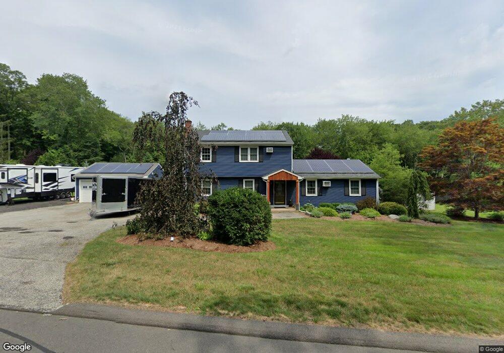
86 Gunger Hill Rd Higganum, CT 06441
Estimated Value: $421,000 - $549,000
4
Beds
2
Baths
2,002
Sq Ft
$235/Sq Ft
Est. Value
About This Home
This home is located at 86 Gunger Hill Rd, Higganum, CT 06441 and is currently estimated at $470,909, approximately $235 per square foot. 86 Gunger Hill Rd is a home located in Middlesex County with nearby schools including Haddam-Killingworth High School.
Ownership History
Date
Name
Owned For
Owner Type
Purchase Details
Closed on
Sep 12, 2019
Sold by
Johnson Patricia S
Bought by
Revis Karen J and Revis William
Current Estimated Value
Purchase Details
Closed on
Jul 21, 1997
Sold by
Moodus Sb
Bought by
Johnson Patricia S and Revis Karen J
Home Financials for this Owner
Home Financials are based on the most recent Mortgage that was taken out on this home.
Original Mortgage
$128,000
Interest Rate
8.38%
Mortgage Type
Unknown
Create a Home Valuation Report for This Property
The Home Valuation Report is an in-depth analysis detailing your home's value as well as a comparison with similar homes in the area
Home Values in the Area
Average Home Value in this Area
Purchase History
| Date | Buyer | Sale Price | Title Company |
|---|---|---|---|
| Revis Karen J | -- | -- | |
| Johnson Patricia S | $144,000 | -- |
Source: Public Records
Mortgage History
| Date | Status | Borrower | Loan Amount |
|---|---|---|---|
| Previous Owner | Johnson Patricia S | $75,000 | |
| Previous Owner | Johnson Patricia S | $128,000 | |
| Previous Owner | Johnson Patricia S | $18,000 |
Source: Public Records
Tax History Compared to Growth
Tax History
| Year | Tax Paid | Tax Assessment Tax Assessment Total Assessment is a certain percentage of the fair market value that is determined by local assessors to be the total taxable value of land and additions on the property. | Land | Improvement |
|---|---|---|---|---|
| 2025 | $5,624 | $163,740 | $60,800 | $102,940 |
| 2024 | $5,624 | $163,740 | $60,800 | $102,940 |
| 2023 | $5,546 | $163,740 | $60,800 | $102,940 |
| 2022 | $5,294 | $163,740 | $60,800 | $102,940 |
| 2021 | $5,266 | $163,740 | $60,800 | $102,940 |
| 2020 | $5,117 | $161,480 | $69,950 | $91,530 |
| 2019 | $5,117 | $161,480 | $69,950 | $91,530 |
| 2018 | $5,117 | $161,480 | $69,950 | $91,530 |
| 2017 | $5,117 | $161,480 | $69,950 | $91,530 |
| 2016 | $5,038 | $161,480 | $69,950 | $91,530 |
| 2015 | $5,691 | $182,400 | $69,950 | $112,450 |
| 2014 | $5,634 | $182,400 | $69,950 | $112,450 |
Source: Public Records
Map
Nearby Homes
- 45 Summersweet Dr
- 3 Copley Rd
- 82 Harvest Woods Ln
- 279 Pokorny Rd
- 0 S Dish Mill Rd Unit 24082788
- 8 Little City Rd
- 82 Jacoby Rd
- 34 Skunk Misery Rd
- 16 Hidden Lake Rd
- 63 Laurel Grove Dr
- 52 Sima Rd
- Lots 1 & 2 Jackson Rd
- 209 Wiese Albert Rd
- 28 Fieldstone Ln
- 521 Foot Hills Rd
- 206 Little City Rd
- 882 Killingworth Rd
- 8 Neffs Corner Rd
- 16 Devonshire Ln
- 12 Jackson Rd
- 78 Gunger Hill Rd
- 92 Gunger Hill Rd
- 81 Gunger Hill Rd
- 97 Gunger Hill Rd
- 96 Gunger Hill Rd
- 12 Arkay Dr
- 79 Gunger Hill Rd
- 24 Arkay Dr
- 66 Gunger Hill Rd
- 110 Gunger Hill Rd
- 57 Gunger Hill Rd
- 52 Gunger Hill Rd
- 11 Arkay Dr
- 29 Arkay Dr
- 32 Arkay Dr
- 116 Gunger Hill Rd
- 75 Gunger Hill Rd
- 45 Gunger Hill Rd
- 20 Mario Dr
- 38 Arkay Dr