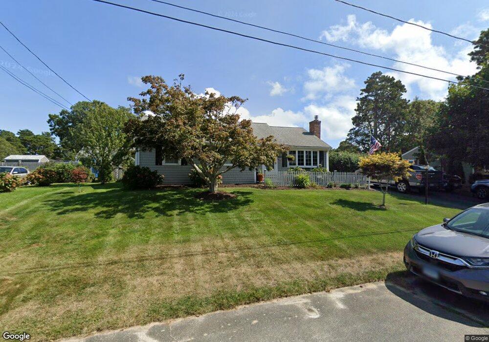
86 Michaels Ave Dennis Port, MA 02639
Dennis Port NeighborhoodEstimated Value: $609,000 - $770,000
3
Beds
1
Bath
1,472
Sq Ft
$493/Sq Ft
Est. Value
About This Home
This home is located at 86 Michaels Ave, Dennis Port, MA 02639 and is currently estimated at $726,043, approximately $493 per square foot. 86 Michaels Ave is a home located in Barnstable County with nearby schools including Dennis-Yarmouth Regional High School and St. Pius X. School.
Ownership History
Date
Name
Owned For
Owner Type
Purchase Details
Closed on
Sep 18, 2012
Sold by
Bioty Joseph M and Bioty Barbara S
Bought by
Bj Ft and Bioty Joseph M
Current Estimated Value
Purchase Details
Closed on
Nov 9, 1989
Sold by
Begin Raymond L
Bought by
Bioty Joseph M
Home Financials for this Owner
Home Financials are based on the most recent Mortgage that was taken out on this home.
Original Mortgage
$113,600
Interest Rate
10.03%
Mortgage Type
Purchase Money Mortgage
Create a Home Valuation Report for This Property
The Home Valuation Report is an in-depth analysis detailing your home's value as well as a comparison with similar homes in the area
Home Values in the Area
Average Home Value in this Area
Purchase History
| Date | Buyer | Sale Price | Title Company |
|---|---|---|---|
| Bj Ft | -- | -- | |
| Bioty Joseph M | $142,000 | -- |
Source: Public Records
Mortgage History
| Date | Status | Borrower | Loan Amount |
|---|---|---|---|
| Previous Owner | Bioty Joseph M | $200,000 | |
| Previous Owner | Bioty Joseph M | $100,000 | |
| Previous Owner | Bioty Joseph M | $106,400 | |
| Previous Owner | Bioty Joseph M | $113,600 |
Source: Public Records
Tax History Compared to Growth
Tax History
| Year | Tax Paid | Tax Assessment Tax Assessment Total Assessment is a certain percentage of the fair market value that is determined by local assessors to be the total taxable value of land and additions on the property. | Land | Improvement |
|---|---|---|---|---|
| 2025 | $3,057 | $706,000 | $204,000 | $502,000 |
| 2024 | $2,919 | $665,000 | $196,100 | $468,900 |
| 2023 | $2,823 | $604,600 | $178,300 | $426,300 |
| 2022 | $2,731 | $487,600 | $160,600 | $327,000 |
| 2021 | $2,740 | $454,400 | $180,000 | $274,400 |
| 2020 | $2,481 | $406,700 | $157,500 | $249,200 |
| 2019 | $2,324 | $376,600 | $154,400 | $222,200 |
| 2018 | $2,229 | $351,600 | $147,000 | $204,600 |
| 2017 | $2,059 | $334,800 | $136,500 | $198,300 |
| 2016 | $2,065 | $316,200 | $147,000 | $169,200 |
| 2015 | $2,024 | $316,200 | $147,000 | $169,200 |
| 2014 | $1,875 | $295,200 | $126,000 | $169,200 |
Source: Public Records
Map
Nearby Homes
- 80 Michaels Ave
- 37 Ocean Dr Unit 2
- 19 Standish Way
- 31 Easy St
- 64 Beaten Rd
- 22 Wixon Rd
- 12 Spoonbill Rd
- 4 Coffey Ln
- 71 Main St
- 112 Old Wharf Rd Unit E4
- 112 Old Wharf Rd Unit E1
- 61 Trotters Ln
- 15 Woodside Park Rd
- 125 Main St Unit 3
- 154 Old Wharf Rd Unit 26
- 154 Old Wharf Rd Unit 14
- 120 Old Wharf Rd Unit 11
- 72 Bassett Ln
- 217 Old Wharf Rd Unit 64
- 262 Old Wharf Rd Unit 67
- 114 Michael's Ave
- 81 Lawrence Rd
- 90 Michaels Ave
- 87 Lawrence Rd
- 87 Michaels Ave
- 79 Lawrence Rd
- 83 Michaels Ave
- 91 Michaels Ave
- 94 Michaels Ave
- 75 Lawrence Rd
- 93 Lawrence Rd
- 74 Michaels Ave
- 79 Michaels Ave
- 95 Michaels Ave
- 73 Lawrence Rd
- 78 Lawrence Rd
- 79 Michael's Ave
- 82 Lawrence Rd
- 99 Michaels Ave
- 98 Michaels Ave