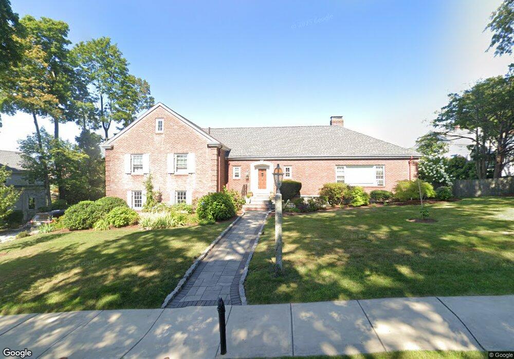
86 Monroe Rd Quincy, MA 02169
Quincy Center NeighborhoodEstimated Value: $1,024,000 - $1,280,000
3
Beds
4
Baths
2,334
Sq Ft
$492/Sq Ft
Est. Value
About This Home
This home is located at 86 Monroe Rd, Quincy, MA 02169 and is currently estimated at $1,149,492, approximately $492 per square foot. 86 Monroe Rd is a home located in Norfolk County with nearby schools including Charles A. Bernazzani Elementary School, Central Middle School, and Quincy High School.
Ownership History
Date
Name
Owned For
Owner Type
Purchase Details
Closed on
Apr 16, 1998
Sold by
Myers Extr Marjorie S
Bought by
Phelan Wiliam and Phelan Tracey
Current Estimated Value
Home Financials for this Owner
Home Financials are based on the most recent Mortgage that was taken out on this home.
Original Mortgage
$185,000
Outstanding Balance
$35,149
Interest Rate
7.11%
Mortgage Type
Purchase Money Mortgage
Estimated Equity
$1,114,343
Create a Home Valuation Report for This Property
The Home Valuation Report is an in-depth analysis detailing your home's value as well as a comparison with similar homes in the area
Home Values in the Area
Average Home Value in this Area
Purchase History
| Date | Buyer | Sale Price | Title Company |
|---|---|---|---|
| Phelan Wiliam | $325,000 | -- |
Source: Public Records
Mortgage History
| Date | Status | Borrower | Loan Amount |
|---|---|---|---|
| Open | Phelan Wiliam | $60,000 | |
| Open | Phelan Wiliam | $185,000 |
Source: Public Records
Tax History Compared to Growth
Tax History
| Year | Tax Paid | Tax Assessment Tax Assessment Total Assessment is a certain percentage of the fair market value that is determined by local assessors to be the total taxable value of land and additions on the property. | Land | Improvement |
|---|---|---|---|---|
| 2025 | $12,324 | $1,068,900 | $329,800 | $739,100 |
| 2024 | $11,441 | $1,015,200 | $315,200 | $700,000 |
| 2023 | $10,836 | $973,600 | $288,600 | $685,000 |
| 2022 | $11,253 | $939,300 | $264,400 | $674,900 |
| 2021 | $10,149 | $836,000 | $264,400 | $571,600 |
| 2020 | $10,201 | $820,700 | $252,800 | $567,900 |
| 2019 | $9,751 | $777,000 | $239,800 | $537,200 |
| 2018 | $9,686 | $726,100 | $239,800 | $486,300 |
| 2017 | $9,388 | $662,500 | $229,500 | $433,000 |
| 2016 | $8,775 | $611,100 | $219,600 | $391,500 |
| 2015 | $8,605 | $589,400 | $219,600 | $369,800 |
| 2014 | $8,435 | $567,600 | $210,200 | $357,400 |
Source: Public Records
Map
Nearby Homes
- 118 Dimmock St
- 77 Adams St Unit 610
- 1 Adams St Unit 502
- 1025 Hancock St Unit 12K
- 1025 Hancock St Unit 1F
- 1025 Hancock St Unit 1K
- 20 Whitney Rd
- 20 Whitney Rd Unit 307
- 20 Whitney Rd Unit 101
- 40 Greenleaf St Unit 102
- 195 Thomas Burgin Pkwy Unit 205
- 73 Cranch St Unit 73
- 312 Adams St
- 215 Thomas Burgin Pkwy Unit 35
- 293 Whitwell St
- 54 Hudson St
- 73 Scotch Pond Place
- 25 Carrolls Ln
- 29 Oval Rd
- 57 Willow Ave
- 96 Monroe Rd
- 76 Monroe Rd
- 69 Presidents Ln
- 31 Fairmount Way
- 29 Fairmount Way
- 25 Fairmount Way
- 72 Monroe Rd
- 85 Monroe Rd
- 79 Monroe Rd
- 21 Fairmount Way
- 17 Fairmount Way
- 75 Monroe Rd
- 95 Monroe Rd
- 95 Monroe Rd Unit 2R
- 95 Monroe Rd Unit 2L
- 95 Monroe Rd Unit 1
- 69 Monroe Rd
- 66 Monroe Rd
- 79 Presidents Ln
- 65 Monroe Rd