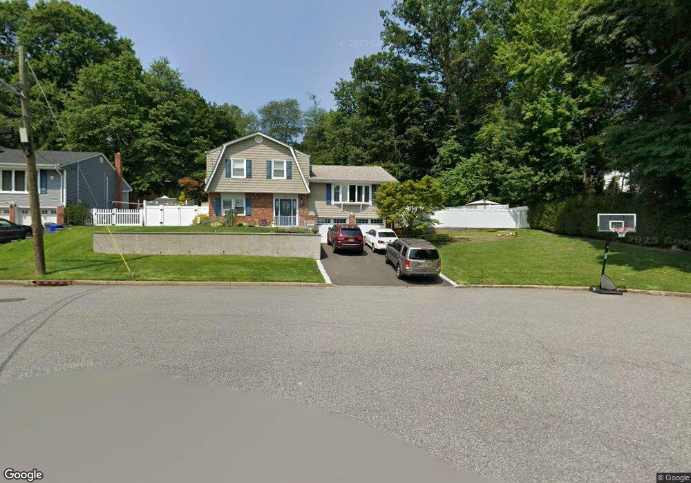
86 Mountain Ave Westwood, NJ 07675
Estimated Value: $838,768 - $964,000
--
Bed
--
Bath
2,172
Sq Ft
$426/Sq Ft
Est. Value
About This Home
This home is located at 86 Mountain Ave, Westwood, NJ 07675 and is currently estimated at $925,192, approximately $425 per square foot. 86 Mountain Ave is a home located in Bergen County with nearby schools including Westwood Regional High School, Primoris Academy, and St. John's Academy.
Ownership History
Date
Name
Owned For
Owner Type
Purchase Details
Closed on
Jul 24, 2025
Sold by
Lori A Moscatello Special Needs Trust and James Kara
Bought by
James Kara and James Nolan
Current Estimated Value
Home Financials for this Owner
Home Financials are based on the most recent Mortgage that was taken out on this home.
Original Mortgage
$443,630
Interest Rate
6.74%
Mortgage Type
FHA
Purchase Details
Closed on
Apr 17, 2025
Sold by
Stark Natalie and Stark James Kara
Bought by
Lori A Moscatello Special Needs Trust and James
Create a Home Valuation Report for This Property
The Home Valuation Report is an in-depth analysis detailing your home's value as well as a comparison with similar homes in the area
Home Values in the Area
Average Home Value in this Area
Purchase History
| Date | Buyer | Sale Price | Title Company |
|---|---|---|---|
| James Kara | -- | Rally Point Title | |
| Lori A Moscatello Special Needs Trust | -- | None Listed On Document | |
| Lori A Moscatello Special Needs Trust | -- | None Listed On Document |
Source: Public Records
Mortgage History
| Date | Status | Borrower | Loan Amount |
|---|---|---|---|
| Previous Owner | James Kara | $443,630 |
Source: Public Records
Tax History Compared to Growth
Tax History
| Year | Tax Paid | Tax Assessment Tax Assessment Total Assessment is a certain percentage of the fair market value that is determined by local assessors to be the total taxable value of land and additions on the property. | Land | Improvement |
|---|---|---|---|---|
| 2025 | $13,032 | $621,200 | $350,500 | $270,700 |
| 2024 | $13,004 | $596,700 | $338,500 | $258,200 |
| 2023 | $13,169 | $567,100 | $315,900 | $251,200 |
| 2022 | $13,169 | $546,900 | $288,300 | $258,600 |
| 2021 | $12,445 | $531,800 | $278,300 | $253,500 |
| 2020 | $13,283 | $524,200 | $273,800 | $250,400 |
| 2019 | $13,107 | $520,100 | $271,300 | $248,800 |
| 2018 | $12,698 | $511,400 | $267,300 | $244,100 |
| 2017 | $12,686 | $505,600 | $263,300 | $242,300 |
| 2016 | $13,185 | $501,900 | $253,300 | $248,600 |
| 2015 | $12,768 | $501,900 | $253,300 | $248,600 |
| 2014 | $12,507 | $501,900 | $253,300 | $248,600 |
Source: Public Records
Map
Nearby Homes
- 665 Calvin St
- 22 Beech St
- 85 Taylor St
- 33 Oak St
- 137 Broadway
- 517 Howard St
- 550 Fairview Ave Unit 116
- 550 Fairview Ave Unit 203
- 6 Fairview Ave
- 25 Cherry Place
- 288 Washington Ave
- 32 Chadwick Rd
- 603 Broadway Unit A
- 192 Broadway
- 680 Mariann Place
- 151 Winchester Ct Unit 151
- 485 Kinderkamack Rd
- 24 Brookside Place
- 662 Jefferson Ave
- 667 Mckinley Ave
- 80 Mountain Ave
- 745 Koch Peak Ave
- 74 Mountain Ave
- 15 Catherine Ct
- 79 Mountain Ave
- 85 Mountain Ave
- 5 Boulevard S
- 73 Mountain Ave
- 32 Summit St
- 739 Koch Peak Ave
- 68 Mountain Ave
- 750 Koch Peak Ave
- 67 Mountain Ave
- 9 Catherine Ct
- 62 Mountain Ave
- 9 Boulevard S
- 100 Hillside Ave
- 106 Hillside Ave
- 61 Mountain Ave
- 747 Koch Peak Ave