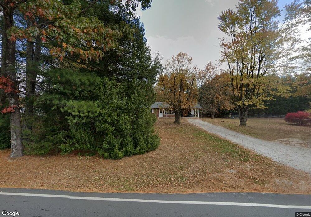
86 Pilot Mountain Rd Hendersonville, NC 28792
Estimated Value: $355,000 - $397,000
--
Bed
1
Bath
1,745
Sq Ft
$213/Sq Ft
Est. Value
About This Home
This home is located at 86 Pilot Mountain Rd, Hendersonville, NC 28792 and is currently estimated at $371,080, approximately $212 per square foot. 86 Pilot Mountain Rd is a home located in Henderson County with nearby schools including Edneyville Elementary School, Apple Valley Middle School, and North Henderson High School.
Ownership History
Date
Name
Owned For
Owner Type
Purchase Details
Closed on
Oct 22, 2021
Sold by
Thompson Thomas H and Staton Sherry
Bought by
Craig Marc B
Current Estimated Value
Home Financials for this Owner
Home Financials are based on the most recent Mortgage that was taken out on this home.
Original Mortgage
$225,000
Outstanding Balance
$205,179
Interest Rate
2.8%
Mortgage Type
New Conventional
Estimated Equity
$165,901
Purchase Details
Closed on
Aug 20, 2018
Sold by
Thompson Joe Ray
Bought by
Thompson Joe Ray and Thompson Thomas H
Create a Home Valuation Report for This Property
The Home Valuation Report is an in-depth analysis detailing your home's value as well as a comparison with similar homes in the area
Home Values in the Area
Average Home Value in this Area
Purchase History
| Date | Buyer | Sale Price | Title Company |
|---|---|---|---|
| Craig Marc B | $500 | Collie Law Firm | |
| Thompson Joe Ray | -- | -- |
Source: Public Records
Mortgage History
| Date | Status | Borrower | Loan Amount |
|---|---|---|---|
| Open | Craig Marc B | $225,000 |
Source: Public Records
Tax History Compared to Growth
Tax History
| Year | Tax Paid | Tax Assessment Tax Assessment Total Assessment is a certain percentage of the fair market value that is determined by local assessors to be the total taxable value of land and additions on the property. | Land | Improvement |
|---|---|---|---|---|
| 2025 | $1,445 | $264,600 | $44,600 | $220,000 |
| 2024 | $1,445 | $264,600 | $44,600 | $220,000 |
| 2023 | $1,445 | $264,600 | $44,600 | $220,000 |
| 2022 | $1,275 | $188,600 | $33,800 | $154,800 |
| 2021 | $0 | $188,600 | $33,800 | $154,800 |
| 2020 | $650 | $188,600 | $0 | $0 |
| 2019 | $650 | $188,600 | $0 | $0 |
Source: Public Records
Map
Nearby Homes
- 271 Freeman Place Trail
- 38 Red Laurel Ct
- 261 Lone Laurel Trail
- 31 Little Hungry Rd
- 41 Little Hungry Rd
- 1154 N Ridge Rd
- 1148 & 1150 N Ridge Rd
- 000 Union Hill Rd
- 00 Low Gap Rd
- 253 Eagles Eye Dr
- 131 Eagles Eye Dr
- 220 Laycock Rd
- 639 Byers Cove Rd
- 114 Major Way
- 212 Walt Dr
- 00 Star Point Dr Unit 9
- 9999 Star Point Dr
- 248 Star Point Dr Unit 8
- 88 Star Point Dr
- 000 Jacks Paw Ln Unit 8
- 15 Ollace Ct
- 15 Ollace Ct Unit 2
- 0 Pilot Mountain Rd Unit NCM422155
- 0 Pilot Mtn Rd Unit NCM462337
- 0 Pilot Mountain Rd Unit 5 3673786
- 0 Pilot Mountain Rd Unit 4 3673785
- 55 Ollace Ct
- 91 Pilot Mountain Rd
- 109 Kate Ln
- 117 Pilot Mountain Rd
- 143 Pilot Mountain Rd
- 16 Ollace Ct
- 54 Ollace Ct
- 33 Julias Way
- 99999 Ridge Rd
- 999999 Ridge Rd Unit 1
- 63 Kate Ln
- 180 Pilot Mountain Rd
- 21 Julias Way
- 64 Kate Ln