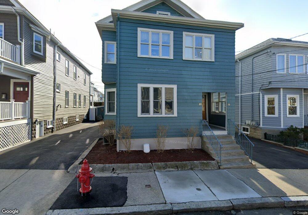
86 Raymond Ave Somerville, MA 02144
West Somerville NeighborhoodEstimated Value: $1,164,000 - $1,333,000
5
Beds
2
Baths
2,321
Sq Ft
$548/Sq Ft
Est. Value
About This Home
This home is located at 86 Raymond Ave, Somerville, MA 02144 and is currently estimated at $1,272,061, approximately $548 per square foot. 86 Raymond Ave is a home located in Middlesex County with nearby schools including Somerville High School, International School of Boston, and Lesley Ellis School.
Ownership History
Date
Name
Owned For
Owner Type
Purchase Details
Closed on
Dec 18, 2019
Sold by
Ciccariello Anthony and Ciccariello Janet
Bought by
Ciccariello Ft
Current Estimated Value
Create a Home Valuation Report for This Property
The Home Valuation Report is an in-depth analysis detailing your home's value as well as a comparison with similar homes in the area
Home Values in the Area
Average Home Value in this Area
Purchase History
| Date | Buyer | Sale Price | Title Company |
|---|---|---|---|
| Ciccariello Ft | -- | None Available |
Source: Public Records
Tax History
| Year | Tax Paid | Tax Assessment Tax Assessment Total Assessment is a certain percentage of the fair market value that is determined by local assessors to be the total taxable value of land and additions on the property. | Land | Improvement |
|---|---|---|---|---|
| 2025 | $11,446 | $1,049,100 | $561,200 | $487,900 |
| 2024 | $10,769 | $1,023,700 | $561,200 | $462,500 |
| 2023 | $10,506 | $1,016,100 | $561,200 | $454,900 |
| 2022 | $9,685 | $951,400 | $534,500 | $416,900 |
| 2021 | $9,423 | $924,700 | $530,600 | $394,100 |
| 2020 | $9,257 | $917,400 | $530,900 | $386,500 |
| 2019 | $8,678 | $806,500 | $483,300 | $323,200 |
| 2018 | $8,411 | $743,700 | $439,400 | $304,300 |
| 2017 | $8,092 | $693,400 | $414,500 | $278,900 |
| 2016 | $8,107 | $647,000 | $370,200 | $276,800 |
| 2015 | $7,536 | $597,600 | $341,900 | $255,700 |
Source: Public Records
Map
Nearby Homes
- 233 Powder House Blvd
- 83 Conwell Ave Unit 1
- 6 Hamilton Rd Unit 6
- 202 Powder House Blvd Unit 1
- 202 Powder House Blvd Unit 2
- 34 Belknap St
- 183 Powder House Blvd
- 123 W Adams St Unit 1
- 138 North St
- 14 Farragut Ave Unit 1
- 150 North St Unit 150
- 59A High St Unit A
- 325A Alewife Brook Pkwy Unit A
- 327 Alewife Brook Pkwy Unit A
- 327 Alewife Brook Pkwy Unit B
- 1188 Broadway Unit 403
- 12 Upland Rd
- 25 Upland Rd
- 106 Electric Ave Unit 3
- 69 Sterling St
- 88 Raymond Ave
- 82 Raymond Ave
- 82 Raymond Ave Unit 2
- 82 Raymond Ave Unit 1
- 78 Raymond Ave
- 80 Raymond Ave
- 78 Raymond Ave Unit 3
- 78 Raymond Ave Unit 1
- 78 Raymond Ave Unit 2
- 92 Raymond Ave Unit 2
- 90 Raymond Ave
- 90 Raymond Ave Unit 1
- 92 Raymond Ave
- 90 Raymond Ave Unit 90
- 231 Powder House Blvd
- 227 Powder House Blvd
- 225 Powder House Blvd
- 225 Powder House Blvd Unit 1
- 235 Powder House Blvd
- 94 Raymond Ave
Your Personal Tour Guide
Ask me questions while you tour the home.