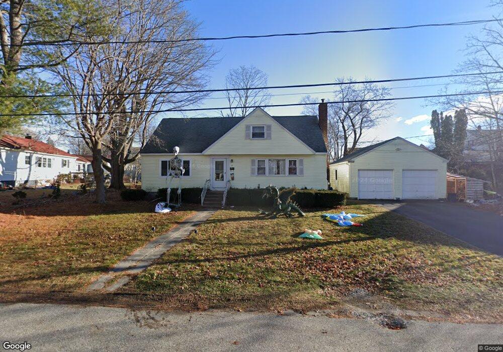
86 Starbird Rd Portland, ME 04102
Nasons Corner NeighborhoodEstimated Value: $535,000 - $581,000
3
Beds
2
Baths
1,572
Sq Ft
$354/Sq Ft
Est. Value
About This Home
This home is located at 86 Starbird Rd, Portland, ME 04102 and is currently estimated at $556,067, approximately $353 per square foot. 86 Starbird Rd is a home located in Cumberland County with nearby schools including Amanda C Rowe School, Lincoln Middle School, and Breakwater School.
Ownership History
Date
Name
Owned For
Owner Type
Purchase Details
Closed on
Mar 18, 2008
Sold by
Kearney Robert and Mike Laura
Bought by
Kearney Ross and Kearney Robert
Current Estimated Value
Home Financials for this Owner
Home Financials are based on the most recent Mortgage that was taken out on this home.
Original Mortgage
$206,400
Outstanding Balance
$128,653
Interest Rate
5.75%
Mortgage Type
Unknown
Estimated Equity
$427,414
Purchase Details
Closed on
Oct 13, 2005
Sold by
Dingley Arthur R
Bought by
Kearney Robert and Mike Laura
Home Financials for this Owner
Home Financials are based on the most recent Mortgage that was taken out on this home.
Original Mortgage
$200,000
Interest Rate
5.78%
Mortgage Type
Purchase Money Mortgage
Purchase Details
Closed on
Mar 9, 2005
Sold by
Shorey Susan G
Bought by
Dingley Arthur R
Create a Home Valuation Report for This Property
The Home Valuation Report is an in-depth analysis detailing your home's value as well as a comparison with similar homes in the area
Home Values in the Area
Average Home Value in this Area
Purchase History
| Date | Buyer | Sale Price | Title Company |
|---|---|---|---|
| Kearney Ross | -- | -- | |
| Kearney Robert | -- | -- | |
| Dingley Arthur R | -- | -- |
Source: Public Records
Mortgage History
| Date | Status | Borrower | Loan Amount |
|---|---|---|---|
| Open | Kearney Ross | $206,400 | |
| Closed | Kearney Ross | $25,800 | |
| Previous Owner | Kearney Ross | $43,000 | |
| Previous Owner | Kearney Robert | $200,000 |
Source: Public Records
Tax History Compared to Growth
Tax History
| Year | Tax Paid | Tax Assessment Tax Assessment Total Assessment is a certain percentage of the fair market value that is determined by local assessors to be the total taxable value of land and additions on the property. | Land | Improvement |
|---|---|---|---|---|
| 2024 | $6,207 | $413,500 | $85,300 | $328,200 |
| 2023 | $5,959 | $413,500 | $85,300 | $328,200 |
| 2022 | $5,628 | $413,500 | $85,300 | $328,200 |
| 2021 | $5,269 | $405,600 | $85,300 | $320,300 |
| 2020 | $5,172 | $221,900 | $62,400 | $159,500 |
| 2019 | $5,172 | $221,900 | $62,400 | $159,500 |
| 2018 | $4,988 | $221,900 | $62,400 | $159,500 |
| 2017 | $4,804 | $221,900 | $62,400 | $159,500 |
| 2016 | $4,684 | $221,900 | $62,400 | $159,500 |
| 2015 | $4,578 | $221,900 | $62,400 | $159,500 |
| 2014 | $4,438 | $221,900 | $62,400 | $159,500 |
Source: Public Records
Map
Nearby Homes
- 63A Capisic St
- 159 Bancroft St
- 0 Hillcrest Ave
- 99 Webb St
- 1346 Westbrook St
- 18 Stoneledge Dr
- 1542 Congress St
- 4 Fairview St
- 1549 Westbrook St
- 7 Twin Knolls Ln
- 16 Black Sparrow Dr
- 37 Tremont St
- 2 Firefly St Unit 303
- 7 Dale Ct
- 1 Firefly St Unit 402
- 1 Firefly St Unit 201
- 1 Firefly St Unit 303
- 1 Firefly St Unit 302
- 1 Firefly St Unit 403/103
- 1 Firefly St Unit 301
- 10 Little Rd
- 96 Starbird Rd
- 96 Starbird Rd Unit 1
- 336 Capisic St
- 100 Starbird Rd
- 330 Capisic St
- 83 Starbird Rd
- 102 Starbird Rd
- 320 Capisic St
- 338 Capisic St
- 104 Starbird Rd
- 104 Starbird Rd Unit 104
- 104 Starbird Rd Unit 5
- 11 Little Rd
- 106 Starbird Rd
- 13 Little Rd
- 314 Capisic St
- 2* Sandy Terrace
- 98 Starbird Rd
- 98 Starbird Rd Unit 2