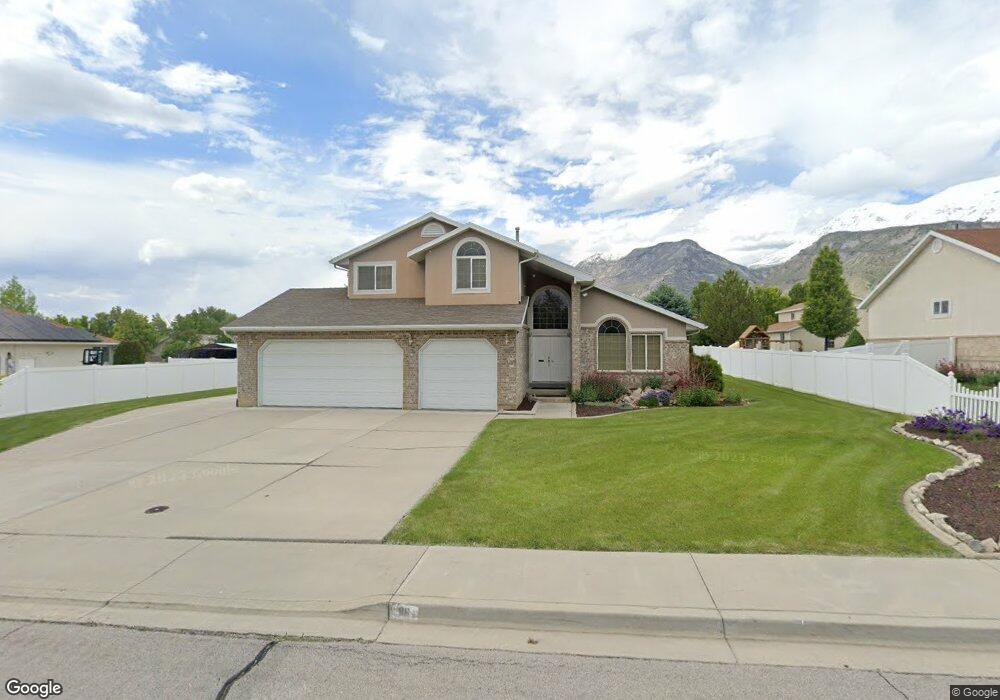
86 W 450 N Lindon, UT 84042
Estimated Value: $858,000 - $966,000
4
Beds
4
Baths
3,696
Sq Ft
$243/Sq Ft
Est. Value
About This Home
This home is located at 86 W 450 N, Lindon, UT 84042 and is currently estimated at $899,931, approximately $243 per square foot. 86 W 450 N is a home located in Utah County with nearby schools including Lindon Elementary School, Oak Canyon Junior High School, and Pleasant Grove High School.
Ownership History
Date
Name
Owned For
Owner Type
Purchase Details
Closed on
May 15, 2020
Sold by
Brown Mary Jo Robinson and Mary Jo Robinson Brown Family
Bought by
Tanuvasa Steve Saia and Tanuvasa Ashlyn Kaliani
Current Estimated Value
Home Financials for this Owner
Home Financials are based on the most recent Mortgage that was taken out on this home.
Original Mortgage
$460,750
Outstanding Balance
$408,288
Interest Rate
3.3%
Mortgage Type
New Conventional
Estimated Equity
$491,643
Purchase Details
Closed on
Mar 31, 2014
Sold by
Brown Mary Jo Robinson
Bought by
Brown Mary Jo Robinson
Purchase Details
Closed on
Sep 26, 1997
Sold by
Ostergaard Arlan and Ostergaard Claudia
Bought by
Brown Mary Jo Robinson
Purchase Details
Closed on
May 15, 1996
Sold by
Ron Avi
Bought by
Ostergaard Arlan and Ostergaard Claudia
Create a Home Valuation Report for This Property
The Home Valuation Report is an in-depth analysis detailing your home's value as well as a comparison with similar homes in the area
Home Values in the Area
Average Home Value in this Area
Purchase History
We collect this data history from publicly available records. To have your information removed, we recommend requesting removal directly through your county’s website.
| Date | Buyer | Sale Price | Title Company |
|---|---|---|---|
| Tanuvasa Steve Saia | -- | Metro National Title | |
| Brown Mary Jo Robinson | -- | None Available | |
| Brown Mary Jo Robinson | -- | First American Title | |
| Ostergaard Arlan | -- | -- | |
| Ron Avi | -- | Provo Land Title Company |
Source: Public Records
Mortgage History
We collect this data history from publicly available records. To have your information removed, we recommend requesting removal directly through your county’s website.
| Date | Status | Borrower | Loan Amount |
|---|---|---|---|
| Open | Tanuvasa Steve Saia | $460,750 |
Source: Public Records
Tax History
| Year | Tax Paid | Tax Assessment Tax Assessment Total Assessment is a certain percentage of the fair market value that is determined by local assessors to be the total taxable value of land and additions on the property. | Land | Improvement |
|---|---|---|---|---|
| 2025 | $3,363 | $452,925 | -- | -- |
| 2024 | $3,363 | $414,535 | $0 | $0 |
| 2023 | $3,123 | $413,490 | $0 | $0 |
| 2022 | $3,165 | $404,855 | $0 | $0 |
| 2021 | $2,674 | $515,800 | $281,100 | $234,700 |
| 2020 | $2,534 | $481,200 | $255,500 | $225,700 |
| 2019 | $2,193 | $434,400 | $208,700 | $225,700 |
| 2018 | $836 | $408,800 | $183,100 | $225,700 |
| 2017 | $2,199 | $220,165 | $0 | $0 |
| 2016 | -- | $202,620 | $0 | $0 |
| 2015 | $2,263 | $198,110 | $0 | $0 |
| 2014 | $2,133 | $185,020 | $0 | $0 |
Source: Public Records
Map
Nearby Homes
Your Personal Tour Guide
Ask me questions while you tour the home.