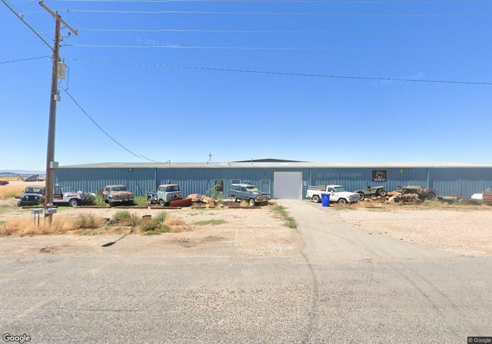
860 Airway Dr Fillmore, UT 84631
--
Bed
--
Bath
--
Sq Ft
4.59
Acres
About This Home
This home is located at 860 Airway Dr, Fillmore, UT 84631. 860 Airway Dr is a home located in Millard County.
Ownership History
Date
Name
Owned For
Owner Type
Purchase Details
Closed on
Jan 11, 2024
Sold by
Bonner Keith and Bonner Gloria
Bought by
Harkness Zach
Home Financials for this Owner
Home Financials are based on the most recent Mortgage that was taken out on this home.
Original Mortgage
$472,500
Outstanding Balance
$464,644
Interest Rate
7.22%
Mortgage Type
Seller Take Back
Purchase Details
Closed on
Jan 14, 2011
Sold by
Casco Group Real Estate Llc
Bought by
Bonner Keith and Bonner Gloria
Home Financials for this Owner
Home Financials are based on the most recent Mortgage that was taken out on this home.
Original Mortgage
$142,912
Interest Rate
4.62%
Mortgage Type
Commercial
Create a Home Valuation Report for This Property
The Home Valuation Report is an in-depth analysis detailing your home's value as well as a comparison with similar homes in the area
Home Values in the Area
Average Home Value in this Area
Purchase History
| Date | Buyer | Sale Price | Title Company |
|---|---|---|---|
| Harkness Zach | -- | Sutherland Title | |
| Bonner Keith | -- | -- |
Source: Public Records
Mortgage History
| Date | Status | Borrower | Loan Amount |
|---|---|---|---|
| Open | Harkness Zach | $472,500 | |
| Previous Owner | Bonner Keith | $142,912 |
Source: Public Records
Tax History Compared to Growth
Tax History
| Year | Tax Paid | Tax Assessment Tax Assessment Total Assessment is a certain percentage of the fair market value that is determined by local assessors to be the total taxable value of land and additions on the property. | Land | Improvement |
|---|---|---|---|---|
| 2024 | $2,241 | $198,194 | $43,987 | $154,207 |
| 2023 | $2,241 | $198,194 | $43,987 | $154,207 |
| 2022 | $2,230 | $200,193 | $45,986 | $154,207 |
| 2021 | $2,322 | $200,193 | $45,986 | $154,207 |
| 2020 | $2,309 | $200,193 | $45,986 | $154,207 |
| 2019 | $2,310 | $200,907 | $46,700 | $154,207 |
| 2018 | $2,257 | $200,907 | $46,700 | $154,207 |
| 2017 | $2,097 | $177,524 | $46,700 | $130,824 |
| 2016 | $2,006 | $177,524 | $46,700 | $130,824 |
| 2015 | $2,007 | $177,524 | $46,700 | $130,824 |
| 2014 | -- | $177,524 | $46,700 | $130,824 |
| 2013 | -- | $177,524 | $46,700 | $130,824 |
Source: Public Records
Map
Nearby Homes
- 1615 W Sunflower Ln Unit 4
- 1565 W Sunflower Ln Unit 3
- 1765 W Sunflower Ln Unit 7
- 1100 S 725 Rd W
- 2600 S 400 Rd W
- 2000 N West Frontage I-15
- 190 W 400 St S
- 410 W 400 N
- 225 W 200 St N
- 30 E 300 S
- 335 W 400 North St
- 60 W 100 N
- 155 E 500 St S
- 380 N 200 St W
- 40 S 100 Rd E
- 220 S 200 E
- 390 N 100 W
- 405 E 500 St S
- 760 E 700 St S
- 430 E Canyon Rd