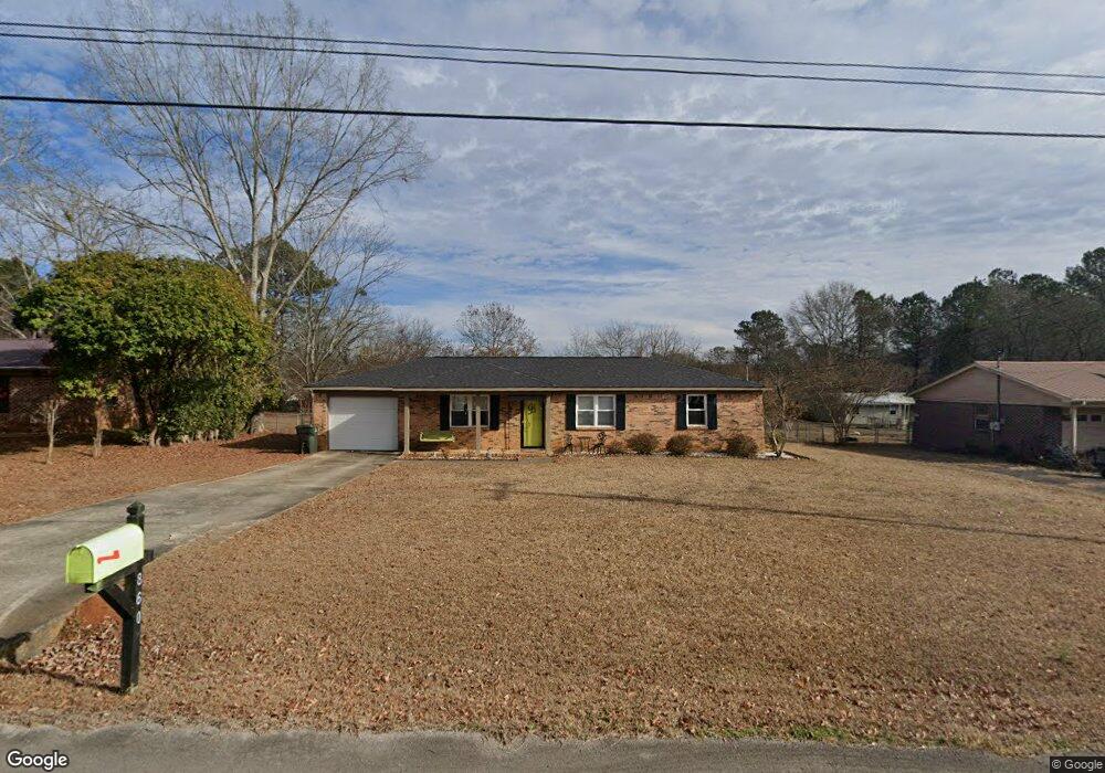
860 Hancock Dr E Scottsboro, AL 35769
Estimated Value: $179,095 - $197,000
Studio
1
Bath
1,150
Sq Ft
$164/Sq Ft
Est. Value
About This Home
This home is located at 860 Hancock Dr E, Scottsboro, AL 35769 and is currently estimated at $188,274, approximately $163 per square foot. 860 Hancock Dr E is a home located in Jackson County with nearby schools including Scottsboro High School and Scottsboro Christian Academy.
Ownership History
Date
Name
Owned For
Owner Type
Purchase Details
Closed on
May 1, 2019
Sold by
Hilliard Christopher and Hilliard Jennifer
Bought by
Caryl Bettye
Current Estimated Value
Home Financials for this Owner
Home Financials are based on the most recent Mortgage that was taken out on this home.
Original Mortgage
$70,000
Outstanding Balance
$60,902
Interest Rate
4%
Mortgage Type
New Conventional
Estimated Equity
$127,372
Purchase Details
Closed on
Apr 24, 2008
Sold by
Amos Jeffery L and Amos Sheila G
Bought by
Hillard Christopher and Hillard Jennifer
Home Financials for this Owner
Home Financials are based on the most recent Mortgage that was taken out on this home.
Original Mortgage
$82,702
Interest Rate
5.82%
Mortgage Type
FHA
Create a Home Valuation Report for This Property
The Home Valuation Report is an in-depth analysis detailing your home's value as well as a comparison with similar homes in the area
Purchase History
| Date | Buyer | Sale Price | Title Company |
|---|---|---|---|
| Caryl Bettye | $100,000 | -- | |
| Hillard Christopher | -- | -- |
Source: Public Records
Mortgage History
| Date | Status | Borrower | Loan Amount |
|---|---|---|---|
| Open | Caryl Bettye | $70,000 | |
| Previous Owner | Hillard Christopher | $82,702 |
Source: Public Records
Tax History
| Year | Tax Paid | Tax Assessment Tax Assessment Total Assessment is a certain percentage of the fair market value that is determined by local assessors to be the total taxable value of land and additions on the property. | Land | Improvement |
|---|---|---|---|---|
| 2025 | $389 | $9,800 | $0 | $0 |
| 2024 | $389 | $9,160 | $0 | $0 |
| 2023 | $362 | $9,160 | $0 | $0 |
| 2022 | $395 | $9,160 | $0 | $0 |
| 2021 | $395 | $9,160 | $0 | $0 |
| 2020 | $367 | $8,580 | $0 | $0 |
| 2019 | $333 | $7,880 | $0 | $0 |
| 2018 | $333 | $7,880 | $0 | $0 |
| 2017 | $333 | $78,700 | $0 | $0 |
| 2016 | $313 | $74,500 | $0 | $0 |
| 2015 | $313 | $74,500 | $0 | $0 |
| 2014 | $313 | $74,500 | $0 | $0 |
| 2013 | -- | $74,500 | $0 | $0 |
Source: Public Records
Map
Nearby Homes
- #80 Snow Dr
- 20 Press Rd
- 22 Press Rd
- Lot 11 Pruett Cir
- 273 Goosepond Dr
- 14 Ski Cove Dr
- 50 Pruett Cir
- 222 Lakewood Dr
- 17 Goose Pond Island Dr
- 1204 Peninsula Dr
- 655 Goose Pond Island Dr
- 131 Anderson St E
- 1.12 acres Savory Dr
- 160 Santa Maria Dr
- 2310 Bob Jones Rd
- 1.0 Acre Lake Pointe Cir
- 3 Acres S Broad St
- 104 Wimberly Dr
- 2567 Lookout Mountain Dr
- 4324 S Broad St
- 877 Hancock Dr E
- 845 Hancock Dr E
- 899 Hancock Dr E
- 169 Chesapeake Dr
- 189 Chesapeake Dr
- 856 Hancock Dr E
- 149 Chesapeake Dr
- 827 Hancock Dr E
- 209 Chesapeake Dr
- 915 Hancock Dr E
- 915 Hancock Dr E
- 811 Hancock Dr E
- 129 Chesapeake Dr
- 900 Hancock Dr E
- 229 Chesapeake Dr
- 808 Hancock Dr E
- 162 Chesapeake Dr
- 184 Chesapeake Dr
- 99 Chesapeake Dr
- 140 Chesapeake Dr
Your Personal Tour Guide
Ask me questions while you tour the home.