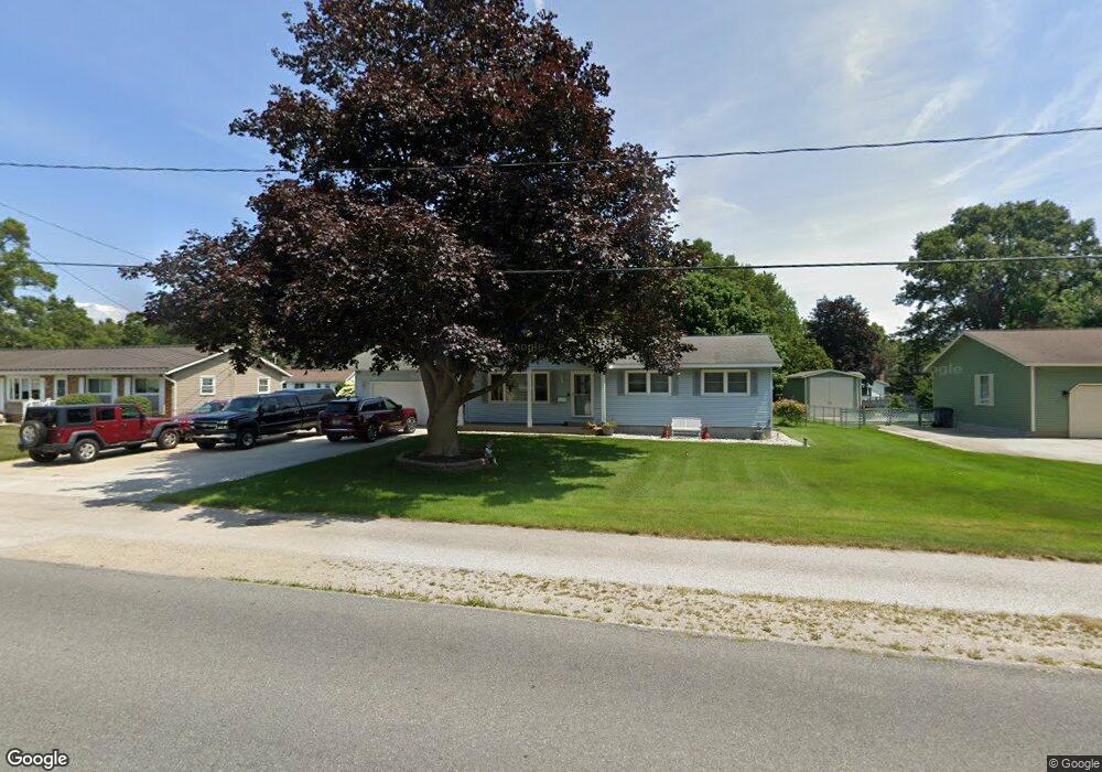
860 Horton Rd Muskegon, MI 49445
Estimated Value: $293,553 - $344,000
3
Beds
2
Baths
1,288
Sq Ft
$242/Sq Ft
Est. Value
About This Home
This home is located at 860 Horton Rd, Muskegon, MI 49445 and is currently estimated at $311,388, approximately $241 per square foot. 860 Horton Rd is a home located in Muskegon County with nearby schools including Reeths-Puffer High School.
Ownership History
Date
Name
Owned For
Owner Type
Purchase Details
Closed on
Mar 5, 2007
Sold by
Brandt Beth G and Brandt Jack Gardner
Bought by
Revocable Living Trust Agreement Of Beth
Current Estimated Value
Purchase Details
Closed on
Oct 6, 2004
Sold by
Wright James and Wright Sherry L
Bought by
Brandt Jack Gardner and Brandt Beth G
Home Financials for this Owner
Home Financials are based on the most recent Mortgage that was taken out on this home.
Original Mortgage
$85,000
Interest Rate
5.89%
Mortgage Type
Purchase Money Mortgage
Create a Home Valuation Report for This Property
The Home Valuation Report is an in-depth analysis detailing your home's value as well as a comparison with similar homes in the area
Home Values in the Area
Average Home Value in this Area
Purchase History
| Date | Buyer | Sale Price | Title Company |
|---|---|---|---|
| Revocable Living Trust Agreement Of Beth | -- | None Available | |
| Brandt Jack Gardner | -- | -- |
Source: Public Records
Mortgage History
| Date | Status | Borrower | Loan Amount |
|---|---|---|---|
| Previous Owner | Brandt Jack Gardner | $85,000 |
Source: Public Records
Tax History Compared to Growth
Tax History
| Year | Tax Paid | Tax Assessment Tax Assessment Total Assessment is a certain percentage of the fair market value that is determined by local assessors to be the total taxable value of land and additions on the property. | Land | Improvement |
|---|---|---|---|---|
| 2025 | $2,055 | $129,300 | $0 | $0 |
| 2024 | $739 | $129,200 | $0 | $0 |
| 2023 | $707 | $112,600 | $0 | $0 |
| 2022 | $1,871 | $85,900 | $0 | $0 |
| 2021 | $1,820 | $78,200 | $0 | $0 |
| 2020 | $1,801 | $73,900 | $0 | $0 |
| 2019 | $1,768 | $71,100 | $0 | $0 |
| 2018 | $1,722 | $68,200 | $0 | $0 |
| 2017 | $1,743 | $68,000 | $0 | $0 |
| 2016 | $593 | $54,900 | $0 | $0 |
| 2015 | -- | $51,600 | $0 | $0 |
| 2014 | -- | $51,900 | $0 | $0 |
| 2013 | -- | $48,000 | $0 | $0 |
Source: Public Records
Map
Nearby Homes
- 780 Horton Rd
- 0 Horton Rd Unit 25046889
- 1596 Nottingham Ct
- 690 W Wedgewood Dr
- 1024 Bear Lake Rd
- 1165 Horton Rd
- 1045 Greenbriar Dr
- 1709 Hampstead Dr
- 1463 Glenwood Ave
- 1499 Glenwood Ave
- 1616 Westwind Ct
- 421 W Chadwick Dr
- 1601 Westwind Ct
- 1141 N Robinhood Dr
- 1310 W Giles Rd
- 1234 W Giles Rd
- 1516 W Addison Way Unit 54
- 1518 W Addison Way Unit 54
- 1513 W Addison Way Unit 28
- 1603 Horton Rd
- 870 Horton Rd
- 854 Horton Rd
- 865 Glenwood Ave
- 875 Glenwood Ave
- 890 Horton Rd
- 845 Glenwood Ave
- 855 Horton Rd
- 895 Glenwood Ave
- 1620 Gaylord Dr
- 835 Glenwood Ave
- 900 Horton Rd
- 810 Horton Rd
- 845 Horton Rd
- 905 Glenwood Ave
- 901 Horton Rd
- 870 Glenwood Ave
- 920 Horton Rd
- 802 Horton Rd
- 815 Glenwood Ave
- 935 Glenwood Ave