Estimated Value: $615,040 - $694,000
--
Bed
4
Baths
2,596
Sq Ft
$248/Sq Ft
Est. Value
About This Home
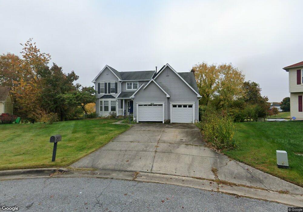
This home is located at 8600 Tabb Ct, Bowie, MD 20720 and is currently estimated at $643,510, approximately $247 per square foot. 8600 Tabb Ct is a home located in Prince George's County with nearby schools including Rockledge Elementary School, Samuel Ogle Middle School, and Bowie High School.
Ownership History
Date
Name
Owned For
Owner Type
Purchase Details
Closed on
Feb 9, 1999
Sold by
Jackson Julia
Bought by
Jackson Julia and Jackson Mark
Current Estimated Value
Purchase Details
Closed on
Oct 8, 1993
Sold by
Wing D D
Bought by
Jackson Julia
Home Financials for this Owner
Home Financials are based on the most recent Mortgage that was taken out on this home.
Original Mortgage
$24,000
Interest Rate
6.9%
Purchase Details
Closed on
Jul 10, 1989
Sold by
Ryland Group Inc
Bought by
Wing Donald D and Wing Patricia M
Create a Home Valuation Report for This Property
The Home Valuation Report is an in-depth analysis detailing your home's value as well as a comparison with similar homes in the area
Home Values in the Area
Average Home Value in this Area
Purchase History
| Date | Buyer | Sale Price | Title Company |
|---|---|---|---|
| Jackson Julia | -- | -- | |
| Jackson Julia | $240,000 | -- | |
| Wing Donald D | $234,500 | -- |
Source: Public Records
Mortgage History
| Date | Status | Borrower | Loan Amount |
|---|---|---|---|
| Previous Owner | Jackson Julia | $24,000 | |
| Closed | Jackson Julia | $192,000 |
Source: Public Records
Tax History Compared to Growth
Tax History
| Year | Tax Paid | Tax Assessment Tax Assessment Total Assessment is a certain percentage of the fair market value that is determined by local assessors to be the total taxable value of land and additions on the property. | Land | Improvement |
|---|---|---|---|---|
| 2024 | $8,015 | $512,500 | $0 | $0 |
| 2023 | $7,464 | $475,500 | $0 | $0 |
| 2022 | $6,914 | $438,500 | $101,700 | $336,800 |
| 2021 | $6,724 | $425,700 | $0 | $0 |
| 2020 | $6,534 | $412,900 | $0 | $0 |
| 2019 | $6,343 | $400,100 | $100,800 | $299,300 |
| 2018 | $6,150 | $387,100 | $0 | $0 |
| 2017 | $5,957 | $374,100 | $0 | $0 |
| 2016 | -- | $361,100 | $0 | $0 |
| 2015 | $4,870 | $338,633 | $0 | $0 |
| 2014 | $4,870 | $316,167 | $0 | $0 |
Source: Public Records
Map
Nearby Homes
- 0 Duckettown Rd
- 12338 Lanham Severn Rd
- 8405 Spruill Dr
- 12605 Lanham Severn Rd
- 11701 Duckettown Rd
- 12707 Duckettown Rd
- 12203 Lanham Severn Rd
- 11911 Frost Dr
- 11718 Backus Dr
- 11690 Duckettown Rd
- 13001 4th St
- 11708 Moriarty Ct
- 11710 Moriarty Way
- Lugano Plan at Glenn Dale Estates
- Belina Plan at Glenn Dale Estates
- Razzano Plan at Glenn Dale Estates
- Palermo Plan at Glenn Dale Estates
- Sorrento 2.0 Plan at Glenn Dale Estates
- 11701 Moriarty Ct
- The Jenkins Plan at Mill Branch Crossing - Townhomes
- 8602 Tabb Ct
- 8601 Tabb Ct
- 12203 Backus Dr
- 12201 Backus Dr
- 8604 Undermire Ct
- 8603 Tabb Ct
- 12119 Backus Dr
- 12117 Backus Dr
- 12204 Backus Dr
- 8611 Ross St
- 12115 Backus Dr
- 8701 Burns Ct
- 12302 Backus Dr
- 8610 Ross St
- 12305 Backus Dr
- 12208 Stanfield Ct
- 12304 Backus Dr
- 12118 Backus Dr
- 8505 Brent Ct
- 12113 Backus Dr