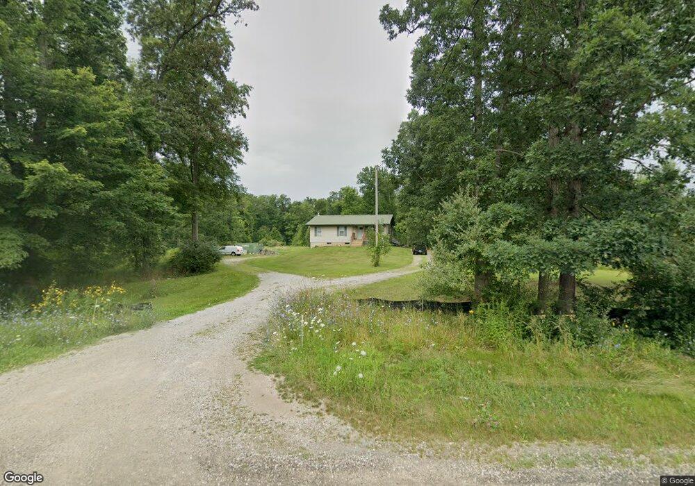
8600 Us Highway 127 Unit US Highway 127 Addison, MI 49220
Estimated Value: $247,000 - $313,000
3
Beds
3
Baths
1,178
Sq Ft
$232/Sq Ft
Est. Value
About This Home
This home is located at 8600 Us Highway 127 Unit US Highway 127, Addison, MI 49220 and is currently estimated at $273,220, approximately $231 per square foot. 8600 Us Highway 127 Unit US Highway 127 is a home located in Lenawee County with nearby schools including Addison Elementary School, Addison Middle School, and Addison High School.
Ownership History
Date
Name
Owned For
Owner Type
Purchase Details
Closed on
Oct 3, 2013
Sold by
Colloway John and Colloway Sally J
Bought by
Federal Home Loan Mortgage Corporation
Current Estimated Value
Purchase Details
Closed on
Jul 11, 1996
Bought by
Calloway John and Calloway Sally J
Create a Home Valuation Report for This Property
The Home Valuation Report is an in-depth analysis detailing your home's value as well as a comparison with similar homes in the area
Home Values in the Area
Average Home Value in this Area
Purchase History
| Date | Buyer | Sale Price | Title Company |
|---|---|---|---|
| Federal Home Loan Mortgage Corporation | $114,225 | None Available | |
| Calloway John | $17,500 | -- |
Source: Public Records
Tax History Compared to Growth
Tax History
| Year | Tax Paid | Tax Assessment Tax Assessment Total Assessment is a certain percentage of the fair market value that is determined by local assessors to be the total taxable value of land and additions on the property. | Land | Improvement |
|---|---|---|---|---|
| 2025 | $1,849 | $107,500 | $0 | $0 |
| 2024 | $856 | $100,700 | $0 | $0 |
| 2023 | -- | $90,300 | $0 | $0 |
| 2022 | $1,694 | $75,900 | $0 | $0 |
| 2021 | $1,652 | $75,100 | $0 | $0 |
| 2020 | $1,612 | $63,800 | $0 | $0 |
| 2019 | $269,301 | $63,800 | $0 | $0 |
| 2018 | $1,914 | $68,415 | $0 | $0 |
| 2017 | $2,244 | $69,500 | $0 | $0 |
| 2016 | $2,239 | $69,040 | $0 | $0 |
| 2014 | -- | $66,444 | $0 | $0 |
Source: Public Records
Map
Nearby Homes
- 9010 U S 127
- 305 N Steer St
- 17475 U S 223
- 135 S Steer St
- 236 S Steer St
- 407 S Comstock St
- 8484 N Rollin Hwy
- 6482 Sorby Hwy
- 15858 Lelah Ln
- 5875 U S 127
- 6000 Devils Lake Hwy
- 10911 Devils Lake Hwy
- 6820 Devils Lake Hwy
- 9265 Devils Lake Hwy
- 6360 Winter Rd
- Unit 3 Hollyhock Dr
- Unit 2 Hollyhock Dr
- 7841 Devils Lake Hwy
- 8000 Parkhurst Hwy Unit Carroll Dr ((1175)
- 9254 Cherry Point Rd
- 8600 Us Highway 127
- 8600 Us Highway 127 Unit US Highway 127
- 8590 N Us-127
- 8590 Us Highway 127
- 8401 Us Highway 127 Unit 127
- 8401 Us Highway 127
- 8401 Us Highway 127
- 8401 Us Highway 127 Unit 127
- 8359 Us Highway 127
- 8359 Us Highway 127
- 8349 Us Highway 127
- 8345 Us Highway 127
- 8345 Us Highway 127
- 8326 Us Highway 127
- 8331 Us Highway 127
- 8308 Us Highway 127
- 8327 Us Highway 127
- 8327 Us Highway 127
- 18233 Pine Rd
- 18153 Pine Rd