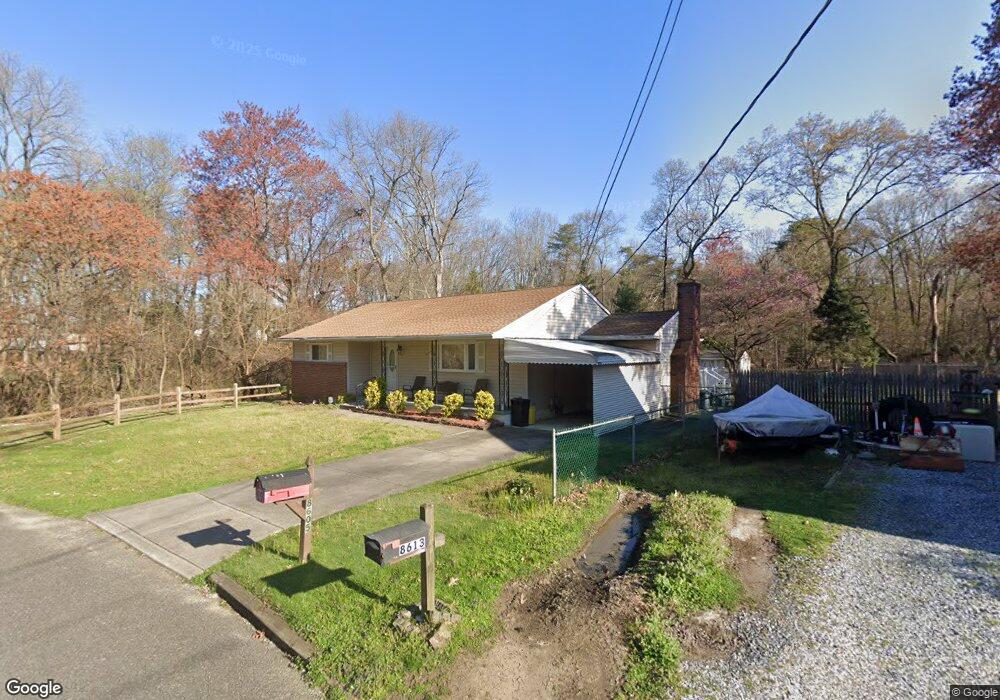
8605 Githens Ave Pennsauken, NJ 08110
Estimated Value: $284,000 - $404,000
Studio
--
Bath
1,432
Sq Ft
$245/Sq Ft
Est. Value
About This Home
This home is located at 8605 Githens Ave, Pennsauken, NJ 08110 and is currently estimated at $351,513, approximately $245 per square foot. 8605 Githens Ave is a home located in Camden County with nearby schools including Pennsauken High School and St. Peter Elementary School.
Ownership History
Date
Name
Owned For
Owner Type
Purchase Details
Closed on
Oct 4, 2024
Sold by
Goodwin Lillian F and Adriano Barbara Ann
Bought by
Reed Justine Jacqueline
Current Estimated Value
Home Financials for this Owner
Home Financials are based on the most recent Mortgage that was taken out on this home.
Original Mortgage
$279,000
Outstanding Balance
$275,937
Interest Rate
6.12%
Mortgage Type
New Conventional
Estimated Equity
$75,576
Purchase Details
Closed on
Jun 5, 1989
Bought by
Goodwin Robert and Goodwin Lillian F
Create a Home Valuation Report for This Property
The Home Valuation Report is an in-depth analysis detailing your home's value as well as a comparison with similar homes in the area
Home Values in the Area
Average Home Value in this Area
Purchase History
| Date | Buyer | Sale Price | Title Company |
|---|---|---|---|
| Reed Justine Jacqueline | $310,000 | Trident Land Transfer | |
| Reed Justine Jacqueline | $310,000 | Trident Land Transfer | |
| Goodwin Robert | $102,000 | -- |
Source: Public Records
Mortgage History
| Date | Status | Borrower | Loan Amount |
|---|---|---|---|
| Open | Reed Justine Jacqueline | $279,000 | |
| Closed | Reed Justine Jacqueline | $279,000 |
Source: Public Records
Tax History
| Year | Tax Paid | Tax Assessment Tax Assessment Total Assessment is a certain percentage of the fair market value that is determined by local assessors to be the total taxable value of land and additions on the property. | Land | Improvement |
|---|---|---|---|---|
| 2025 | $7,014 | $308,700 | $59,300 | $249,400 |
| 2024 | $6,867 | $160,900 | $53,500 | $107,400 |
| 2023 | $6,867 | $160,900 | $53,500 | $107,400 |
| 2022 | $6,209 | $160,900 | $53,500 | $107,400 |
| 2021 | $5,872 | $160,900 | $53,500 | $107,400 |
| 2020 | $5,712 | $160,900 | $53,500 | $107,400 |
| 2019 | $5,778 | $160,900 | $53,500 | $107,400 |
| 2018 | $5,808 | $160,900 | $53,500 | $107,400 |
| 2017 | $5,820 | $160,900 | $53,500 | $107,400 |
| 2016 | $5,715 | $160,900 | $53,500 | $107,400 |
| 2015 | $5,886 | $160,900 | $53,500 | $107,400 |
| 2014 | $5,935 | $106,700 | $29,500 | $77,200 |
Source: Public Records
Map
Nearby Homes
- 2819 Haddonfield Rd
- 2569 Hadley Dr
- 3444 New Jersey Ave
- 8661 Wyndam Rd
- 2561 Burning Tree Rd
- 3002 Gladwyn Ave
- 3220 Gladwyn Ave
- 8315 Stockton Ave
- 2703 Union Ave
- 7487 Githens Ave
- 7775 Marion Ave
- 2626 Manall Ave
- 27 Indian Queen Ln
- 7435 Rogers Ave
- 7426 Collins Ave
- 331 Collins Ln
- 7408 Githens Ave
- 2657 Rockafellow Ave
- 2316 Corbett Rd
- 7445 Park Ave
- 8613 Githens Ave
- 8621 Githens Ave
- 8631 Githens Ave
- 8360 Harrowgate Dr
- 8366 Harrowgate Dr
- 8354 Harrowgate Dr
- 8624 Githens Ave
- 8372 Harrowgate Dr
- 3021 Powell Ave
- 8348 Harrowgate Dr
- 3005 Powell Ave
- 8378 Harrowgate Dr
- 3031 Powell Ave
- 8640 Githens Ave
- 8342 Harrowgate Dr
- 8345 Harrowgate Dr
- 8384 Harrowgate Dr
- 8357 Harrowgate Dr
- 2943 Powell Ave
- 8318 Crofton Ln
Your Personal Tour Guide
Ask me questions while you tour the home.