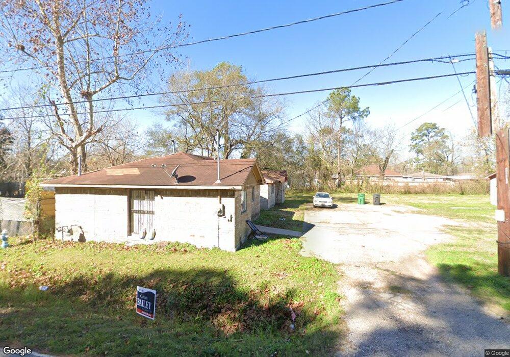
8605 Westcott Rd Houston, TX 77016
Trinity-Houston Gardens NeighborhoodEstimated Value: $88,000 - $280,000
3
Beds
2
Baths
1,034
Sq Ft
$204/Sq Ft
Est. Value
About This Home
This home is located at 8605 Westcott Rd, Houston, TX 77016 and is currently estimated at $211,000, approximately $204 per square foot. 8605 Westcott Rd is a home located in Harris County with nearby schools including Felix Cook Jr. Elementary School, Key Middle, and Kashmere High School.
Ownership History
Date
Name
Owned For
Owner Type
Purchase Details
Closed on
Dec 7, 2017
Sold by
Resenberg Ems Corp
Bought by
Banks Caliph
Current Estimated Value
Purchase Details
Closed on
Oct 8, 2013
Sold by
Onwuchekwa Bennett Ihie and Onwuchekwa Gloria
Bought by
Rosenberg Ems Corp
Purchase Details
Closed on
May 11, 2011
Sold by
Taku Moses N
Bought by
Onwuchekwa Bennett Ihie and Onwuchekwa Gloria
Purchase Details
Closed on
Jun 3, 2010
Sold by
Robert Jack Golden Inc
Bought by
County Of Harris and City Of Houston
Create a Home Valuation Report for This Property
The Home Valuation Report is an in-depth analysis detailing your home's value as well as a comparison with similar homes in the area
Home Values in the Area
Average Home Value in this Area
Purchase History
| Date | Buyer | Sale Price | Title Company |
|---|---|---|---|
| Banks Caliph | -- | None Available | |
| Rosenberg Ems Corp | -- | None Available | |
| Onwuchekwa Bennett Ihie | $4,000 | None Available | |
| County Of Harris | -- | None Available |
Source: Public Records
Tax History Compared to Growth
Tax History
| Year | Tax Paid | Tax Assessment Tax Assessment Total Assessment is a certain percentage of the fair market value that is determined by local assessors to be the total taxable value of land and additions on the property. | Land | Improvement |
|---|---|---|---|---|
| 2025 | $1,077 | $54,600 | $54,600 | -- |
| 2024 | $1,077 | $51,480 | $51,480 | -- |
| 2023 | $943 | $46,800 | $46,800 | $0 |
| 2022 | $859 | $39,000 | $39,000 | $0 |
| 2021 | $454 | $19,500 | $19,500 | $0 |
| 2020 | $472 | $19,500 | $19,500 | $0 |
| 2019 | $493 | $19,500 | $19,500 | $0 |
| 2018 | $444 | $17,550 | $17,550 | $0 |
| 2017 | $444 | $17,550 | $17,550 | $0 |
| 2016 | $444 | $17,550 | $17,550 | $0 |
| 2015 | $451 | $17,550 | $17,550 | $0 |
| 2014 | $451 | $17,550 | $17,550 | $0 |
Source: Public Records
Map
Nearby Homes
- 8700 Lanewood Dr
- 8420 Lanewood Dr
- 6908 S Hall St
- 7002 S Hall St
- 6320 Laura Koppe Rd
- 6513 Laura Koppe Rd
- 6415 Laura Koppe Rd
- 7010 S Hall St
- 7126 Bywood St
- 7126 Bywood A and B St
- 7101 Weyburn St Unit C
- 8100 Homestead Rd
- 8502 Shady Dr
- 7129 Springdale St Unit A/B
- 8312 Lanewood Dr
- 7100 W Knoll St
- 6213 Laura Koppe Rd
- 7206 Bywood St
- 8914 Lanewood Dr
- 6838 Carothers St
- 8611 Westcott Rd
- 8525 Westcott Rd
- 8615 Westcott Rd
- 8604 Spaulding St
- 8526 Spaulding St
- 8610 Spaulding St
- 8522 Spaulding St
- 8614 Spaulding St
- 8619 Westcott Rd
- 8518 Spaulding St
- 8616 Spaulding St
- 8516 Spaulding St
- 8513 Westcott Rd
- 8514 Spaulding St
- 8514 Spaulding St Unit 1
- 8620 Spaulding St
- 8510 Spaulding St
- 8605 Spaulding St
- 8609 Spaulding St
- 8611 Spaulding St