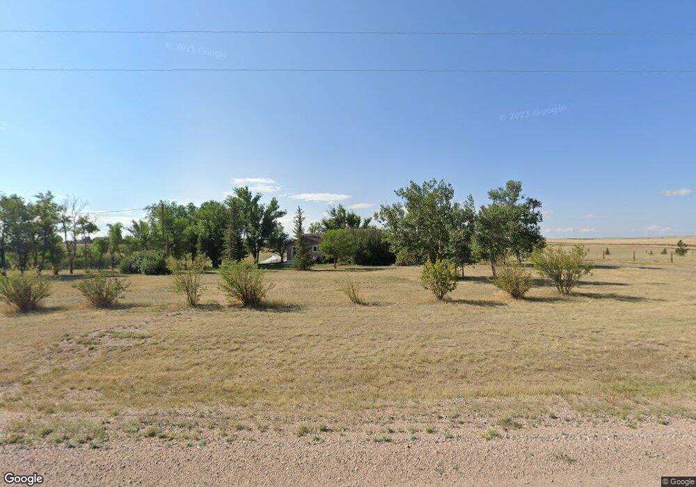
8607 Cox Rd Cheyenne, WY 82009
Estimated Value: $499,000 - $509,000
--
Bed
--
Bath
1,512
Sq Ft
$332/Sq Ft
Est. Value
About This Home
This home is located at 8607 Cox Rd, Cheyenne, WY 82009 and is currently estimated at $502,448, approximately $332 per square foot. 8607 Cox Rd is a home with nearby schools including Gilchrist Elementary School, McCormick Junior High School, and Central High School.
Ownership History
Date
Name
Owned For
Owner Type
Purchase Details
Closed on
Jan 30, 2025
Sold by
Kaelin Daniel R and Kaelin Cassandra L
Bought by
Kaelin Family Living Trust and Kaelin
Current Estimated Value
Purchase Details
Closed on
Mar 2, 2018
Sold by
Marineie Kerstin and Marineie William M
Bought by
Kaelin Daniel R and Kaelin Cassandra L
Home Financials for this Owner
Home Financials are based on the most recent Mortgage that was taken out on this home.
Original Mortgage
$225,000
Interest Rate
4.04%
Mortgage Type
New Conventional
Purchase Details
Closed on
Jun 28, 1999
Sold by
Babb James A and Babb Pamela
Bought by
Couch Michael R and Couch Teresa L
Home Financials for this Owner
Home Financials are based on the most recent Mortgage that was taken out on this home.
Original Mortgage
$117,198
Interest Rate
7.11%
Mortgage Type
VA
Create a Home Valuation Report for This Property
The Home Valuation Report is an in-depth analysis detailing your home's value as well as a comparison with similar homes in the area
Home Values in the Area
Average Home Value in this Area
Purchase History
| Date | Buyer | Sale Price | Title Company |
|---|---|---|---|
| Kaelin Family Living Trust | -- | None Listed On Document | |
| Kaelin Daniel R | -- | None Available | |
| Couch Michael R | -- | Laramie Cnty Abstract & Titl |
Source: Public Records
Mortgage History
| Date | Status | Borrower | Loan Amount |
|---|---|---|---|
| Previous Owner | Kaelin Daniel R | $225,000 | |
| Previous Owner | Couch Michael R | $117,198 |
Source: Public Records
Tax History Compared to Growth
Tax History
| Year | Tax Paid | Tax Assessment Tax Assessment Total Assessment is a certain percentage of the fair market value that is determined by local assessors to be the total taxable value of land and additions on the property. | Land | Improvement |
|---|---|---|---|---|
| 2025 | $2,375 | $42,328 | $8,212 | $34,116 |
| 2024 | $2,375 | $35,334 | $10,949 | $24,385 |
| 2023 | $2,144 | $32,631 | $9,179 | $23,452 |
| 2022 | $1,793 | $26,694 | $7,094 | $19,600 |
| 2021 | $1,674 | $24,864 | $6,808 | $18,056 |
| 2020 | $1,581 | $23,550 | $5,881 | $17,669 |
| 2019 | $1,400 | $20,831 | $5,881 | $14,950 |
| 2018 | $1,294 | $19,455 | $5,881 | $13,574 |
| 2017 | $1,289 | $19,188 | $5,881 | $13,307 |
| 2016 | $1,188 | $17,677 | $4,609 | $13,068 |
| 2015 | $1,151 | $17,122 | $4,609 | $12,513 |
| 2014 | $1,155 | $17,060 | $4,609 | $12,451 |
Source: Public Records
Map
Nearby Homes
- TBD Laramie St
- Lot 2 Sunset Mountain Rd
- Lot 5 Snowy Mountain Ct
- Lot 7 Snowy Mountain Ct
- Lot 13 Misty Mountain Rd
- 4807 Sunset Mountain Rd
- Lot 11 Misty Mountain Rd
- Lot 15 Misty Mountain Rd
- Lot 48 Big Horn Mountain Rd
- 3307 Hynds Blvd
- Lot 8 Sunset Mountain Rd
- Lot 32 Blue Ridge Mountain Rd
- Lot 58 Sunset Mountain Rd
- Lot 54 Misty Mountain Rd
- Lot 14 Misty Mountain Rd
- Lot 10 Misty Mountain Rd
- Lot 50 Misty Mountain Rd
- Lot 18 Misty Mountain Rd
- TBD W Lincolnway
- Lot 35 Blue Ridge Mountain Rd