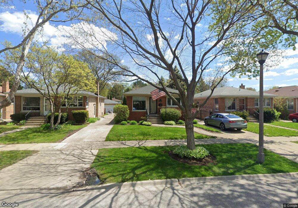
8607 Frontage Rd Skokie, IL 60077
Southwest Skokie NeighborhoodEstimated Value: $299,000 - $495,000
3
Beds
1
Bath
997
Sq Ft
$397/Sq Ft
Est. Value
About This Home
This home is located at 8607 Frontage Rd, Skokie, IL 60077 and is currently estimated at $396,013, approximately $397 per square foot. 8607 Frontage Rd is a home located in Cook County with nearby schools including Park View Elementary School, Niles West High School, and Arie Crown Hebrew Day School.
Ownership History
Date
Name
Owned For
Owner Type
Purchase Details
Closed on
Jul 16, 2003
Sold by
Mckinley Bernice E
Bought by
Goldberg Alicia M
Current Estimated Value
Purchase Details
Closed on
May 24, 1999
Sold by
American National Bk & Tr Co Of Chicago
Bought by
Mckinley Bernice
Home Financials for this Owner
Home Financials are based on the most recent Mortgage that was taken out on this home.
Original Mortgage
$172,800
Interest Rate
6.92%
Create a Home Valuation Report for This Property
The Home Valuation Report is an in-depth analysis detailing your home's value as well as a comparison with similar homes in the area
Home Values in the Area
Average Home Value in this Area
Purchase History
| Date | Buyer | Sale Price | Title Company |
|---|---|---|---|
| Goldberg Alicia M | -- | Chicago Title Insurance Comp | |
| Mckinley Bernice | $216,000 | -- |
Source: Public Records
Mortgage History
| Date | Status | Borrower | Loan Amount |
|---|---|---|---|
| Previous Owner | Mckinley Bernice | $172,800 |
Source: Public Records
Tax History Compared to Growth
Tax History
| Year | Tax Paid | Tax Assessment Tax Assessment Total Assessment is a certain percentage of the fair market value that is determined by local assessors to be the total taxable value of land and additions on the property. | Land | Improvement |
|---|---|---|---|---|
| 2024 | $6,619 | $27,750 | $7,072 | $20,678 |
| 2023 | $6,669 | $27,750 | $7,072 | $20,678 |
| 2022 | $6,669 | $29,000 | $7,072 | $21,928 |
| 2021 | $5,928 | $22,841 | $4,352 | $18,489 |
| 2020 | $5,857 | $22,841 | $4,352 | $18,489 |
| 2019 | $5,912 | $25,664 | $4,352 | $21,312 |
| 2018 | $5,543 | $22,020 | $3,944 | $18,076 |
| 2017 | $5,620 | $22,020 | $3,944 | $18,076 |
| 2016 | $5,895 | $23,156 | $3,944 | $19,212 |
| 2015 | $5,470 | $20,469 | $3,400 | $17,069 |
| 2014 | $5,470 | $20,469 | $3,400 | $17,069 |
| 2013 | $5,372 | $20,469 | $3,400 | $17,069 |
Source: Public Records
Map
Nearby Homes
- 8541 Lotus Ave Unit 914
- 5510 Lincoln Ave Unit B301
- 5510 Lincoln Ave Unit B101
- 5506 Lincoln Ave Unit A117
- 5506 Lincoln Ave Unit A211
- 5506 Lincoln Ave Unit A216
- 8655 Harms Rd
- 8708 Central Ave
- 5500 Lincoln Ave Unit 407W
- 5500 Lincoln Ave Unit 116E
- 5500 Lincoln Ave Unit 109W
- 5501 Lincoln Ave Unit 203
- 8464 Gross Point Rd
- 8461 Gross Point Rd
- 5309 Crain St
- 5536 Greenwood St
- 5459 Suffield Ct
- 5352 Greenwood St
- 8717 Gross Point Rd
- 8918 Parkside Ave
- 8603 Frontage Rd
- 8611 Frontage Rd
- 8615 Frontage Rd
- 8601 Frontage Rd
- 8617 Frontage Rd
- 8559 Hamilton Dr
- 5460 Greenleaf St
- 5462 Greenleaf St
- 8557 Hamilton Dr
- 8619 Frontage Rd
- 5458 Greenleaf St
- 8555 Hamilton Dr
- 8623 Frontage Rd
- 8553 Hamilton Dr
- 5456 Greenleaf St
- 8549 Hamilton Dr
- 8625 Frontage Rd
- 8556 Hamilton Dr
- 8547 Hamilton Dr
- 5454 Greenleaf St