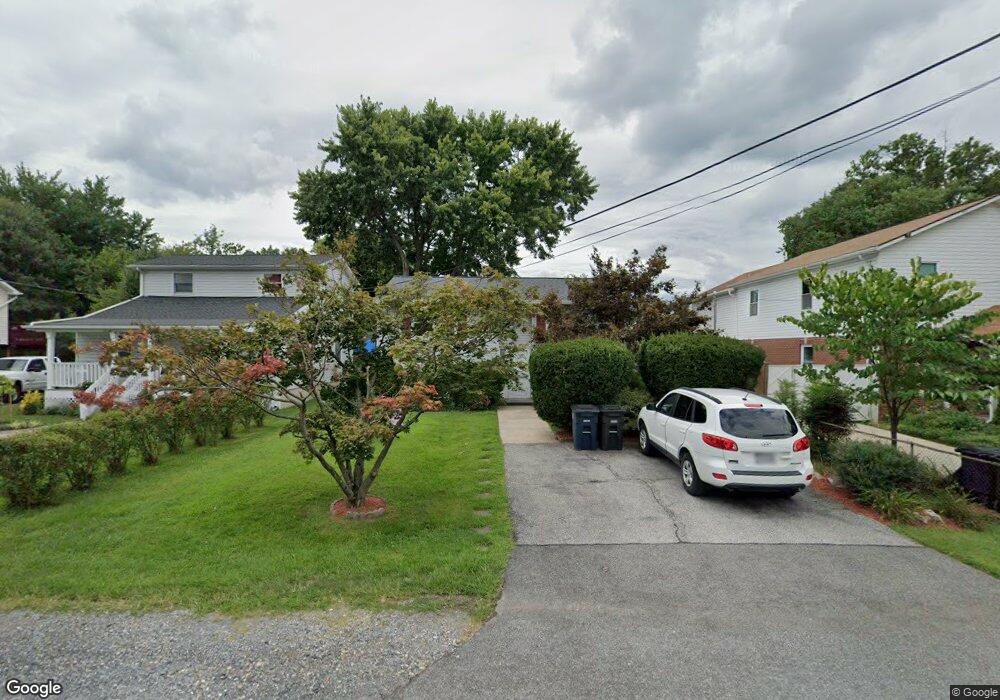
8609 Locust Grove Dr Laurel, MD 20707
South Laurel NeighborhoodEstimated Value: $333,259 - $448,000
--
Bed
2
Baths
828
Sq Ft
$503/Sq Ft
Est. Value
About This Home
This home is located at 8609 Locust Grove Dr, Laurel, MD 20707 and is currently estimated at $416,815, approximately $503 per square foot. 8609 Locust Grove Dr is a home located in Prince George's County with nearby schools including James H. Harrison Elementary School, Laurel High School, and Christian Academy of Laurel.
Ownership History
Date
Name
Owned For
Owner Type
Purchase Details
Closed on
Jan 10, 1994
Sold by
New Concept Homes Inc
Bought by
Schofield Sarah A
Current Estimated Value
Home Financials for this Owner
Home Financials are based on the most recent Mortgage that was taken out on this home.
Original Mortgage
$131,893
Interest Rate
7.23%
Purchase Details
Closed on
Dec 13, 1977
Sold by
Messersmith Robert
Bought by
Madigan James T and Madigan Jane M
Create a Home Valuation Report for This Property
The Home Valuation Report is an in-depth analysis detailing your home's value as well as a comparison with similar homes in the area
Home Values in the Area
Average Home Value in this Area
Purchase History
| Date | Buyer | Sale Price | Title Company |
|---|---|---|---|
| Schofield Sarah A | $130,091 | -- | |
| Madigan James T | $44,000 | -- |
Source: Public Records
Mortgage History
| Date | Status | Borrower | Loan Amount |
|---|---|---|---|
| Closed | Schofield Sarah A | $131,893 |
Source: Public Records
Tax History Compared to Growth
Tax History
| Year | Tax Paid | Tax Assessment Tax Assessment Total Assessment is a certain percentage of the fair market value that is determined by local assessors to be the total taxable value of land and additions on the property. | Land | Improvement |
|---|---|---|---|---|
| 2025 | $3,920 | $326,800 | $110,700 | $216,100 |
| 2024 | $3,920 | $306,667 | $0 | $0 |
| 2023 | $3,762 | $286,533 | $0 | $0 |
| 2022 | $3,570 | $266,400 | $100,700 | $165,700 |
| 2021 | $3,444 | $258,833 | $0 | $0 |
| 2020 | $3,389 | $251,267 | $0 | $0 |
| 2019 | $3,297 | $243,700 | $75,300 | $168,400 |
| 2018 | $3,141 | $222,267 | $0 | $0 |
| 2017 | $3,011 | $200,833 | $0 | $0 |
| 2016 | -- | $179,400 | $0 | $0 |
| 2015 | $2,592 | $177,767 | $0 | $0 |
| 2014 | $2,592 | $176,133 | $0 | $0 |
Source: Public Records
Map
Nearby Homes
- 0 Chestnut Ridge Dr
- 0 Railroad Ave
- 14105 William St Unit 15-C
- 8210 Willow St
- 14226 Yardarm Way Unit 107
- 14106 William St Unit 19B
- 14011F Briston St
- 8700 Kiama Rd
- 14007 Briston St
- 14114B Lauren Ln
- 8203 Willow St
- 14007B Korba Place Unit 2B
- 14002F Korba Place
- 14119 Bowsprit Ln Unit 312
- 14229 Bowsprit Ln Unit 501
- 9274 Cherry Ln Unit 82
- 14012C Justin Way Unit 26-C
- 9254 Cherry Ln Unit 17
- 13401 Kiama Ct
- 9268 Cherry Ln Unit 62
- 8611 Locust Grove Dr
- 8607 Locust Grove Dr
- 8613 Locust Grove Dr
- 8605 Locust Grove Dr
- 8608 Lindendale Dr
- 8606 Lindendale Dr
- 8610 Lindendale Dr
- 8601 Locust Grove Dr
- 8604 Lindendale Dr
- 14105 Waggaman Ave
- 8617 Locust Grove Dr
- 8606 Locust Grove Dr
- 8608 Locust Grove Dr
- 8602 Lindendale Dr
- 8614 Lindendale Dr
- 8610 Locust Grove Dr
- 8604 Locust Grove Dr
- 8612 Locust Grove Dr
- 14103 Waggaman Ave
- 8616 Lindendale Dr