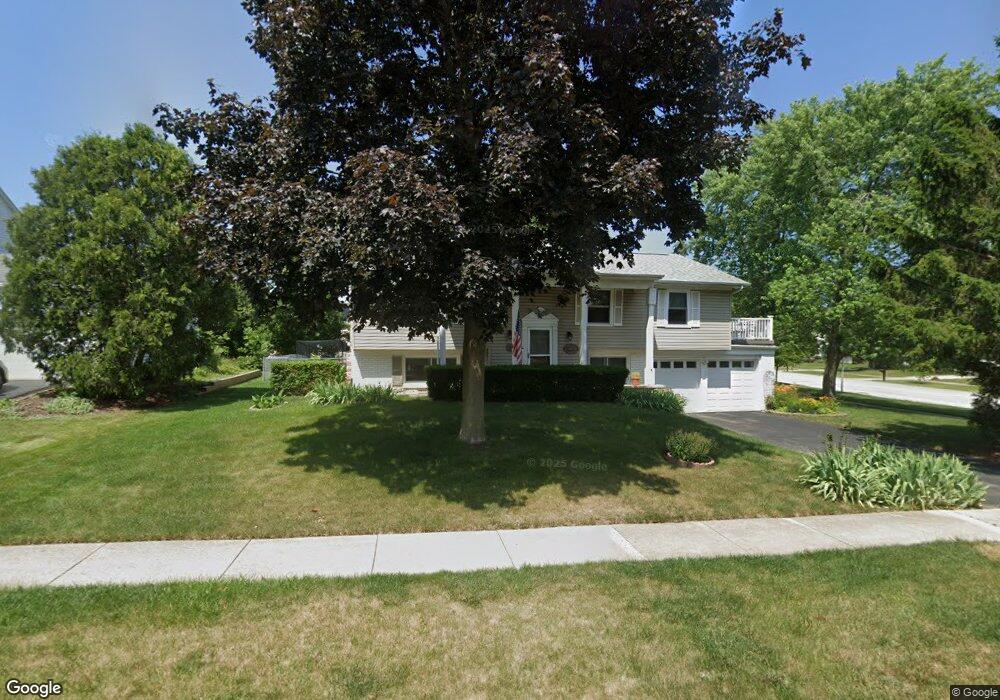
861 Dunham Ln Buffalo Grove, IL 60089
Estimated Value: $431,059 - $515,000
--
Bed
3
Baths
1,332
Sq Ft
$355/Sq Ft
Est. Value
About This Home
This home is located at 861 Dunham Ln, Buffalo Grove, IL 60089 and is currently estimated at $472,765, approximately $354 per square foot. 861 Dunham Ln is a home located in Lake County with nearby schools including Ivy Hall Elementary School, Twin Groves Middle School, and Adlai E Stevenson High School.
Ownership History
Date
Name
Owned For
Owner Type
Purchase Details
Closed on
Dec 21, 2001
Sold by
Marko William F and Marko Sherry M
Bought by
Prentiss Victor J and Prentiss Janice E
Current Estimated Value
Home Financials for this Owner
Home Financials are based on the most recent Mortgage that was taken out on this home.
Original Mortgage
$180,000
Interest Rate
6.87%
Purchase Details
Closed on
Mar 5, 1994
Sold by
Howard Robert W
Bought by
Marko William F and Marko Sherry M
Home Financials for this Owner
Home Financials are based on the most recent Mortgage that was taken out on this home.
Original Mortgage
$158,650
Interest Rate
7.27%
Create a Home Valuation Report for This Property
The Home Valuation Report is an in-depth analysis detailing your home's value as well as a comparison with similar homes in the area
Home Values in the Area
Average Home Value in this Area
Purchase History
| Date | Buyer | Sale Price | Title Company |
|---|---|---|---|
| Prentiss Victor J | $284,500 | -- | |
| Marko William F | $111,333 | First American Title Insuran |
Source: Public Records
Mortgage History
| Date | Status | Borrower | Loan Amount |
|---|---|---|---|
| Previous Owner | Prentiss Victor J | $180,000 | |
| Previous Owner | Marko William F | $158,650 |
Source: Public Records
Tax History Compared to Growth
Tax History
| Year | Tax Paid | Tax Assessment Tax Assessment Total Assessment is a certain percentage of the fair market value that is determined by local assessors to be the total taxable value of land and additions on the property. | Land | Improvement |
|---|---|---|---|---|
| 2024 | $11,391 | $134,643 | $32,969 | $101,674 |
| 2023 | $10,635 | $127,046 | $31,109 | $95,937 |
| 2022 | $10,635 | $112,993 | $27,668 | $85,325 |
| 2021 | $10,225 | $111,775 | $27,370 | $84,405 |
| 2020 | $9,789 | $112,156 | $27,463 | $84,693 |
| 2019 | $9,662 | $111,743 | $27,362 | $84,381 |
| 2018 | $9,601 | $110,932 | $27,042 | $83,890 |
| 2017 | $9,749 | $108,343 | $26,411 | $81,932 |
| 2016 | $9,491 | $103,747 | $25,291 | $78,456 |
| 2015 | $9,233 | $97,023 | $23,652 | $73,371 |
| 2014 | $9,474 | $98,055 | $25,402 | $72,653 |
| 2012 | $9,405 | $98,252 | $25,453 | $72,799 |
Source: Public Records
Map
Nearby Homes
- 810 Silver Rock Ln
- 760 Checker Dr
- 620 Twisted Oak Ln
- 12 Cloverdale Ct
- 1315 Gail Dr
- 630 Woodhollow Ln
- 1327 Larchmont Dr
- 1325 Fairfax Ln
- 938 Hidden Lake Dr
- 5107 N Arlington Heights Rd
- 1117 Franklin Ln Unit C52
- 531 Lasalle Ln
- 412 Chateau Dr
- 728 Old Checker Rd Unit C4
- 131 Autumn Ct Unit CT10602
- 746 Old Checker Rd Unit E5
- 1514 Sumter Dr
- 690 Dunhill Dr
- 5135 Bridlewood Ct
- 1272 Sandhurst Dr
- 871 Dunham Ln
- 850 Ridgefield Ln
- 861 Checker Dr
- 881 Dunham Ln
- 870 Checker Dr
- 860 Ridgefield Ln
- 880 Checker Dr
- 870 Dunham Ln
- 860 Checker Dr
- 891 Dunham Ln
- 870 Ridgefield Ln Unit 10
- 910 Checker Dr
- 921 Checker Dr
- 871 Essington Ln Unit 9
- 850 Checker Dr Unit 8
- 880 Dunham Ln
- 811 Belmar Ln
- 861 Essington Ln
- 880 Ridgefield Ln
- 920 Checker Dr