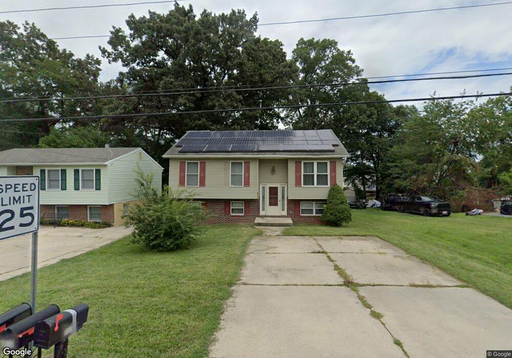
8610 Locust Grove Dr Laurel, MD 20707
South Laurel NeighborhoodEstimated Value: $392,216 - $477,000
Studio
3
Baths
1,068
Sq Ft
$417/Sq Ft
Est. Value
About This Home
This home is located at 8610 Locust Grove Dr, Laurel, MD 20707 and is currently estimated at $445,554, approximately $417 per square foot. 8610 Locust Grove Dr is a home located in Prince George's County with nearby schools including James H. Harrison Elementary School, Dwight D. Eisenhower Middle School, and Laurel High School.
Ownership History
Date
Name
Owned For
Owner Type
Purchase Details
Closed on
Aug 13, 1998
Sold by
Flynn Charles S
Bought by
Hall Lanita G and Daniel Marian E
Current Estimated Value
Purchase Details
Closed on
Aug 22, 1996
Sold by
Matthews Viola
Bought by
Flynn Charles S and Flynn Iona C
Create a Home Valuation Report for This Property
The Home Valuation Report is an in-depth analysis detailing your home's value as well as a comparison with similar homes in the area
Home Values in the Area
Average Home Value in this Area
Purchase History
| Date | Buyer | Sale Price | Title Company |
|---|---|---|---|
| Hall Lanita G | $155,000 | -- | |
| Flynn Charles S | $30,000 | -- |
Source: Public Records
Tax History
| Year | Tax Paid | Tax Assessment Tax Assessment Total Assessment is a certain percentage of the fair market value that is determined by local assessors to be the total taxable value of land and additions on the property. | Land | Improvement |
|---|---|---|---|---|
| 2025 | $5,005 | $416,000 | $110,700 | $305,300 |
| 2024 | $5,005 | $388,767 | -- | -- |
| 2023 | $4,792 | $361,533 | $0 | $0 |
| 2022 | $4,534 | $334,300 | $100,700 | $233,600 |
| 2021 | $4,379 | $326,900 | $0 | $0 |
| 2020 | $4,319 | $319,500 | $0 | $0 |
| 2019 | $4,161 | $312,100 | $75,300 | $236,800 |
| 2018 | $3,961 | $281,833 | $0 | $0 |
| 2017 | $3,796 | $251,567 | $0 | $0 |
| 2016 | -- | $221,300 | $0 | $0 |
| 2015 | $3,259 | $218,833 | $0 | $0 |
| 2014 | $3,259 | $216,367 | $0 | $0 |
Source: Public Records
Map
Nearby Homes
- 0 Railroad Ave
- 9272 Cherry Ln Unit 75
- 14111 Yardarm Way Unit 1209
- 14105 William St Unit 15-C
- 14113 William St Unit 17-C
- 14226 Yardarm Way Unit 107
- 14106 William St Unit 19B
- 9278 Cherry Ln Unit 91
- 14007 Briston St
- 7907 Crows Nest Ct Unit 11
- 14009 Korba Place
- 14119 Bowsprit Ln Unit 312
- 9260 Cherry Ln Unit 34
- 14229 Bowsprit Ln Unit 501
- 14215 Summit Ln
- 14229 Jib St Unit 12
- 14235 Jib St Unit 12
- 14044 Vista Dr
- 7902 Bayshore Dr Unit 32
- 14053 Vista Dr
- 8612 Locust Grove Dr
- 8608 Locust Grove Dr
- 8606 Locust Grove Dr
- 8618 Locust Grove Dr
- 8613 Chestnut Ridge Dr
- 8611 Chestnut Ridge Dr
- 8615 Chestnut Ridge Dr
- 8609 Chestnut Ridge Dr
- 8613 Locust Grove Dr
- 8604 Locust Grove Dr
- 8611 Locust Grove Dr
- 8607 Chestnut Ridge Dr
- 14106 Williamson Ave
- 8609 Locust Grove Dr
- 8617 Locust Grove Dr
- 8607 Locust Grove Dr
- 8700 Locust Grove Dr
- 14109A Williamson Ave
- 14109B Williamson Ave
- 14109C Williamson Ave
Your Personal Tour Guide
Ask me questions while you tour the home.