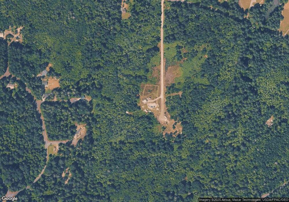
8614 112th Ave Anderson Island, WA 98303
Estimated Value: $325,000 - $429,000
3
Beds
4
Baths
2,269
Sq Ft
$164/Sq Ft
Est. Value
About This Home
This home is located at 8614 112th Ave, Anderson Island, WA 98303 and is currently estimated at $372,097, approximately $163 per square foot. 8614 112th Ave is a home with nearby schools including Anderson Island Elementary School, Pioneer Middle School, and Steilacoom High School.
Ownership History
Date
Name
Owned For
Owner Type
Purchase Details
Closed on
Nov 22, 2010
Sold by
Maan Enterprises Llc
Bought by
Wheeler Daniel A and Wheeler Ramona D
Current Estimated Value
Purchase Details
Closed on
Sep 18, 2006
Sold by
Lanco Llc
Bought by
Maan Enterprises Llc
Home Financials for this Owner
Home Financials are based on the most recent Mortgage that was taken out on this home.
Original Mortgage
$600,000
Interest Rate
6.76%
Mortgage Type
Seller Take Back
Purchase Details
Closed on
Aug 23, 2006
Sold by
Oronco Investment & Development Corp
Bought by
Lanco Llc
Home Financials for this Owner
Home Financials are based on the most recent Mortgage that was taken out on this home.
Original Mortgage
$600,000
Interest Rate
6.76%
Mortgage Type
Seller Take Back
Create a Home Valuation Report for This Property
The Home Valuation Report is an in-depth analysis detailing your home's value as well as a comparison with similar homes in the area
Home Values in the Area
Average Home Value in this Area
Purchase History
| Date | Buyer | Sale Price | Title Company |
|---|---|---|---|
| Wheeler Daniel A | $60,000 | Stewart Title Company | |
| Maan Enterprises Llc | -- | First American Title Ins Co | |
| Lanco Llc | $600,000 | Fatco |
Source: Public Records
Mortgage History
| Date | Status | Borrower | Loan Amount |
|---|---|---|---|
| Previous Owner | Lanco Llc | $600,000 |
Source: Public Records
Tax History Compared to Growth
Tax History
| Year | Tax Paid | Tax Assessment Tax Assessment Total Assessment is a certain percentage of the fair market value that is determined by local assessors to be the total taxable value of land and additions on the property. | Land | Improvement |
|---|---|---|---|---|
| 2025 | $2,817 | $276,200 | $125,000 | $151,200 |
| 2024 | $2,817 | $267,600 | $122,200 | $145,400 |
| 2023 | $2,817 | $261,000 | $126,100 | $134,900 |
| 2022 | $2,232 | $241,500 | $126,100 | $115,400 |
| 2021 | $2,340 | $177,800 | $86,100 | $91,700 |
| 2019 | $2,139 | $167,000 | $78,900 | $88,100 |
| 2018 | $2,208 | $157,800 | $71,100 | $86,700 |
| 2017 | $1,924 | $144,800 | $61,100 | $83,700 |
| 2016 | $1,181 | $80,800 | $53,300 | $27,500 |
| 2014 | $711 | $80,800 | $53,300 | $27,500 |
| 2013 | $711 | $43,300 | $43,300 | $0 |
Source: Public Records
Map
Nearby Homes
- 8510 112th Ave
- 8406 112th Ave
- 8615 Eckenstam Johnson Rd
- 11316 Breaker Way
- 9223 Kootenai Dr
- 12123 Sunset Place
- 9026 Villa Beach Rd Unit AI
- 9705 117th Ave
- 9310 123rd Ave
- 12408 93rd St
- 10018 Selma Cir
- 8912 126th Avenue Ct
- 12606 Silver Dr
- 10114 Selma Cir
- 11116 Matthews Way
- 8811 127th Avenue Ct
- 11104 Matthews Way
- 10519 Suncrest Dr
- 10102 104th Ave
- 10824 Suncrest Dr
- 0 Brod Ln & Larson Rd Unit 2 28128078
- 0 Brod Ln & Larson Rd Unit 28128093
- 0 Brod Ln & Larson Rd Unit 28128104
- 0 Brod Ln & Larson Rd Unit 28128101
- 0 Brod Ln & Larson Rd Unit 28128099
- 0 Brod Ln & Larson Rd Unit 28128096
- 0 Brod Ln & Larson Rd Unit 28128084
- 0 Brod Lane&larson Rd Unit Lot 1 28127268
- 11404 86th Street Ct Unit AI
- 8721 112th Ave
- 11408 86th Street Ct Unit AI
- 11407 87th Street Ct
- 11407 87th St Ct
- 11411 86th Street Ct
- 11411 87th Street Ct
- 11416 86th Street Ct
- 11416 86th St Ct
- 11420 86th St Ct
- 11420 86th Street Ct
- 11304 Larson Rd Unit AI
