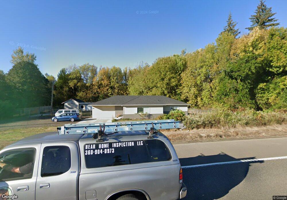
8614 NE 219th St Battle Ground, WA 98604
Estimated Value: $530,885 - $591,000
3
Beds
1
Bath
1,688
Sq Ft
$332/Sq Ft
Est. Value
About This Home
This home is located at 8614 NE 219th St, Battle Ground, WA 98604 and is currently estimated at $560,471, approximately $332 per square foot. 8614 NE 219th St is a home located in Clark County with nearby schools including Daybreak Primary School, Daybreak Middle School, and Prairie High School.
Ownership History
Date
Name
Owned For
Owner Type
Purchase Details
Closed on
Mar 14, 2013
Sold by
Hall Angie L and Hall Randy S
Bought by
State Of Washington and Department Of Transportation
Current Estimated Value
Purchase Details
Closed on
Sep 22, 2006
Sold by
Mattis Larsen Carol M
Bought by
Hall Randy S and Hall Angie L
Home Financials for this Owner
Home Financials are based on the most recent Mortgage that was taken out on this home.
Original Mortgage
$190,000
Interest Rate
6.53%
Mortgage Type
Purchase Money Mortgage
Purchase Details
Closed on
Apr 11, 2000
Sold by
Larsen Jorgen
Bought by
Mattis Larsen Carol M
Home Financials for this Owner
Home Financials are based on the most recent Mortgage that was taken out on this home.
Original Mortgage
$76,600
Interest Rate
8.24%
Create a Home Valuation Report for This Property
The Home Valuation Report is an in-depth analysis detailing your home's value as well as a comparison with similar homes in the area
Home Values in the Area
Average Home Value in this Area
Purchase History
| Date | Buyer | Sale Price | Title Company |
|---|---|---|---|
| State Of Washington | -- | Clark County Title | |
| Hall Randy S | $290,000 | Stewart Title | |
| Mattis Larsen Carol M | -- | Fidelity National Title Co |
Source: Public Records
Mortgage History
| Date | Status | Borrower | Loan Amount |
|---|---|---|---|
| Previous Owner | Hall Randy S | $190,000 | |
| Previous Owner | Mattis Larsen Carol M | $76,600 |
Source: Public Records
Tax History Compared to Growth
Tax History
| Year | Tax Paid | Tax Assessment Tax Assessment Total Assessment is a certain percentage of the fair market value that is determined by local assessors to be the total taxable value of land and additions on the property. | Land | Improvement |
|---|---|---|---|---|
| 2025 | $4,211 | $509,829 | $206,086 | $303,743 |
| 2024 | $3,805 | $478,731 | $206,086 | $272,645 |
| 2023 | $3,704 | $485,590 | $210,190 | $275,400 |
| 2022 | $3,583 | $432,505 | $162,370 | $270,135 |
| 2021 | $3,380 | $388,619 | $157,786 | $230,833 |
| 2020 | $3,356 | $334,328 | $134,868 | $199,460 |
| 2019 | $2,786 | $325,567 | $137,160 | $188,407 |
| 2018 | $3,384 | $309,300 | $0 | $0 |
| 2017 | $2,613 | $287,432 | $0 | $0 |
| 2016 | $2,510 | $240,406 | $0 | $0 |
| 2015 | $2,455 | $212,717 | $0 | $0 |
| 2014 | -- | $198,215 | $0 | $0 |
| 2013 | -- | $164,375 | $0 | $0 |
Source: Public Records
Map
Nearby Homes
- 23001 NE 82nd Ave
- 23403 NE 92nd Ave
- 151 NW 30th Ave
- 344 NW 29th Way
- 23615 NE 92nd Ave
- 2514 W Main St
- 1410 NW 30th Ave
- 2507 SW 5th Way
- 2307 SW 5th Cir
- 1019 SW 27th Ct
- 810 NW 25th Ave
- 2812 NW 14th St
- 2301 SW 5th Cir
- 23422 NE 72nd Ave
- 2401 NW 10th Way
- 2111 SW 5th St
- 2200 NW 5th St
- 20204 NE 104th Ave
- 1210 NW 24th Ave
- 2213 SW 10th St
- 8602 NE 219th St
- 21812 NE 87th Ave
- 21812 NE 87th Ave
- 8728 NE 219th St
- 8515 NE 219th St
- 8415 NE 219th St
- 8315 NE 219th St
- 8918 NE 219th St
- 21600 NE 87th Ave
- 8213 NE 219th St
- 8217 NE 219th St
- 22202 NE 84th Ave
- 00 NE 219th St
- 8909 NE 223rd Cir
- 8919 NE 219th St
- 8001 NE 219th St
- 9009 NE 223rd Cir
- 22204 NE 84th Ave
- 21408 NE 87th Ave
- 8911 NE 223rd Cir