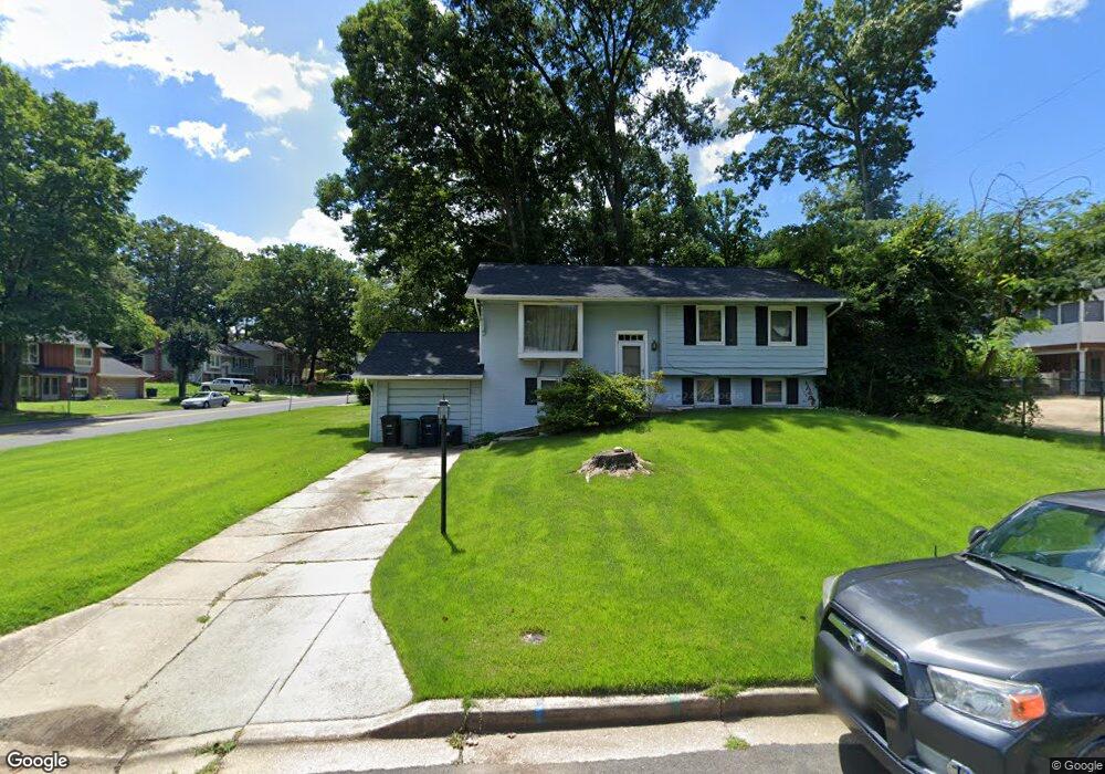
8617 Kiama Rd Laurel, MD 20708
South Laurel NeighborhoodEstimated Value: $430,627 - $468,000
Studio
2
Baths
1,091
Sq Ft
$412/Sq Ft
Est. Value
About This Home
This home is located at 8617 Kiama Rd, Laurel, MD 20708 and is currently estimated at $449,657, approximately $412 per square foot. 8617 Kiama Rd is a home located in Prince George's County with nearby schools including James H. Harrison Elementary School, Dwight D. Eisenhower Middle School, and Laurel High School.
Ownership History
Date
Name
Owned For
Owner Type
Purchase Details
Closed on
Oct 21, 1999
Sold by
Federal National Mortgage Assn
Bought by
Shode Hassan
Current Estimated Value
Purchase Details
Closed on
Jun 11, 1999
Sold by
Carley Helen A
Bought by
Federal National Mortgage Assn and Ste 1900
Purchase Details
Closed on
Jan 13, 1993
Sold by
Fetzner Raymond J and Fetzner Judith A
Bought by
Carley Helen A
Create a Home Valuation Report for This Property
The Home Valuation Report is an in-depth analysis detailing your home's value as well as a comparison with similar homes in the area
Home Values in the Area
Average Home Value in this Area
Purchase History
| Date | Buyer | Sale Price | Title Company |
|---|---|---|---|
| Shode Hassan | $142,000 | -- | |
| Federal National Mortgage Assn | $140,000 | -- | |
| Carley Helen A | $149,000 | -- |
Source: Public Records
Tax History
| Year | Tax Paid | Tax Assessment Tax Assessment Total Assessment is a certain percentage of the fair market value that is determined by local assessors to be the total taxable value of land and additions on the property. | Land | Improvement |
|---|---|---|---|---|
| 2025 | $4,539 | $350,700 | $126,500 | $224,200 |
| 2024 | $4,539 | $341,133 | -- | -- |
| 2023 | $4,419 | $331,567 | $0 | $0 |
| 2022 | $3,581 | $322,000 | $101,500 | $220,500 |
| 2021 | $5,343 | $322,000 | $101,500 | $220,500 |
| 2020 | $8,254 | $322,000 | $101,500 | $220,500 |
| 2019 | $4,647 | $324,500 | $100,700 | $223,800 |
| 2018 | $3,744 | $293,567 | $0 | $0 |
| 2017 | $3,661 | $262,633 | $0 | $0 |
| 2016 | -- | $231,700 | $0 | $0 |
| 2015 | $3,100 | $226,167 | $0 | $0 |
| 2014 | $3,100 | $220,633 | $0 | $0 |
Source: Public Records
Map
Nearby Homes
- 13400 Oaklands Manor Dr
- 8479 Imperial Dr
- 0 Railroad Ave
- 8908 Eastbourne Ln
- 13713 Shannon Ave
- 8415 Snowden Oaks Place
- 14009 Korba Place
- 8904 Royal Ridge Ln
- 14007 Briston St
- 14105 William St Unit 15-C
- 14113 William St Unit 17-C
- 14106 William St Unit 19B
- 14111 Yardarm Way Unit 1209
- 7607 Lexington Ave
- 8307 Snowden Oaks Place
- 14226 Yardarm Way Unit 107
- 14119 Bowsprit Ln Unit 312
- 14215 Summit Ln
- 14210 Greenview Dr
- 14229 Bowsprit Ln Unit 501
- 13406 Briarwood Dr
- 13405 Kiama Ct
- 8618 Kiama Rd
- 8701 Kiama Rd
- 13407 Briarwood Dr
- 8616 Kiama Rd
- 13400 Briarwood Dr
- 13405 Briarwood Dr
- 13403 Kiama Ct
- 13502 Briarwood Dr
- 8614 Kiama Rd
- 13408 Kiama Ct
- 8612 Kiama Rd
- 13404 Kiama Ct
- 13504 Briarwood Dr
- 13501 Briarcroft Ct
- 13332 Santa Anita Rd
- 13503 Briarwood Dr
- 13503 Briarcroft Ct
- 13401 Briarwood Dr
Your Personal Tour Guide
Ask me questions while you tour the home.