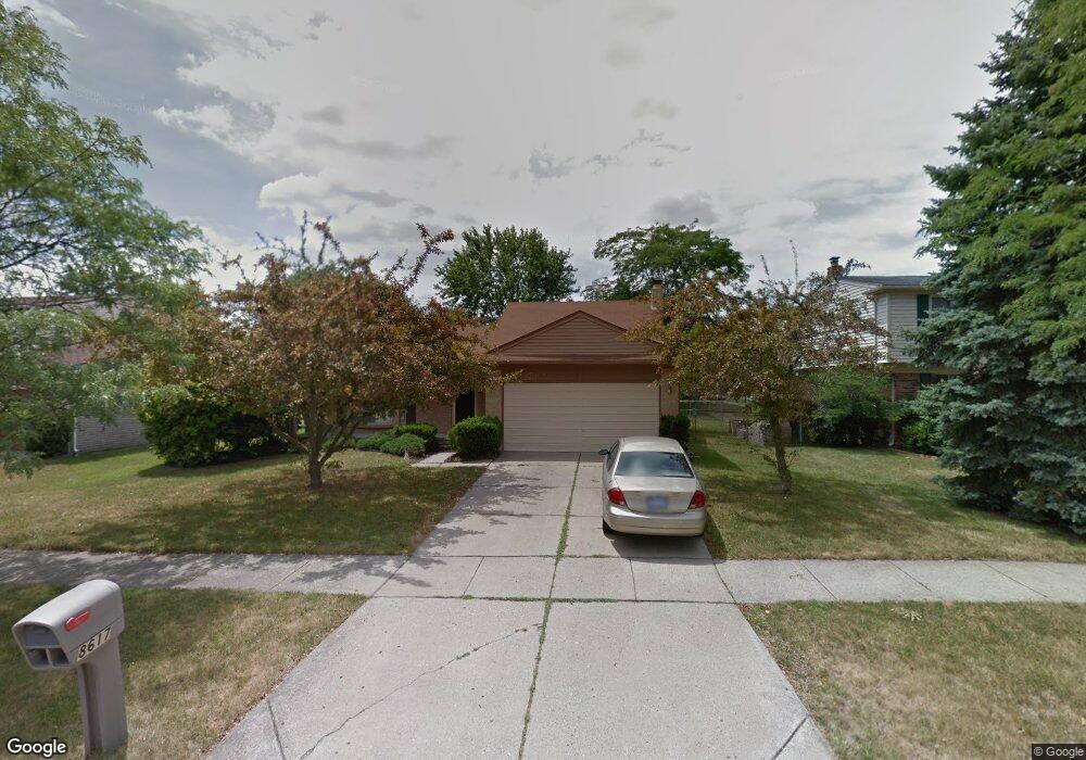
8617 Mannington Rd Canton, MI 48187
Estimated Value: $419,653 - $446,000
--
Bed
3
Baths
2,142
Sq Ft
$202/Sq Ft
Est. Value
About This Home
This home is located at 8617 Mannington Rd, Canton, MI 48187 and is currently estimated at $433,413, approximately $202 per square foot. 8617 Mannington Rd is a home located in Wayne County with nearby schools including Canton High School, Salem High School, and East Middle School.
Ownership History
Date
Name
Owned For
Owner Type
Purchase Details
Closed on
Dec 8, 2006
Sold by
Countrywide Home Loan Inc
Bought by
Bank Of New York and The Certificate Holders Of Cwabs 2004-09
Current Estimated Value
Purchase Details
Closed on
Dec 27, 2005
Sold by
Mortgage Electronic Registration Systems
Bought by
Countrywide Home Loans
Purchase Details
Closed on
Dec 7, 2005
Sold by
Frazier Tina and Frazier Deondre
Bought by
Mortgage Electronic Registration Systems
Purchase Details
Closed on
Jul 15, 2004
Sold by
Rudis Margaret M and Higgins James E
Bought by
Frazier Tina
Purchase Details
Closed on
Jul 26, 2000
Create a Home Valuation Report for This Property
The Home Valuation Report is an in-depth analysis detailing your home's value as well as a comparison with similar homes in the area
Home Values in the Area
Average Home Value in this Area
Purchase History
| Date | Buyer | Sale Price | Title Company |
|---|---|---|---|
| Bank Of New York | -- | None Available | |
| Countrywide Home Loans | -- | None Available | |
| Mortgage Electronic Registration Systems | $219,702 | None Available | |
| Frazier Tina | $243,253 | Golden Title | |
| -- | -- | -- |
Source: Public Records
Tax History Compared to Growth
Tax History
| Year | Tax Paid | Tax Assessment Tax Assessment Total Assessment is a certain percentage of the fair market value that is determined by local assessors to be the total taxable value of land and additions on the property. | Land | Improvement |
|---|---|---|---|---|
| 2025 | $1,912 | $187,400 | $0 | $0 |
| 2024 | $1,912 | $171,200 | $0 | $0 |
| 2023 | $1,823 | $156,600 | $0 | $0 |
| 2022 | $4,014 | $135,700 | $0 | $0 |
| 2021 | $3,904 | $129,400 | $0 | $0 |
| 2020 | $3,845 | $129,500 | $0 | $0 |
| 2019 | $3,781 | $120,590 | $0 | $0 |
| 2018 | $1,550 | $122,120 | $0 | $0 |
| 2017 | $3,868 | $119,300 | $0 | $0 |
| 2016 | $3,438 | $119,500 | $0 | $0 |
| 2015 | $8,514 | $109,320 | $0 | $0 |
| 2013 | $8,248 | $88,260 | $0 | $0 |
| 2010 | -- | $86,280 | $39,869 | $46,411 |
Source: Public Records
Map
Nearby Homes
- 8451 Mannington Rd
- 8530 Elmhurst St
- 8834 Northern Ave
- 8830 Northern Ave
- 8845 Oakview St
- 8591 Kingsley Dr
- 8880 Elmhurst Ave
- 8870 Brookline Ave
- 44223 Crofton Ct
- 8876 N Sheldon Rd
- 9060 N Sheldon Rd
- 43984 Arlington Rd
- 9230 Brookline Ave
- 44127 Arlington Rd
- 44854 Forest Trail Dr
- 9264 Brookline Ave
- 9205 Rocker Ave
- 9405 Northern Ave
- 43086 Versailles Rd
- 42990 Arlington Rd
- 8629 Mannington Rd
- 8595 Mannington Rd
- 8560 Westchester Ln
- 8544 Westchester Ln
- 8645 Mannington Rd
- 8571 Mannington Rd
- 8580 Westchester Ln
- 8526 Westchester Ln
- 8622 Mannington Rd
- 8598 Mannington Rd
- 8663 Mannington Rd
- 8547 Mannington Rd
- 8598 Westchester Ln
- 8574 Mannington Rd
- 8508 Westchester Ln
- 43850 Ascot St
- 8616 Westchester Ln
- 8679 Mannington Rd
- 8523 Mannington Rd
- 8550 Mannington Rd