Estimated Value: $167,140 - $341,000
3
Beds
2
Baths
1,540
Sq Ft
$165/Sq Ft
Est. Value
About This Home
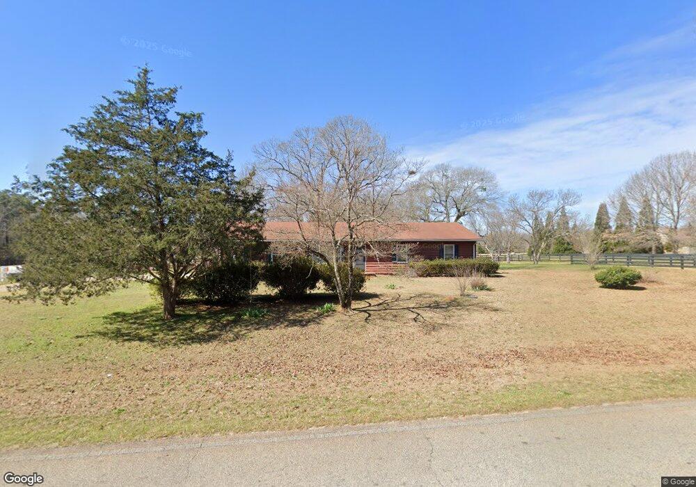
This home is located at 862 Airport Rd, Perry, GA 31069 and is currently estimated at $254,285, approximately $165 per square foot. 862 Airport Rd is a home located in Peach County with nearby schools including Kay Road Elementary School, Fort Valley Middle School, and Peach County High School.
Ownership History
Date
Name
Owned For
Owner Type
Purchase Details
Closed on
Mar 23, 2015
Sold by
Johnson Susie
Bought by
Houser Barbara Neal and Riley Lisa
Current Estimated Value
Purchase Details
Closed on
Jul 6, 2011
Sold by
Green Randolph
Bought by
Johnson Susie M
Purchase Details
Closed on
Jun 28, 2011
Sold by
Singletary Yvette Green
Bought by
Johnson Susie M
Purchase Details
Closed on
Jun 27, 2011
Sold by
Green Shirlise
Bought by
Johnson Susie M
Purchase Details
Closed on
Mar 31, 1995
Bought by
Green Ed and Johnson Susie M
Create a Home Valuation Report for This Property
The Home Valuation Report is an in-depth analysis detailing your home's value as well as a comparison with similar homes in the area
Home Values in the Area
Average Home Value in this Area
Purchase History
| Date | Buyer | Sale Price | Title Company |
|---|---|---|---|
| Houser Barbara Neal | -- | -- | |
| Johnson Susie M | $938 | -- | |
| Johnson Susie M | $938 | -- | |
| Johnson Susie M | $938 | -- | |
| Johnson Susie M | $938 | -- | |
| Johnson Susie M | $938 | -- | |
| Johnson Susie M | $938 | -- | |
| Johnson Susie M | $938 | -- | |
| Johnson Susie M | $938 | -- | |
| Green Ed | $17,500 | -- |
Source: Public Records
Tax History
| Year | Tax Paid | Tax Assessment Tax Assessment Total Assessment is a certain percentage of the fair market value that is determined by local assessors to be the total taxable value of land and additions on the property. | Land | Improvement |
|---|---|---|---|---|
| 2025 | $1,316 | $42,960 | $7,840 | $35,120 |
| 2024 | $1,345 | $42,760 | $7,840 | $34,920 |
| 2023 | $1,123 | $34,440 | $5,200 | $29,240 |
| 2022 | $1,083 | $32,640 | $5,200 | $27,440 |
| 2021 | $1,006 | $25,680 | $5,200 | $20,480 |
| 2020 | $1,251 | $33,520 | $5,200 | $28,320 |
| 2019 | $1,222 | $32,440 | $5,200 | $27,240 |
| 2018 | $1,227 | $32,440 | $5,200 | $27,240 |
| 2017 | $1,232 | $32,440 | $5,200 | $27,240 |
| 2016 | $1,249 | $33,120 | $5,880 | $27,240 |
| 2015 | $647 | $32,040 | $4,800 | $27,240 |
| 2014 | $647 | $32,040 | $4,800 | $27,240 |
| 2013 | -- | $32,040 | $4,800 | $27,240 |
Source: Public Records
Map
Nearby Homes
- 0 Airport Rd Unit 250304
- 2XX Airport Rd
- 0 Todd Rd Unit 253674
- 108 Dogwood Dr
- 309 Bermuda Ridge
- 150 MacK Thompson Rd
- 108 Chimney Rock Rd
- 0 MacK Thompson Rd Unit 253661
- 149 MacK Thompson Road Common
- 1801 Quail Ridge Ln
- 902 Quail Ridge Ln
- 102 Steerwood Trail
- 309 Charles Gray Blvd
- 328 Pebble Beach Dr
- 204 Greylock Dr
- 304 S Houston Springs Blvd
- 107 Fairway Oaks Dr
- 216 S Houston Springs Blvd
- 214 S Houston Springs Blvd
- 310 Pebble Beach Dr
- 309 Walton Chase
- 880 Airport Rd
- 305 Walton Chase
- 982 Airport Rd
- 301 Walton Chase
- 302 Walton Chase
- 17 Racking Ln Unit 17A
- 0 Racking Ln Unit M151217
- 0 Racking Ln Unit 8906118
- 0 Racking Ln
- 104 Racking Ln
- 226 Walton Chase
- 1717 Harper Rd
- 222 Walton Chase
- 616 Harper Rd
- 38 Harper Rd
- 227 Walton Chase
- 605 Harper Rd
- 223 Walton Chase
- 601 Harper Rd
Your Personal Tour Guide
Ask me questions while you tour the home.