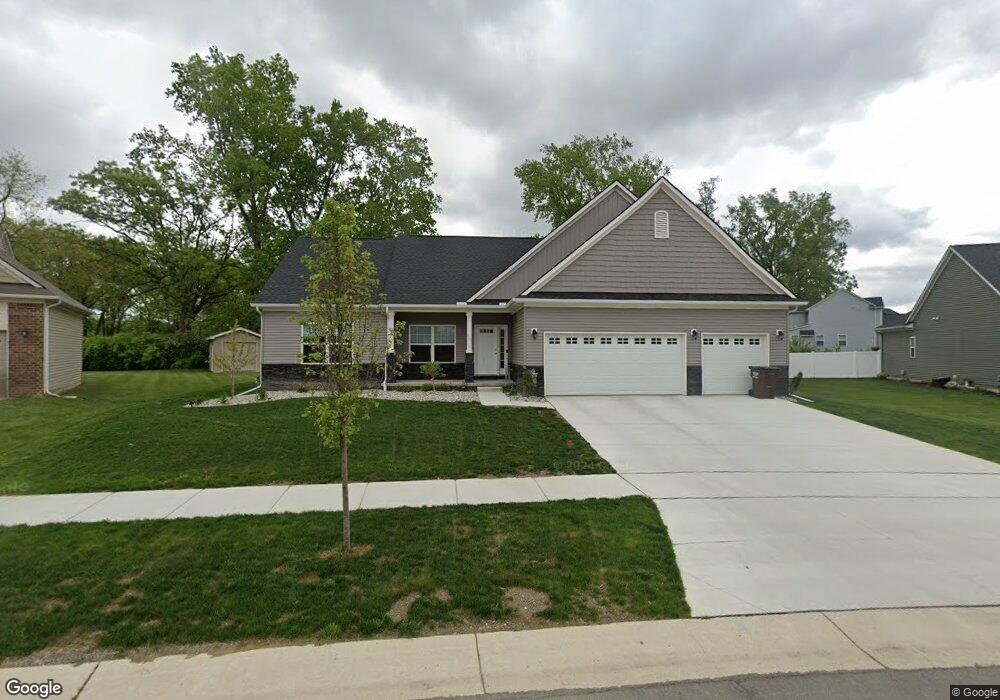
862 Henning St Dundee, MI 48131
Estimated Value: $343,000 - $383,392
Studio
--
Bath
--
Sq Ft
--
Built
About This Home
This home is located at 862 Henning St, Dundee, MI 48131 and is currently estimated at $369,348. 862 Henning St is a home located in Monroe County with nearby schools including Dundee Middle School, Dundee Elementary School, and Dundee Community High School.
Ownership History
Date
Name
Owned For
Owner Type
Purchase Details
Closed on
Dec 1, 2025
Sold by
Gillean Ashley
Bought by
Lewis Sherri
Current Estimated Value
Purchase Details
Closed on
Sep 16, 2022
Sold by
Tanglewood Condominiums Llc
Bought by
Gillean Ashley Nicole
Home Financials for this Owner
Home Financials are based on the most recent Mortgage that was taken out on this home.
Original Mortgage
$253,440
Interest Rate
5.13%
Mortgage Type
New Conventional
Create a Home Valuation Report for This Property
The Home Valuation Report is an in-depth analysis detailing your home's value as well as a comparison with similar homes in the area
Home Values in the Area
Average Home Value in this Area
Purchase History
| Date | Buyer | Sale Price | Title Company |
|---|---|---|---|
| Lewis Sherri | -- | None Listed On Document | |
| Gillean Ashley Nicole | $317,720 | Ata National Title Group |
Source: Public Records
Mortgage History
| Date | Status | Borrower | Loan Amount |
|---|---|---|---|
| Previous Owner | Gillean Ashley Nicole | $253,440 |
Source: Public Records
Tax History
| Year | Tax Paid | Tax Assessment Tax Assessment Total Assessment is a certain percentage of the fair market value that is determined by local assessors to be the total taxable value of land and additions on the property. | Land | Improvement |
|---|---|---|---|---|
| 2025 | $3,856 | $176,880 | $176,880 | $0 |
| 2024 | $3,532 | $170,140 | $0 | $0 |
| 2023 | $1,719 | $27,550 | $0 | $0 |
| 2022 | $105 | $27,550 | $0 | $0 |
| 2021 | $281 | $19,000 | $0 | $0 |
| 2020 | $278 | $13,540 | $0 | $0 |
| 2019 | $99 | $13,540 | $0 | $0 |
| 2018 | $266 | $11,880 | $0 | $0 |
| 2017 | $257 | $11,880 | $0 | $0 |
| 2016 | $210 | $11,880 | $0 | $0 |
| 2015 | $209 | $10,690 | $0 | $0 |
| 2014 | $249 | $10,690 | $0 | $0 |
| 2013 | $194 | $10,690 | $0 | $0 |
Source: Public Records
Map
Nearby Homes
- 439 E Monroe St
- 13493 Dixon Rd
- 232 Dundee Ridge Dr
- 671 Elk Ridge Dr
- 535 Falcon Dr
- 301 White Owl Ln Unit 236
- 251 Midway St
- 583 Falcon Dr
- 000 Lloyd Rd
- 769 Falcon Dr
- 1353 W Lloyd Rd
- 264 Ypsilanti St
- 626 Plank St
- 150 Waterstradt Commerce Dr
- 504 Brooks Hollow Ct
- 5024 Chatsworth St
- 512 Brooks Hollow Ct
- 469 Corinth
- 2 Covell
- 7 Covell Rd
- 866 Henning St
- 858 Henning St
- 802 Henning St
- 779 Golf Ridge Dr
- 870 Henning St Unit Bldg-Unit
- 870 Henning St
- 859 Henning St
- 874 Henning St
- 854 Henning St
- 855 Henning St
- 783 Golf Ridge Dr
- 851 Henning St
- 782 Golf Ridge Dr
- 878 Henning St
- 850 Henning St
- 862 Bradford Dr
- 787 Golf Ridge Dr
- 874 Bradford Dr
- 786 Golf Ridge Dr
- 786 Golf Ridge Dr Unit Bldg-Unit
Your Personal Tour Guide
Ask me questions while you tour the home.