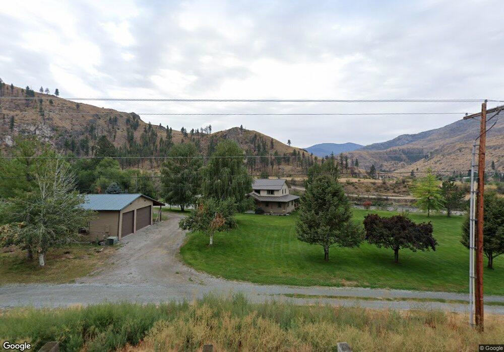
862 Highway 153 Pateros, WA 98846
Estimated Value: $895,000 - $1,125,000
4
Beds
3
Baths
3,584
Sq Ft
$285/Sq Ft
Est. Value
About This Home
This home is located at 862 Highway 153, Pateros, WA 98846 and is currently estimated at $1,022,217, approximately $285 per square foot. 862 Highway 153 is a home with nearby schools including Pateros Elementary School and Pateros High School.
Ownership History
Date
Name
Owned For
Owner Type
Purchase Details
Closed on
Jun 26, 2008
Sold by
Libbey Daryl and Libbey Susan
Bought by
Mcguire Lance and Mcguire Brooke
Current Estimated Value
Purchase Details
Closed on
Jul 11, 2007
Sold by
Libbey Daryl and Libbey Susan
Bought by
Mcguire Brooke and Mcguire Lance
Create a Home Valuation Report for This Property
The Home Valuation Report is an in-depth analysis detailing your home's value as well as a comparison with similar homes in the area
Home Values in the Area
Average Home Value in this Area
Purchase History
| Date | Buyer | Sale Price | Title Company |
|---|---|---|---|
| Mcguire Lance | -- | Transnation Title Ins Co | |
| Mcguire Brooke | -- | None Available |
Source: Public Records
Tax History Compared to Growth
Tax History
| Year | Tax Paid | Tax Assessment Tax Assessment Total Assessment is a certain percentage of the fair market value that is determined by local assessors to be the total taxable value of land and additions on the property. | Land | Improvement |
|---|---|---|---|---|
| 2025 | $7,099 | $995,900 | $135,000 | $860,900 |
| 2024 | $7,099 | $852,400 | $135,000 | $717,400 |
| 2022 | $6,336 | $526,300 | $71,000 | $455,300 |
| 2021 | $6,410 | $526,300 | $71,000 | $455,300 |
| 2020 | $6,357 | $526,300 | $71,000 | $455,300 |
| 2019 | $5,582 | $526,300 | $71,000 | $455,300 |
| 2018 | $6,695 | $526,300 | $71,000 | $455,300 |
| 2017 | $6,214 | $537,300 | $77,300 | $460,000 |
| 2016 | $6,330 | $537,300 | $77,300 | $460,000 |
| 2015 | $6,770 | $537,300 | $77,300 | $460,000 |
| 2013 | -- | $563,000 | $103,000 | $460,000 |
Source: Public Records
Map
Nearby Homes
- 6 Cowboy Rd
- 31 Cowboy Rd
- 2xx Buckhorn Mountain Rd
- 0 Flycast Rd Unit NWM2358192
- 0 Sky Ridge Rd Unit NWM2346303
- 4 Brook Trout Ln
- 3 Xx Buckhorn Mountain Rd
- 4 Black Canyon Rd
- 2 Black Canyon Rd
- 251 Burma Rd
- 15 Cowboy Rd
- 1077 Washington 153
- 38A Main St
- 3 XX Buckhorn Mountain Rd
- 2 XX Buckhorn Mountain Rd
- 29 Barn Dance Dr
- 12 Charlie Dr
- 577 Bill Shaw Rd
- 15 Sawtooth View Rd
- 2 Island View Ln
- 860 Highway 153
- 895C Highway 153
- 895 Highway 153 Unit B
- 886 Highway 153
- 6 Burma Rd
- 913 Washington 153
- 781 153 Hwy
- 0 Black Pine Rd Unit 1925756
- 0 Black Pine Rd Unit 1925745
- 83 Burma Rd
- 913 Highway 153
- 87 Burma Rd
- 916 Washington 153
- 85 Burma Rd
- 0 Lot 8 Burma Rd Unit 1153300
- 292D Highway 153
- 82 Burma Rd
- 92 Burma Rd
- 93 Burma Rd
- 916B Washington 153