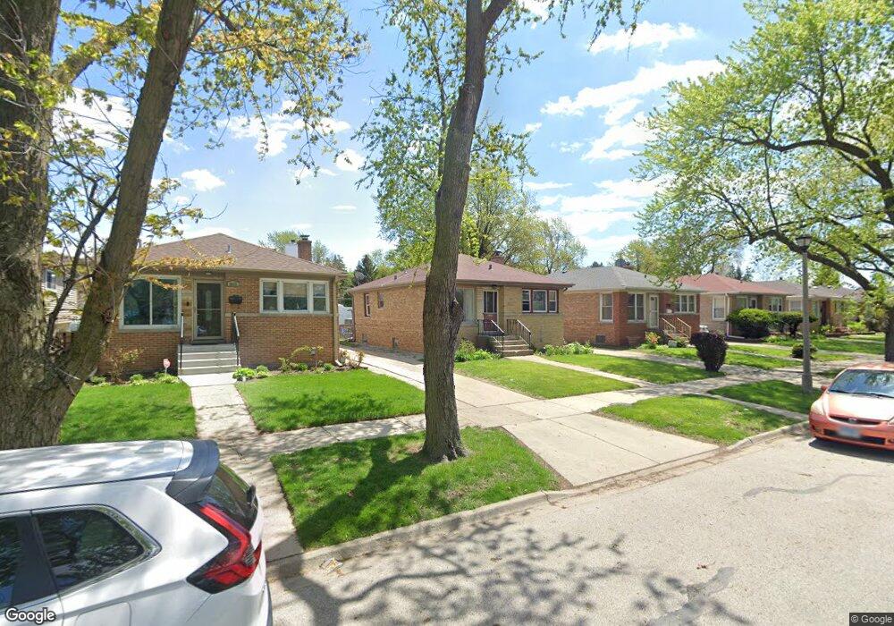
8629 Frontage Rd Skokie, IL 60077
Southwest Skokie NeighborhoodEstimated Value: $354,000 - $410,000
3
Beds
2
Baths
997
Sq Ft
$390/Sq Ft
Est. Value
About This Home
This home is located at 8629 Frontage Rd, Skokie, IL 60077 and is currently estimated at $388,517, approximately $389 per square foot. 8629 Frontage Rd is a home located in Cook County with nearby schools including Park View Elementary School, Niles West High School, and Arie Crown Hebrew Day School.
Ownership History
Date
Name
Owned For
Owner Type
Purchase Details
Closed on
Aug 25, 2005
Sold by
Kueller Elisabeth
Bought by
Shaoul David H
Current Estimated Value
Home Financials for this Owner
Home Financials are based on the most recent Mortgage that was taken out on this home.
Original Mortgage
$240,000
Outstanding Balance
$129,689
Interest Rate
6.01%
Mortgage Type
Fannie Mae Freddie Mac
Estimated Equity
$258,828
Purchase Details
Closed on
Nov 14, 1994
Sold by
American National Bk & Tr Co Of Chicago
Bought by
Elisabeth Kueller Trust
Create a Home Valuation Report for This Property
The Home Valuation Report is an in-depth analysis detailing your home's value as well as a comparison with similar homes in the area
Home Values in the Area
Average Home Value in this Area
Purchase History
| Date | Buyer | Sale Price | Title Company |
|---|---|---|---|
| Shaoul David H | $340,000 | Cti | |
| Elisabeth Kueller Trust | -- | -- |
Source: Public Records
Mortgage History
| Date | Status | Borrower | Loan Amount |
|---|---|---|---|
| Open | Shaoul David H | $240,000 |
Source: Public Records
Tax History Compared to Growth
Tax History
| Year | Tax Paid | Tax Assessment Tax Assessment Total Assessment is a certain percentage of the fair market value that is determined by local assessors to be the total taxable value of land and additions on the property. | Land | Improvement |
|---|---|---|---|---|
| 2024 | $7,229 | $26,130 | $6,240 | $19,890 |
| 2023 | $6,929 | $30,000 | $6,240 | $23,760 |
| 2022 | $6,929 | $30,000 | $6,240 | $23,760 |
| 2021 | $5,907 | $22,773 | $3,840 | $18,933 |
| 2020 | $5,837 | $22,773 | $3,840 | $18,933 |
| 2019 | $5,892 | $25,588 | $3,840 | $21,748 |
| 2018 | $5,440 | $21,675 | $3,480 | $18,195 |
| 2017 | $5,516 | $21,675 | $3,480 | $18,195 |
| 2016 | $5,473 | $21,675 | $3,480 | $18,195 |
| 2015 | $5,645 | $21,038 | $3,000 | $18,038 |
| 2014 | $5,644 | $21,038 | $3,000 | $18,038 |
| 2013 | $5,543 | $21,038 | $3,000 | $18,038 |
Source: Public Records
Map
Nearby Homes
- 8655 Harms Rd
- 8541 Lotus Ave Unit 914
- 8708 Central Ave
- 5510 Lincoln Ave Unit B301
- 5510 Lincoln Ave Unit B101
- 5506 Lincoln Ave Unit A117
- 5506 Lincoln Ave Unit A211
- 5506 Lincoln Ave Unit A216
- 5309 Crain St
- 5500 Lincoln Ave
- 5500 Lincoln Ave Unit 116E
- 5500 Lincoln Ave Unit 109W
- 5501 Lincoln Ave Unit 203
- 8461 Gross Point Rd
- 5352 Greenwood St
- 5536 Greenwood St
- 8717 Gross Point Rd
- 8605 Laramie Ave
- 8918 Parkside Ave
- 5317 Suffield Ct
- 8633 Frontage Rd
- 8625 Frontage Rd
- 8637 Frontage Rd
- 8623 Frontage Rd
- 5457 Conrad St
- 8619 Frontage Rd
- 8641 Frontage Rd
- 5456 Greenleaf St
- 5453 Conrad St
- 8617 Frontage Rd
- 5458 Greenleaf St
- 5454 Greenleaf St
- 8645 Frontage Rd
- 8615 Frontage Rd
- 8636 Harms Rd
- 5460 Greenleaf St
- 8640 Harms Rd
- 8626 Harms Rd
- 5452 Greenleaf St
- 8611 Frontage Rd