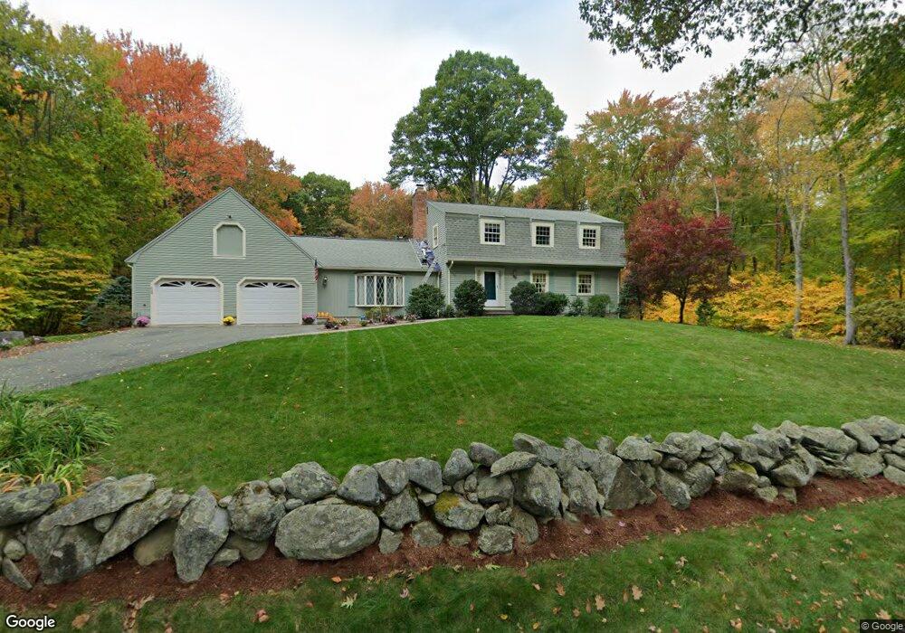
863 Depot Rd Boxborough, MA 01719
Estimated Value: $931,117 - $1,131,000
4
Beds
3
Baths
3,040
Sq Ft
$329/Sq Ft
Est. Value
About This Home
This home is located at 863 Depot Rd, Boxborough, MA 01719 and is currently estimated at $1,000,529, approximately $329 per square foot. 863 Depot Rd is a home located in Middlesex County with nearby schools including Acton-Boxborough Regional High School.
Ownership History
Date
Name
Owned For
Owner Type
Purchase Details
Closed on
Dec 16, 2021
Sold by
Mccarthy Jerome F and Mccarthy Rita E
Bought by
Mccarthy Jerome F and Mccarthy Lauren M
Current Estimated Value
Purchase Details
Closed on
Aug 2, 1976
Bought by
Mccarthy Jerome F and Mccarthy Rita E
Create a Home Valuation Report for This Property
The Home Valuation Report is an in-depth analysis detailing your home's value as well as a comparison with similar homes in the area
Home Values in the Area
Average Home Value in this Area
Purchase History
| Date | Buyer | Sale Price | Title Company |
|---|---|---|---|
| Mccarthy Jerome F | -- | None Available | |
| Mccarthy Jerome F | -- | -- |
Source: Public Records
Mortgage History
| Date | Status | Borrower | Loan Amount |
|---|---|---|---|
| Previous Owner | Mccarthy Jerome F | $82,000 | |
| Previous Owner | Mccarthy Jerome F | $55,000 |
Source: Public Records
Tax History Compared to Growth
Tax History
| Year | Tax Paid | Tax Assessment Tax Assessment Total Assessment is a certain percentage of the fair market value that is determined by local assessors to be the total taxable value of land and additions on the property. | Land | Improvement |
|---|---|---|---|---|
| 2025 | $12,542 | $828,400 | $294,300 | $534,100 |
| 2024 | $11,614 | $774,800 | $282,900 | $491,900 |
| 2023 | $10,796 | $695,600 | $244,000 | $451,600 |
| 2022 | $10,525 | $604,200 | $244,000 | $360,200 |
| 2020 | $9,550 | $571,200 | $244,000 | $327,200 |
| 2019 | $10,911 | $571,200 | $244,000 | $327,200 |
| 2018 | $0 | $540,900 | $232,600 | $308,300 |
| 2017 | $8,946 | $532,200 | $232,600 | $299,600 |
| 2016 | $8,522 | $520,900 | $232,600 | $288,300 |
| 2015 | $8,037 | $482,700 | $200,100 | $282,600 |
| 2014 | $8,054 | $455,300 | $194,300 | $261,000 |
Source: Public Records
Map
Nearby Homes
- 777 Depot Rd
- 139 Picnic St
- 62 Waite Rd
- 134 Russet Ln
- 96 Cedarwood Rd
- 89 School House Ln
- 68 Macintosh Ln
- 63 Leonard Rd Unit 63
- 1155 Burroughs Rd
- 58 Spencer Rd Unit 18K
- 50 Spencer Rd Unit 36
- 30 Paul Revere Rd
- 53 Swanson Ct Unit 36C
- 42 Swanson Ct Unit 14A
- 31 Mohawk Dr
- 5 Elm St Unit 1
- 9 Elm St Unit 1
- Lot 2 Strawberry Farm
- 220 Swanson Rd Unit 605
- 220 Swanson Rd Unit 606