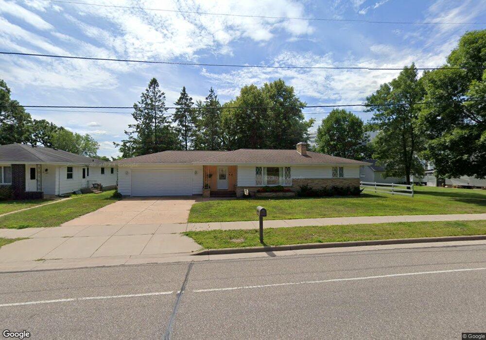
863 Truax Blvd Eau Claire, WI 54703
Upper Westside NeighborhoodEstimated Value: $236,000 - $269,857
2
Beds
2
Baths
1,600
Sq Ft
$159/Sq Ft
Est. Value
About This Home
This home is located at 863 Truax Blvd, Eau Claire, WI 54703 and is currently estimated at $254,464, approximately $159 per square foot. 863 Truax Blvd is a home located in Eau Claire County with nearby schools including Roosevelt Elementary School, Delong Middle School, and North High School.
Ownership History
Date
Name
Owned For
Owner Type
Purchase Details
Closed on
May 26, 2021
Sold by
Olson Geraldine L
Bought by
Ische Timothy B and Ische Leslie L
Current Estimated Value
Home Financials for this Owner
Home Financials are based on the most recent Mortgage that was taken out on this home.
Original Mortgage
$165,750
Outstanding Balance
$150,066
Interest Rate
2.9%
Mortgage Type
New Conventional
Estimated Equity
$104,398
Purchase Details
Closed on
Nov 15, 2010
Sold by
Roberts Dennis A
Bought by
Olson Geraldine L
Purchase Details
Closed on
Dec 20, 2006
Sold by
Roberts Diane J
Bought by
Olson Geraldine L and Olson Helmer O
Home Financials for this Owner
Home Financials are based on the most recent Mortgage that was taken out on this home.
Original Mortgage
$52,000
Interest Rate
6.27%
Mortgage Type
New Conventional
Create a Home Valuation Report for This Property
The Home Valuation Report is an in-depth analysis detailing your home's value as well as a comparison with similar homes in the area
Home Values in the Area
Average Home Value in this Area
Purchase History
| Date | Buyer | Sale Price | Title Company |
|---|---|---|---|
| Ische Timothy B | $195,000 | None Available | |
| Olson Geraldine L | -- | None Available | |
| Roberts Dennis A | -- | None Available | |
| Olson Geraldine L | -- | None Available |
Source: Public Records
Mortgage History
| Date | Status | Borrower | Loan Amount |
|---|---|---|---|
| Open | Ische Timothy B | $165,750 | |
| Previous Owner | Olson Geraldine L | $52,000 |
Source: Public Records
Tax History Compared to Growth
Tax History
| Year | Tax Paid | Tax Assessment Tax Assessment Total Assessment is a certain percentage of the fair market value that is determined by local assessors to be the total taxable value of land and additions on the property. | Land | Improvement |
|---|---|---|---|---|
| 2024 | $3,751 | $190,400 | $26,800 | $163,600 |
| 2023 | $3,434 | $190,400 | $26,800 | $163,600 |
| 2022 | $3,338 | $190,400 | $26,800 | $163,600 |
| 2021 | $3,276 | $190,400 | $26,800 | $163,600 |
| 2020 | $2,815 | $149,800 | $26,600 | $123,200 |
| 2019 | $2,794 | $149,800 | $26,600 | $123,200 |
| 2018 | $3,201 | $149,800 | $26,600 | $123,200 |
| 2017 | $3,164 | $125,200 | $22,900 | $102,300 |
| 2016 | $3,195 | $125,200 | $22,900 | $102,300 |
| 2014 | -- | $125,200 | $22,900 | $102,300 |
| 2013 | -- | $125,200 | $22,900 | $102,300 |
Source: Public Records
Map
Nearby Homes
- 3004 14th St
- 2813 12th St
- 1231 Maleda Dr
- 316 Long St
- 2842 4th St
- 709 Bolles St
- 3124 County Farm Rd
- 2726 4th St
- 599 Hagman St Unit Lot 36
- 523 Hagman St Unit Lot 28
- 521 Hagman St Unit Lot 27
- 546 Hagman St Unit Lot 20
- 548 Hagman St Unit Lot 19
- 658 Hagman St Unit Lot 4
- 2719 4th St
- 1122 Grissom Dr
- 2825 Crestwood Rd
- 2627 2nd St Unit 1-2
- 2508 Mont Claire Rd
- 2412 5th St