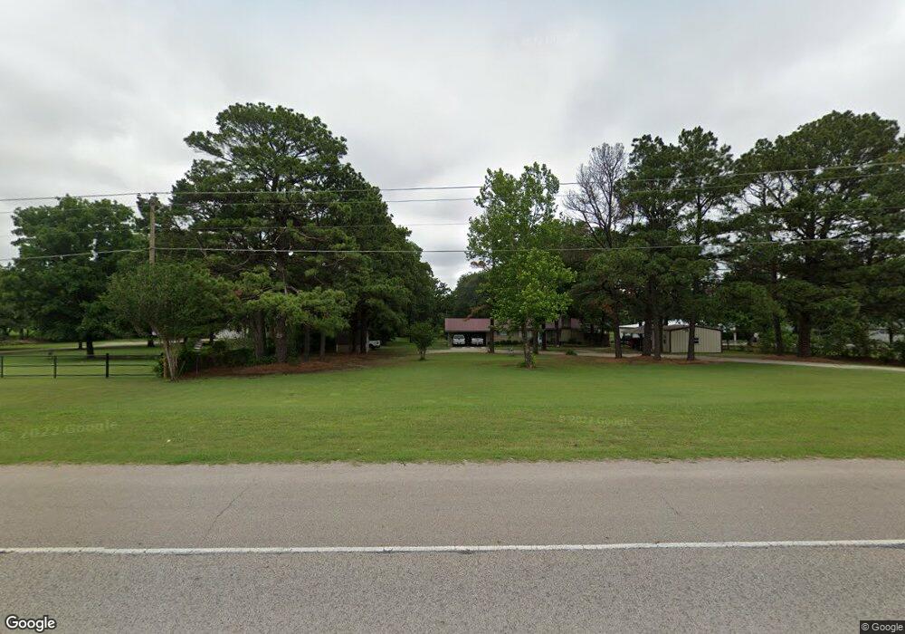
8630 State Highway 199 Ardmore, OK 73401
Estimated Value: $221,000 - $302,000
2
Beds
2
Baths
1,649
Sq Ft
$158/Sq Ft
Est. Value
About This Home
This home is located at 8630 State Highway 199, Ardmore, OK 73401 and is currently estimated at $261,104, approximately $158 per square foot. 8630 State Highway 199 is a home located in Carter County with nearby schools including Dickson Elementary School, Dickson Upper Elementary School, and Dickson Middle School.
Ownership History
Date
Name
Owned For
Owner Type
Purchase Details
Closed on
May 2, 2016
Sold by
Standard George E
Bought by
Colelasure Jeff C and Colelasure Leah S
Current Estimated Value
Purchase Details
Closed on
Mar 8, 2010
Sold by
Maher Sean M and Maher Julie M
Bought by
Harrell James and Harrell Laurie
Home Financials for this Owner
Home Financials are based on the most recent Mortgage that was taken out on this home.
Original Mortgage
$93,279
Interest Rate
5.5%
Mortgage Type
FHA
Create a Home Valuation Report for This Property
The Home Valuation Report is an in-depth analysis detailing your home's value as well as a comparison with similar homes in the area
Home Values in the Area
Average Home Value in this Area
Purchase History
| Date | Buyer | Sale Price | Title Company |
|---|---|---|---|
| Colelasure Jeff C | $152,000 | None Available | |
| Harrell James | $95,000 | -- |
Source: Public Records
Mortgage History
| Date | Status | Borrower | Loan Amount |
|---|---|---|---|
| Previous Owner | Harrell James | $93,279 |
Source: Public Records
Tax History Compared to Growth
Tax History
| Year | Tax Paid | Tax Assessment Tax Assessment Total Assessment is a certain percentage of the fair market value that is determined by local assessors to be the total taxable value of land and additions on the property. | Land | Improvement |
|---|---|---|---|---|
| 2025 | $2,178 | $21,278 | $5,141 | $16,137 |
| 2024 | $2,178 | $20,264 | $5,141 | $15,123 |
| 2023 | $2,064 | $19,300 | $5,141 | $14,159 |
| 2022 | $1,812 | $18,381 | $5,141 | $13,240 |
| 2021 | $1,771 | $17,506 | $5,141 | $12,365 |
| 2020 | $1,745 | $17,506 | $5,141 | $12,365 |
| 2019 | $1,683 | $17,448 | $5,141 | $12,307 |
| 2018 | $1,639 | $16,757 | $5,141 | $11,616 |
| 2017 | $1,819 | $18,240 | $5,141 | $13,099 |
| 2016 | $1,334 | $14,631 | $2,520 | $12,111 |
| 2015 | $1,293 | $14,175 | $2,520 | $11,655 |
| 2014 | $1,435 | $16,800 | $1,428 | $15,372 |
Source: Public Records
Map
Nearby Homes
- 8596 State Highway 199
- 8590 State Highway 199
- 8726 State Highway 199
- 0 Sam Noble Pkwy Unit 2523300
- 0 Hwy 177 Unit 2502315
- 0 Hwy 177 Unit 2546627
- 0 Dogwood Rd Unit 2545060
- 810 Gene Autry Rd
- 402 Beaumont Dr
- 3133 Cardinal Dr
- 60 Town And Country Cir
- 6080 Red Cedar Rd
- 4042 3rd Ave NE
- 1348 Gene Autry Rd
- 2370 Mary Niblack Rd
- 58 Smokey Ridge Rd
- 6389 Oklahoma 199
- 2106 Oakglen Dr
- 7 Ponderosa Rd
- 2430 3rd Ave NE
- 8630 State Highway 199
- 8662 State Highway 199
- 8611 State Highway 199
- 8651 State Highway 199
- 8581 State Highway 199
- 8769 State Highway 199
- 8726 State Highway 199
- 8726 State Highway 199
- 8543 State Highway 199
- 8521 State Highway 199
- 5918 Dogwood Rd
- 0 Sam Noble Pkwy Unit 34031
- 0 Sam Noble Pkwy Unit 2419389
- 0 Sam Noble Pkwy Unit 2320008
- 0 Sam Noble Pkwy Unit 36398
- 5894 Dogwood Rd
- 8489 State Highway 199
- 5927 Dogwood Rd
- 6155 Dogwood Rd
- 8350 State Highway 199