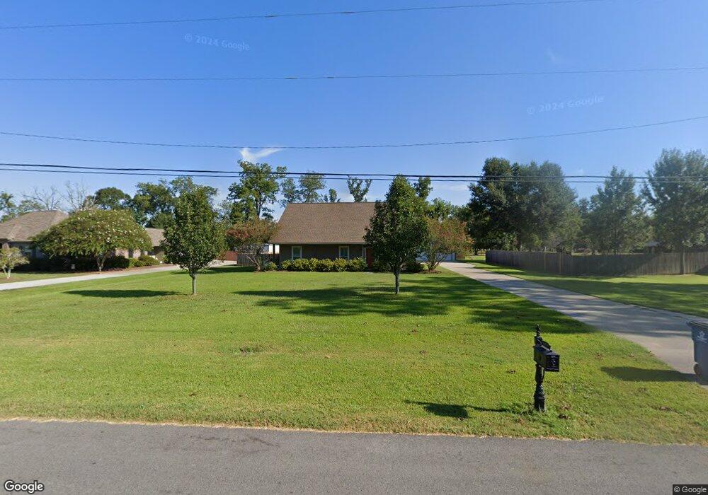
8632 Singleton Rd Port Allen, LA 70767
West Baton Rouge Parish NeighborhoodEstimated Value: $299,000 - $375,000
Studio
--
Bath
1,786
Sq Ft
$185/Sq Ft
Est. Value
About This Home
This home is located at 8632 Singleton Rd, Port Allen, LA 70767 and is currently estimated at $331,179, approximately $185 per square foot. 8632 Singleton Rd is a home located in West Baton Rouge Parish with nearby schools including Caneview K-8 School and Port Allen High School.
Ownership History
Date
Name
Owned For
Owner Type
Purchase Details
Closed on
Jan 27, 2017
Sold by
Hamil Pisani Daniel David and Hamil Ton Pisani Eunice
Bought by
Pemble Steven Jennings and Pemble Marsha H
Current Estimated Value
Home Financials for this Owner
Home Financials are based on the most recent Mortgage that was taken out on this home.
Original Mortgage
$209,700
Outstanding Balance
$174,203
Interest Rate
4.32%
Mortgage Type
New Conventional
Estimated Equity
$156,976
Create a Home Valuation Report for This Property
The Home Valuation Report is an in-depth analysis detailing your home's value as well as a comparison with similar homes in the area
Home Values in the Area
Average Home Value in this Area
Purchase History
| Date | Buyer | Sale Price | Title Company |
|---|---|---|---|
| Pemble Steven Jennings | $233,000 | None Available |
Source: Public Records
Mortgage History
| Date | Status | Borrower | Loan Amount |
|---|---|---|---|
| Open | Pemble Steven Jennings | $209,700 |
Source: Public Records
Tax History
| Year | Tax Paid | Tax Assessment Tax Assessment Total Assessment is a certain percentage of the fair market value that is determined by local assessors to be the total taxable value of land and additions on the property. | Land | Improvement |
|---|---|---|---|---|
| 2024 | $1,695 | $25,000 | $8,030 | $16,970 |
| 2023 | $1,622 | $23,120 | $6,520 | $16,600 |
| 2022 | $2,425 | $23,120 | $6,520 | $16,600 |
| 2021 | $2,480 | $23,120 | $6,520 | $16,600 |
| 2020 | $2,254 | $20,810 | $5,870 | $14,940 |
| 2019 | $2,974 | $26,360 | $4,500 | $21,860 |
| 2018 | $3,028 | $26,360 | $4,500 | $21,860 |
| 2017 | $2,796 | $26,360 | $4,500 | $21,860 |
| 2015 | $2,149 | $25,020 | $3,160 | $21,860 |
| 2014 | $2,114 | $25,020 | $3,160 | $21,860 |
| 2013 | $2,114 | $25,020 | $3,160 | $21,860 |
Source: Public Records
Map
Nearby Homes
- 8958 Singleton Rd
- 8856 Singleton Rd
- 10082 Swanson Ln
- 4900 Bueche Rd
- 5211 Wilcox Dr
- 7058 Hwy 190 W
- 6642 Section Rd
- 4216 Higdon Ln
- 6255 Rougon Rd
- 6229 Rougon Rd
- 6029 Elm Grove Rd
- 9765 Skynet Ln
- 11710 Parkland Dr S
- 8330 Bueche Rd
- 9766 Skynet Ln
- 9527 Burnside Rd
- 7000 Bueche Rd
- TBD E Subdivision Rd
- TBD E Subdivision Rd
- 841 Poydras Bayou Rd
- 8714 Singleton Rd
- 8622 Singleton Rd
- 3747 Treuil Rd
- 8734 Singleton Rd
- 3813 Treuil Rd
- 8633 Singleton Rd
- 8612 Singleton Rd
- 8816 Singleton Rd
- 8613 Singleton Rd
- 8623 Singleton Rd
- 3667 Treuil Rd
- 8836 Singleton Rd
- 8813 Singleton Rd
- 3750 Treuil Rd
- 3822 Treuil Rd
- LOT 43 Singleton Rd
- 3656 Treuil Rd
- 8853 Singleton Rd
- 3650 Twin Ln
- 3738 Treuil Rd
Your Personal Tour Guide
Ask me questions while you tour the home.