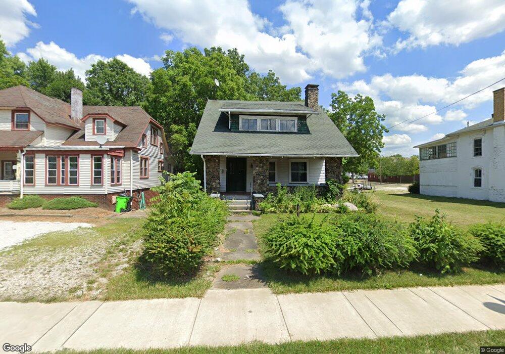
864 S Union Ave Alliance, OH 44601
Estimated Value: $81,000 - $102,000
3
Beds
1
Bath
1,724
Sq Ft
$52/Sq Ft
Est. Value
About This Home
This home is located at 864 S Union Ave, Alliance, OH 44601 and is currently estimated at $89,877, approximately $52 per square foot. 864 S Union Ave is a home located in Stark County with nearby schools including Alliance Elementary School at Rockhill, Alliance Intermediate School at Northside, and Alliance Middle School.
Ownership History
Date
Name
Owned For
Owner Type
Purchase Details
Closed on
Aug 8, 2025
Sold by
Your Forever Home Llc
Bought by
Steed Family Properties Llc
Current Estimated Value
Purchase Details
Closed on
Jan 30, 2024
Sold by
975 Hawkins Trust
Bought by
Your Forever Home Llc
Purchase Details
Closed on
Jan 24, 2024
Sold by
One-Ci-0-One Alliance Llc
Bought by
975 Hawkins Trust and Allen
Purchase Details
Closed on
Nov 14, 2000
Sold by
Schillig Sherry L and Roosa Pearl M
Bought by
One O O One Inc
Create a Home Valuation Report for This Property
The Home Valuation Report is an in-depth analysis detailing your home's value as well as a comparison with similar homes in the area
Home Values in the Area
Average Home Value in this Area
Purchase History
| Date | Buyer | Sale Price | Title Company |
|---|---|---|---|
| Steed Family Properties Llc | $22,400 | None Listed On Document | |
| Your Forever Home Llc | $15,000 | None Listed On Document | |
| 975 Hawkins Trust | -- | Heritage Union Title | |
| One O O One Inc | $60,000 | Union Title Company |
Source: Public Records
Tax History Compared to Growth
Tax History
| Year | Tax Paid | Tax Assessment Tax Assessment Total Assessment is a certain percentage of the fair market value that is determined by local assessors to be the total taxable value of land and additions on the property. | Land | Improvement |
|---|---|---|---|---|
| 2025 | $957 | $22,400 | $3,570 | $18,830 |
| 2024 | -- | $22,400 | $3,570 | $18,830 |
| 2023 | $996 | $14,950 | $1,960 | $12,990 |
| 2022 | $619 | $14,950 | $1,960 | $12,990 |
| 2021 | $621 | $14,950 | $1,960 | $12,990 |
| 2020 | $592 | $13,300 | $1,680 | $11,620 |
| 2019 | $584 | $13,300 | $1,680 | $11,620 |
| 2018 | $586 | $13,300 | $1,680 | $11,620 |
| 2017 | $520 | $11,590 | $1,400 | $10,190 |
| 2016 | $524 | $11,590 | $1,400 | $10,190 |
| 2015 | $529 | $11,590 | $1,400 | $10,190 |
| 2014 | $346 | $7,210 | $1,260 | $5,950 |
| 2013 | $172 | $7,210 | $1,260 | $5,950 |
Source: Public Records
Map
Nearby Homes
- 807 S Union Ave
- 140 W Summit St
- 427 S Union Ave
- 1005 S Freedom Ave
- 452 E Summit St
- 1175 S Freedom Ave
- 1475 Chatauqua Ct
- 432 S Linden Ave
- 1437 S Linden Ave
- 645 W Summit St
- 551 South St
- 356 E Broadway St
- 1044 S Liberty Ave
- V/L S Fredeom Ave
- 132 S Haines Ave
- 738 Kingsway St
- 725 W Summit St
- 814 Milner St
- 112 E College St
- 442 S Liberty Ave
- 852 S Union Ave
- 880 Union St
- 846 S Union Ave
- 836 S Union Ave
- 836 S Union Ave
- 828 S Union Ave
- 46 Rosenberry St
- 818 S Union Ave
- 817 S Union Ave
- 806 S Union Ave
- 35 E Grant St
- 72 Rosenberry St
- 51 E Grant St
- 69 E Grant St
- 75 Glamorgan St Unit 101
- 75 Glamorgan St
- 75 Glamorgan St
- 75 Glamorgan St
- 75 Glamorgan St
- 75 Glamorgan St Unit 107