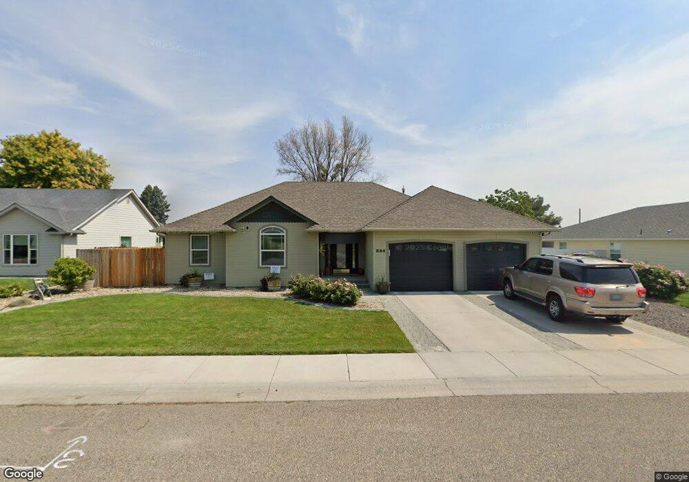
864 Triand Dr Ontario, OR 97914
Estimated Value: $345,710 - $365,000
3
Beds
2
Baths
1,563
Sq Ft
$227/Sq Ft
Est. Value
About This Home
This home is located at 864 Triand Dr, Ontario, OR 97914 and is currently estimated at $355,355, approximately $227 per square foot. 864 Triand Dr is a home located in Malheur County with nearby schools including Ontario High School, Four Rivers Community School, and Treasure Valley Christian School.
Ownership History
Date
Name
Owned For
Owner Type
Purchase Details
Closed on
Jun 22, 2020
Sold by
Maeda John S and Maeda Lisa S
Bought by
Nunez Miguel A and Nunez Cacho Lizbeth
Current Estimated Value
Home Financials for this Owner
Home Financials are based on the most recent Mortgage that was taken out on this home.
Original Mortgage
$223,250
Outstanding Balance
$197,894
Interest Rate
3.2%
Mortgage Type
New Conventional
Estimated Equity
$157,461
Create a Home Valuation Report for This Property
The Home Valuation Report is an in-depth analysis detailing your home's value as well as a comparison with similar homes in the area
Home Values in the Area
Average Home Value in this Area
Purchase History
| Date | Buyer | Sale Price | Title Company |
|---|---|---|---|
| Nunez Miguel A | $235,000 | Mctc |
Source: Public Records
Mortgage History
| Date | Status | Borrower | Loan Amount |
|---|---|---|---|
| Open | Nunez Miguel A | $223,250 |
Source: Public Records
Tax History Compared to Growth
Tax History
| Year | Tax Paid | Tax Assessment Tax Assessment Total Assessment is a certain percentage of the fair market value that is determined by local assessors to be the total taxable value of land and additions on the property. | Land | Improvement |
|---|---|---|---|---|
| 2024 | $2,786 | $180,687 | $39,569 | $141,118 |
| 2023 | $2,712 | $175,425 | $35,311 | $140,114 |
| 2022 | $2,640 | $170,316 | $40,179 | $130,137 |
| 2021 | $2,573 | $165,356 | $42,204 | $123,152 |
| 2020 | $2,504 | $160,540 | $40,696 | $119,844 |
| 2019 | $2,439 | $155,865 | $32,511 | $123,354 |
| 2018 | $2,266 | $151,326 | $32,553 | $118,773 |
| 2017 | $2,196 | $146,919 | $30,787 | $116,132 |
| 2016 | $2,101 | $142,640 | $29,890 | $112,750 |
| 2015 | $2,072 | $138,930 | $30,702 | $108,228 |
| 2014 | $1,998 | $134,884 | $29,168 | $105,716 |
Source: Public Records
Map
Nearby Homes
- 1439 Hunter Ln
- 655 NW 15th St
- 658 NW 14th St
- 563 NW 18th St
- 5387 Oregon 201
- 770 N Dorian Dr
- 335 NW 19th St
- 2048 NW 3rd Ave
- TBD Malheur Dr
- 1274 Arata Way
- 1425 W Idaho Ave
- 1360 NW 18th Ave
- 49 NW 19th St
- 124 Sears Dr
- 1488 W Idaho Ave
- 332 Sears Dr
- 1863 SW 1st Ave
- 41 N Dorian Dr
- 2543 Lauren Dr
- 1921 Arcata Way