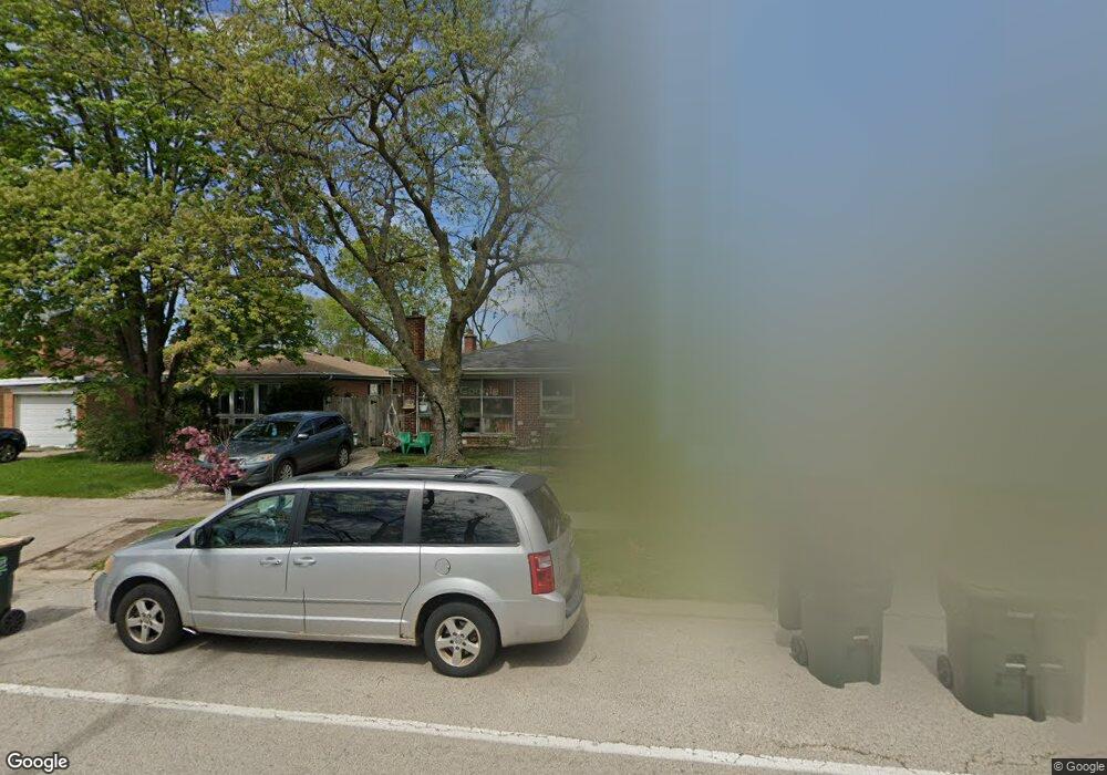
8640 Frontage Rd Morton Grove, IL 60053
Estimated Value: $372,000 - $822,000
3
Beds
1
Bath
1,064
Sq Ft
$478/Sq Ft
Est. Value
About This Home
This home is located at 8640 Frontage Rd, Morton Grove, IL 60053 and is currently estimated at $508,693, approximately $478 per square foot. 8640 Frontage Rd is a home located in Cook County with nearby schools including Park View Elementary School, Niles West High School, and Arie Crown Hebrew Day School.
Ownership History
Date
Name
Owned For
Owner Type
Purchase Details
Closed on
Mar 4, 2010
Sold by
Esmail Shahnaz and Esmail Mohammad
Bought by
Esmail Mohammad and Esmail Shahnaz
Current Estimated Value
Purchase Details
Closed on
Sep 12, 2002
Sold by
Hansen Joseph J and Hansen Beatrice L
Bought by
Esmail Shahnaz
Home Financials for this Owner
Home Financials are based on the most recent Mortgage that was taken out on this home.
Original Mortgage
$232,500
Outstanding Balance
$99,247
Interest Rate
6.54%
Estimated Equity
$409,446
Create a Home Valuation Report for This Property
The Home Valuation Report is an in-depth analysis detailing your home's value as well as a comparison with similar homes in the area
Home Values in the Area
Average Home Value in this Area
Purchase History
| Date | Buyer | Sale Price | Title Company |
|---|---|---|---|
| Esmail Mohammad | -- | None Available | |
| Esmail Shahnaz | $245,000 | -- |
Source: Public Records
Mortgage History
| Date | Status | Borrower | Loan Amount |
|---|---|---|---|
| Open | Esmail Shahnaz | $232,500 |
Source: Public Records
Tax History Compared to Growth
Tax History
| Year | Tax Paid | Tax Assessment Tax Assessment Total Assessment is a certain percentage of the fair market value that is determined by local assessors to be the total taxable value of land and additions on the property. | Land | Improvement |
|---|---|---|---|---|
| 2024 | $6,909 | $27,236 | $10,121 | $17,115 |
| 2023 | $6,554 | $27,236 | $10,121 | $17,115 |
| 2022 | $6,554 | $27,236 | $10,121 | $17,115 |
| 2021 | $6,465 | $23,486 | $6,228 | $17,258 |
| 2020 | $6,850 | $25,041 | $6,228 | $18,813 |
| 2019 | $6,918 | $28,136 | $6,228 | $21,908 |
| 2018 | $5,639 | $21,306 | $5,644 | $15,662 |
| 2017 | $5,700 | $21,306 | $5,644 | $15,662 |
| 2016 | $6,310 | $23,555 | $5,644 | $17,911 |
| 2015 | $5,401 | $19,385 | $4,865 | $14,520 |
| 2014 | $5,738 | $20,392 | $4,865 | $15,527 |
| 2013 | $5,587 | $20,392 | $4,865 | $15,527 |
Source: Public Records
Map
Nearby Homes
- 8708 Central Ave
- 8655 Harms Rd
- 8541 Lotus Ave Unit 914
- 5510 Lincoln Ave Unit B301
- 5510 Lincoln Ave Unit B101
- 5506 Lincoln Ave Unit A117
- 5506 Lincoln Ave Unit A211
- 5506 Lincoln Ave Unit A216
- 5500 Lincoln Ave Unit 116E
- 5500 Lincoln Ave Unit 109W
- 5309 Crain St
- 5536 Greenwood St
- 5501 Lincoln Ave Unit 203
- 8918 Parkside Ave
- 5352 Greenwood St
- 8461 Gross Point Rd
- 8841 Menard Ave
- 5317 Suffield Ct
- 8717 Gross Point Rd
- 8836 Mansfield Ave
- 8636 Frontage Rd
- 8644 Frontage Rd
- 8644 W Frontage Rd
- 8632 Frontage Rd
- 8648 Frontage Rd
- 8628 Frontage Rd
- 8652 Frontage Rd
- 5555 Theobald Rd
- 8624 Frontage Rd
- 8656 Frontage Rd
- 5551 Theobald Rd
- 5547 Theobald Rd
- 5543 Theobald Rd
- 8620 Frontage Rd
- 8660 Frontage Rd
- 5605 Theobald Rd
- 5539 Theobald Rd
- 8616 Frontage Rd
- 5609 Theobald Rd
- 8622 Lillibet Terrace