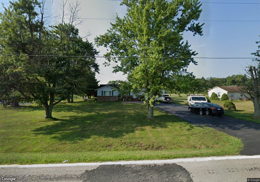
8641 State Route 762 Orient, OH 43146
Estimated Value: $337,000 - $399,000
3
Beds
2
Baths
1,516
Sq Ft
$235/Sq Ft
Est. Value
About This Home
This home is located at 8641 State Route 762, Orient, OH 43146 and is currently estimated at $355,529, approximately $234 per square foot. 8641 State Route 762 is a home located in Pickaway County.
Ownership History
Date
Name
Owned For
Owner Type
Purchase Details
Closed on
Nov 3, 1998
Sold by
Roberts Sherry L
Bought by
Aden Brian J and Aden Jennifer J
Current Estimated Value
Home Financials for this Owner
Home Financials are based on the most recent Mortgage that was taken out on this home.
Original Mortgage
$128,000
Outstanding Balance
$28,407
Interest Rate
6.78%
Mortgage Type
New Conventional
Estimated Equity
$327,122
Create a Home Valuation Report for This Property
The Home Valuation Report is an in-depth analysis detailing your home's value as well as a comparison with similar homes in the area
Home Values in the Area
Average Home Value in this Area
Purchase History
| Date | Buyer | Sale Price | Title Company |
|---|---|---|---|
| Aden Brian J | $145,000 | -- |
Source: Public Records
Mortgage History
| Date | Status | Borrower | Loan Amount |
|---|---|---|---|
| Open | Aden Brian J | $128,000 |
Source: Public Records
Tax History Compared to Growth
Tax History
| Year | Tax Paid | Tax Assessment Tax Assessment Total Assessment is a certain percentage of the fair market value that is determined by local assessors to be the total taxable value of land and additions on the property. | Land | Improvement |
|---|---|---|---|---|
| 2024 | -- | $89,540 | $22,330 | $67,210 |
| 2023 | $3,381 | $89,540 | $22,330 | $67,210 |
| 2022 | $2,605 | $63,300 | $14,890 | $48,410 |
| 2021 | $2,613 | $63,300 | $14,890 | $48,410 |
| 2020 | $2,610 | $63,300 | $14,890 | $48,410 |
| 2019 | $2,127 | $52,240 | $14,170 | $38,070 |
| 2018 | $2,037 | $52,240 | $14,170 | $38,070 |
| 2017 | $2,099 | $52,240 | $14,170 | $38,070 |
| 2016 | $2,042 | $50,700 | $12,360 | $38,340 |
| 2015 | $2,043 | $50,700 | $12,360 | $38,340 |
| 2014 | $2,045 | $50,700 | $12,360 | $38,340 |
| 2013 | $2,125 | $50,700 | $12,360 | $38,340 |
Source: Public Records
Map
Nearby Homes
- 0 Burgett Rd
- 7789 State Route 762
- 11652 Matville Rd
- 10819 Thrailkill Rd
- 11044 Coontz Rd
- 182 Honey Locust Ln
- 186 Red Oak Ct
- 169 Chestnut Commons Dr
- 166 Rosewood Loop SE
- 161 Chestnut Estates Dr
- 0 Matville Rd Unit 225036975
- 0 Matville Rd Unit 225031013
- 0 Matville Rd Unit 225030661
- 0 Matville Rd Unit 225030635
- 8143 Snyder Rd
- 56 Chambers Bay Rd
- 294 Shady Hollow Dr
- 47 Front St
- 0 Scioto-Darby Rd Unit 225032793
- 0 Lane Rd Unit 225004404
- 8661 State Route 762
- 8629 State Route 762
- 8617 State Route 762
- 8681 State Route 762
- 8581 State Route 762
- 8561 State Route 762
- 10879 Matville Rd
- 10901 Matville Rd
- 8723 State Route 762
- 10937 Matville Rd
- 11017 Matville Rd
- 11045 Matville Rd
- 10560 Matville Rd
- 8310 State Route 762
- 8901 State Route 762
- 8952 State Route 762
- 11201 Matville Rd
- 9124 State Route 762
- 11320 Matville Rd
- 9127 State Route 762