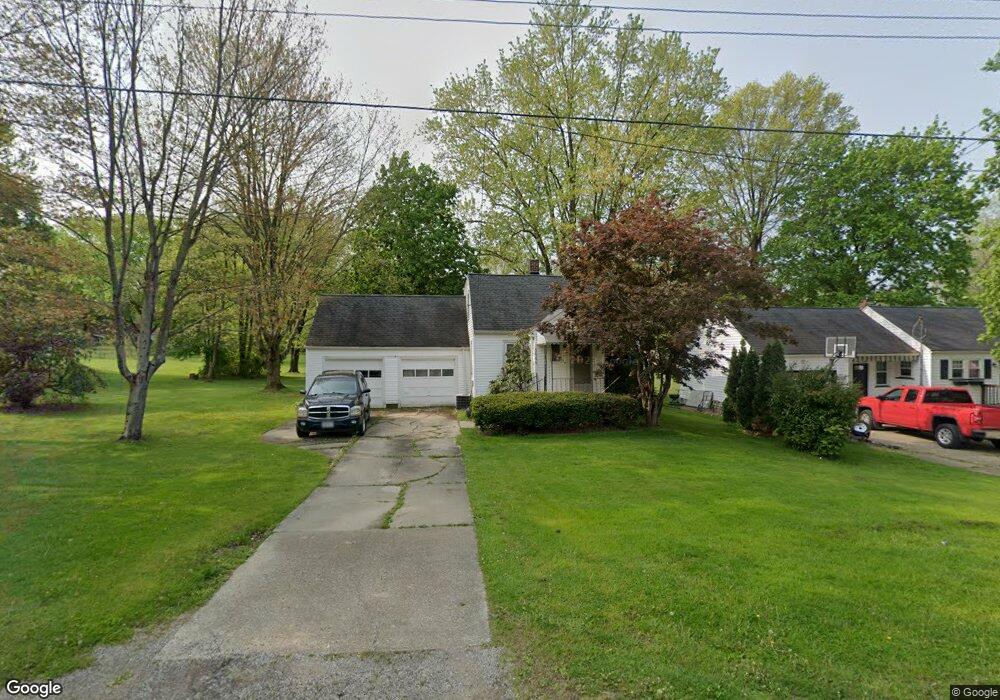
8644 Stetson Dr NE Warren, OH 44484
Estimated Value: $121,630 - $148,000
2
Beds
1
Bath
871
Sq Ft
$155/Sq Ft
Est. Value
About This Home
This home is located at 8644 Stetson Dr NE, Warren, OH 44484 and is currently estimated at $135,158, approximately $155 per square foot. 8644 Stetson Dr NE is a home located in Trumbull County with nearby schools including Howland High School and John F. Kennedy Catholic School - Lower Campus.
Ownership History
Date
Name
Owned For
Owner Type
Purchase Details
Closed on
Jan 16, 2024
Sold by
Powell Jon K and Powell Melissa D
Bought by
A & S Twins Properties Llc
Current Estimated Value
Purchase Details
Closed on
Nov 15, 2017
Sold by
Powell Jon K
Bought by
Powell Jon K and Powel Melissa D
Purchase Details
Closed on
Jan 1, 1990
Bought by
Jon K Powell
Create a Home Valuation Report for This Property
The Home Valuation Report is an in-depth analysis detailing your home's value as well as a comparison with similar homes in the area
Home Values in the Area
Average Home Value in this Area
Purchase History
| Date | Buyer | Sale Price | Title Company |
|---|---|---|---|
| A & S Twins Properties Llc | $55,000 | None Listed On Document | |
| Powell Jon K | -- | None Available | |
| Jon K Powell | -- | -- |
Source: Public Records
Tax History Compared to Growth
Tax History
| Year | Tax Paid | Tax Assessment Tax Assessment Total Assessment is a certain percentage of the fair market value that is determined by local assessors to be the total taxable value of land and additions on the property. | Land | Improvement |
|---|---|---|---|---|
| 2024 | $1,733 | $31,990 | $9,940 | $22,050 |
| 2023 | $1,733 | $31,990 | $9,940 | $22,050 |
| 2022 | $878 | $22,720 | $9,940 | $12,780 |
| 2021 | $858 | $22,720 | $9,940 | $12,780 |
| 2020 | $861 | $22,720 | $9,940 | $12,780 |
| 2019 | $834 | $21,560 | $9,940 | $11,620 |
| 2018 | $798 | $21,560 | $9,940 | $11,620 |
| 2017 | $717 | $21,560 | $9,940 | $11,620 |
| 2016 | $589 | $18,970 | $9,870 | $9,100 |
| 2015 | $574 | $18,970 | $9,870 | $9,100 |
| 2014 | $554 | $18,970 | $9,870 | $9,100 |
| 2013 | $799 | $18,970 | $9,870 | $9,100 |
Source: Public Records
Map
Nearby Homes
- 8848 King Graves Rd NE
- 8936 Stetson Dr NE
- 0 King Graves Rd NE
- 8545 Carriage Hill Dr NE
- 2133 Silver Fox Ln NE
- 1750 Portal Dr NE
- 8531 Red Oak Dr NE
- 2193 Howland Wilson Rd NE
- 2140 Howland Wilson Rd NE
- 106 N Aspen Ct Unit 4
- 126 N Aspen Ct Unit 2
- 7979 Brookwood St NE
- Lot 4 N Gulch Ln
- 1015 Cambridge Ct NE
- 7837 Raglan Dr NE
- 5 Oh-46
- 4 Niles Cortland Rd NE
- 0 #3 Niles Cortland Rd- Sr 46 Unit 4274646
- 1 Oh-46
- 0 Niles Cortland Rd Sr 46 Unit 4273262
- 8628 Stetson Dr NE
- 8664 Stetson Dr NE
- 8635 Stetson Dr NE
- 8622 Stetson Dr NE
- 0 Stetson Unit 4006120
- 0 Stetson Unit 3716519
- 8683 Stetson Dr NE
- 8618 King Graves Rd NE
- 8638 King Graves Rd NE
- 8658 King Graves Rd NE
- 8703 Stetson Dr NE
- 2200 Rolling Meadows Dr NE
- 2190 Rolling Meadows Dr NE
- 8712 Stetson Dr NE
- 2210 Rolling Meadows Dr NE
- 2180 Rolling Meadows Dr NE
- 1589 Duffus Rd NE
- 8718 King Graves Rd NE
- 2170 Rolling Meadows Dr NE
- 2220 Rolling Meadows Dr NE