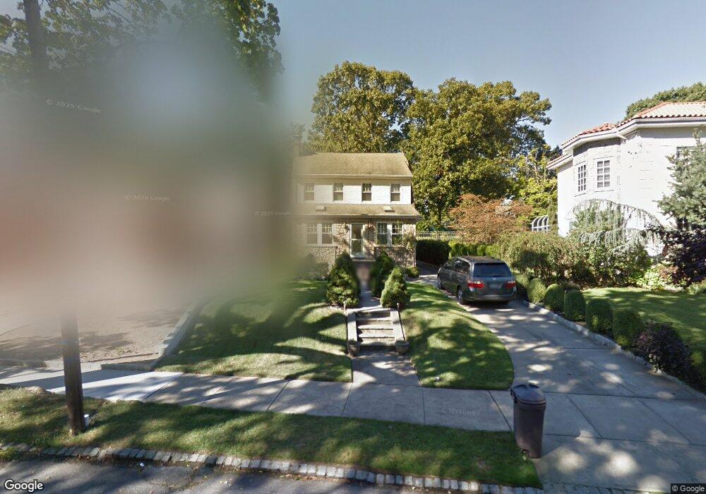
8646 Palo Alto St Hollis, NY 11423
Holliswood NeighborhoodEstimated Value: $1,159,000 - $1,297,000
--
Bed
--
Bath
2,002
Sq Ft
$620/Sq Ft
Est. Value
About This Home
This home is located at 8646 Palo Alto St, Hollis, NY 11423 and is currently estimated at $1,241,929, approximately $620 per square foot. 8646 Palo Alto St is a home located in Queens County with nearby schools including P.S. 35 Nathaniel Woodhull, I.S. 238 Susan B Anthony Academy, and The Wellspring Schools.
Ownership History
Date
Name
Owned For
Owner Type
Purchase Details
Closed on
Apr 12, 1995
Sold by
Iacona Joseph P and Iacona Frances A
Bought by
Tsang Jimmy H and Tsang Eileen Lee
Current Estimated Value
Home Financials for this Owner
Home Financials are based on the most recent Mortgage that was taken out on this home.
Original Mortgage
$196,000
Interest Rate
8.33%
Create a Home Valuation Report for This Property
The Home Valuation Report is an in-depth analysis detailing your home's value as well as a comparison with similar homes in the area
Home Values in the Area
Average Home Value in this Area
Purchase History
| Date | Buyer | Sale Price | Title Company |
|---|---|---|---|
| Tsang Jimmy H | $245,000 | First American Title Ins Co |
Source: Public Records
Mortgage History
| Date | Status | Borrower | Loan Amount |
|---|---|---|---|
| Closed | Tsang Jimmy H | $196,000 |
Source: Public Records
Tax History Compared to Growth
Tax History
| Year | Tax Paid | Tax Assessment Tax Assessment Total Assessment is a certain percentage of the fair market value that is determined by local assessors to be the total taxable value of land and additions on the property. | Land | Improvement |
|---|---|---|---|---|
| 2025 | $11,735 | $63,416 | $23,081 | $40,335 |
| 2024 | $11,747 | $59,827 | $23,512 | $36,315 |
| 2023 | $11,055 | $56,442 | $21,212 | $35,230 |
| 2022 | $10,583 | $59,400 | $24,240 | $35,160 |
| 2021 | $11,163 | $54,540 | $24,240 | $30,300 |
| 2020 | $10,890 | $57,780 | $24,240 | $33,540 |
| 2019 | $10,137 | $63,660 | $24,240 | $39,420 |
| 2018 | $9,290 | $47,035 | $15,324 | $31,711 |
| 2017 | $8,950 | $45,376 | $17,746 | $27,630 |
| 2016 | $8,761 | $45,376 | $17,746 | $27,630 |
| 2015 | $4,943 | $44,039 | $23,428 | $20,611 |
| 2014 | $4,943 | $41,547 | $21,417 | $20,130 |
Source: Public Records
Map
Nearby Homes
- 190-22 Nero Ave
- 86-55 Santiago St
- 8714 Santiago St
- 8684 188th St
- 8702 Chevy Chase St
- 8702 188th St
- 8716 Palo Alto St
- 195-12 Mclaughlin Ave
- 186-34 Henley Rd
- 19346 Mclaughlin Ave
- 184-51 Hovenden Rd
- 19127 Foothill Ave
- 193-03 85th Rd
- 19512 Mclaughlin Ave
- 19615 Como Ave
- 195-22 Mclaughlin Ave
- 193-55 85th Rd
- 187-14 Wexford Terrace
- 18414 Grand Central Pkwy
- 8746 Chelsea St Unit 6E
- 8652 Palo Alto St
- 8636 Palo Alto St
- 8656 Palo Alto St
- 86-32 Palo Alto St
- 8632 Palo Alto St
- 8660 Palo Alto St
- 8660 Palo Alto St
- 8623 Santiago St
- 8628 Palo Alto St
- 86-23 Santiago St
- 8627 Santiago St
- 8609 Santiago St
- 8641 Santiago St
- 8664 Palo Alto St
- 8624 Palo Alto St
- 8645 Santiago St
- 8605 Santiago St
- 86-45 Santiago St
- 86-05 Santiago St
- 8653 Palo Alto St