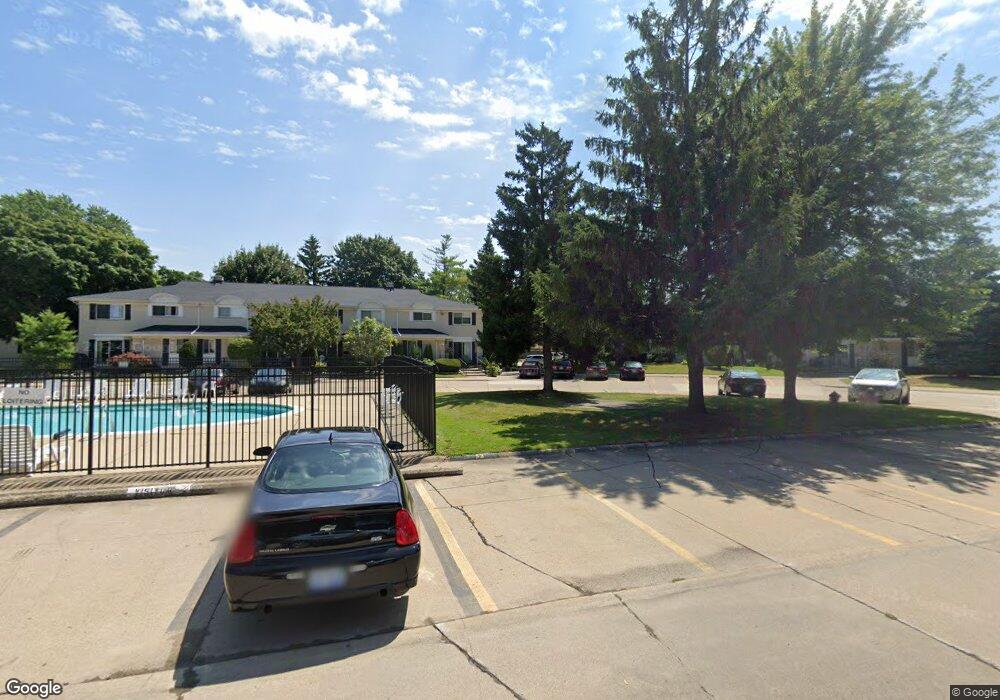
8647 Winchester Dr Unit M 8 Sterling Heights, MI 48313
Estimated Value: $181,512 - $187,000
--
Bed
2
Baths
1,321
Sq Ft
$139/Sq Ft
Est. Value
About This Home
This home is located at 8647 Winchester Dr Unit M 8, Sterling Heights, MI 48313 and is currently estimated at $184,128, approximately $139 per square foot. 8647 Winchester Dr Unit M 8 is a home located in Macomb County with nearby schools including Schwarzkoff Elementary School, Davis Junior High School, and Adlai Stevenson High School.
Ownership History
Date
Name
Owned For
Owner Type
Purchase Details
Closed on
Apr 28, 2011
Sold by
Albanian American Moslem Society Of Detr
Bought by
Qafleshi Liridon
Current Estimated Value
Purchase Details
Closed on
Jan 5, 2011
Sold by
Vancleve Norman L and Van Cleve Betty J
Bought by
Deutsche Bank National Trust Company
Purchase Details
Closed on
Apr 5, 1995
Sold by
Sefcovic Joseph S
Bought by
Cleve Norman L and Cleve Bettye J Van
Home Financials for this Owner
Home Financials are based on the most recent Mortgage that was taken out on this home.
Original Mortgage
$46,500
Interest Rate
8.55%
Mortgage Type
New Conventional
Create a Home Valuation Report for This Property
The Home Valuation Report is an in-depth analysis detailing your home's value as well as a comparison with similar homes in the area
Home Values in the Area
Average Home Value in this Area
Purchase History
| Date | Buyer | Sale Price | Title Company |
|---|---|---|---|
| Qafleshi Liridon | -- | None Available | |
| Deutsche Bank National Trust Company | $108,504 | None Available | |
| Cleve Norman L | $66,500 | -- |
Source: Public Records
Mortgage History
| Date | Status | Borrower | Loan Amount |
|---|---|---|---|
| Previous Owner | Cleve Norman L | $46,500 |
Source: Public Records
Tax History Compared to Growth
Tax History
| Year | Tax Paid | Tax Assessment Tax Assessment Total Assessment is a certain percentage of the fair market value that is determined by local assessors to be the total taxable value of land and additions on the property. | Land | Improvement |
|---|---|---|---|---|
| 2025 | $1,884 | $72,800 | $0 | $0 |
| 2024 | $1,472 | $67,100 | $0 | $0 |
| 2023 | $1,392 | $63,900 | $0 | $0 |
| 2022 | $1,662 | $60,100 | $0 | $0 |
| 2021 | $1,627 | $56,100 | $0 | $0 |
| 2020 | $1,252 | $54,300 | $0 | $0 |
| 2019 | $1,441 | $49,600 | $0 | $0 |
| 2018 | $1,526 | $48,000 | $0 | $0 |
| 2017 | $1,475 | $50,000 | $5,000 | $45,000 |
| 2016 | $1,441 | $50,000 | $0 | $0 |
| 2015 | -- | $37,500 | $0 | $0 |
| 2014 | -- | $25,900 | $0 | $0 |
Source: Public Records
Map
Nearby Homes
- 41515 Hamilton Dr
- 41371 Hamilton Dr
- 42049 Farm Lane Ct
- 11716 Clinton River Rd
- 8125 Ogden Dr
- 42790 Utica Rd
- 40453 Regency Dr
- 40309 Lexington Park Dr
- 11615 Diehl Dr
- 8644 Independence Dr
- 8273 Independence Dr
- 8641 Alwardt Dr
- 11898 Lewlund Dr
- 8341 Clay Ct
- 41744 Mae Wood Dr
- 39856 Parklawn Dr
- 43044 Pontchartrain Ave Unit 63
- 11156 Diamond Dr
- 8147 Clay Ct
- 8133 Clay Ct
- 8645 Winchester Dr Unit 7
- 8645 Winchester Dr Unit M, 7
- 8645 Winchester Dr Unit M
- 8647 Winchester Dr Unit 8
- 8645 Winchester Dr
- 8643 Winchester Dr Unit M6
- 8641 Winchester Dr Unit M5
- 8607 Winchester Dr Unit M4
- 8605 Winchester Dr Unit M3
- 8603 Winchester Dr Unit M2
- 8601 Winchester Dr
- 8637 Winchester Dr Unit L5
- 8619 Winchester Dr Unit 2
- 8619 Winchester Dr Unit L 2
- 8619 Winchester Dr
- 8619 Winchester Dr Unit 2, Bldg L
- 8687 Winchester Dr Unit Q8
- 8685 Winchester Dr Unit 7
- 8683 Winchester Dr
- 8681 Winchester Dr