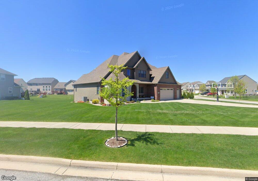
865 Huey Dr Crown Point, IN 46307
Estimated Value: $771,603 - $850,000
4
Beds
4
Baths
3,212
Sq Ft
$252/Sq Ft
Est. Value
About This Home
This home is located at 865 Huey Dr, Crown Point, IN 46307 and is currently estimated at $808,401, approximately $251 per square foot. 865 Huey Dr is a home located in Lake County with nearby schools including Lake Street Elementary School, Robert Taft Middle School, and Crown Point High School.
Ownership History
Date
Name
Owned For
Owner Type
Purchase Details
Closed on
Apr 22, 2020
Sold by
Doctor Darrel R and Doctor Melissa M
Bought by
Ballou Benjamin T and Ballou Angela J
Current Estimated Value
Home Financials for this Owner
Home Financials are based on the most recent Mortgage that was taken out on this home.
Original Mortgage
$269,000
Outstanding Balance
$183,512
Interest Rate
3.5%
Mortgage Type
New Conventional
Estimated Equity
$624,889
Purchase Details
Closed on
Aug 21, 2012
Sold by
Blum Construction Inc
Bought by
Doctor Darrel and Doctor Missy
Purchase Details
Closed on
May 16, 2012
Sold by
Doctor Missy M
Bought by
Blum Construction Inc
Purchase Details
Closed on
Feb 10, 2012
Sold by
Rohaley Daniel M and Trust #202615-96
Bought by
Doctor Missy M
Create a Home Valuation Report for This Property
The Home Valuation Report is an in-depth analysis detailing your home's value as well as a comparison with similar homes in the area
Home Values in the Area
Average Home Value in this Area
Purchase History
| Date | Buyer | Sale Price | Title Company |
|---|---|---|---|
| Ballou Benjamin T | -- | Community Title Co | |
| Doctor Darrel R | -- | Community Title Co | |
| Doctor Darrel | -- | Multiple | |
| Blum Construction Inc | -- | Accommodation | |
| Doctor Missy M | -- | Fidelity Mo |
Source: Public Records
Mortgage History
| Date | Status | Borrower | Loan Amount |
|---|---|---|---|
| Open | Ballou Benjamin T | $269,000 |
Source: Public Records
Tax History
| Year | Tax Paid | Tax Assessment Tax Assessment Total Assessment is a certain percentage of the fair market value that is determined by local assessors to be the total taxable value of land and additions on the property. | Land | Improvement |
|---|---|---|---|---|
| 2025 | $7,237 | $735,600 | $87,400 | $648,200 |
| 2024 | $17,735 | $705,000 | $87,400 | $617,600 |
| 2023 | $7,192 | $645,300 | $87,400 | $557,900 |
| 2022 | $6,871 | $610,500 | $87,400 | $523,100 |
| 2021 | $6,804 | $604,600 | $69,500 | $535,100 |
| 2020 | $6,608 | $587,400 | $69,500 | $517,900 |
| 2019 | $5,971 | $526,800 | $69,500 | $457,300 |
| 2018 | $7,849 | $518,100 | $69,500 | $448,600 |
| 2017 | $7,362 | $489,100 | $69,500 | $419,600 |
| 2016 | $6,954 | $457,700 | $64,100 | $393,600 |
| 2014 | $6,259 | $432,500 | $64,100 | $368,400 |
| 2013 | $6,182 | $423,200 | $64,100 | $359,100 |
Source: Public Records
Map
Nearby Homes
- 1140 Hyde Park
- 1156 Donegal Ln
- 1144 Mary Ellen Dr
- 12109 White Oak Dr
- 804 Shannon Dr
- 964 Ryan Ct
- 3709 W 121st Ave
- 11606 Westvalley Dr
- 815 Hayfield Dr
- 12418 White Oak Dr
- 802 Hayfield Dr
- 1002 Gordon Ct
- 744 S Court St
- 629 W South St
- 1575 S Feather Rock Dr
- 217 Crestview Ln
- 12201 Cedar Lake Rd
- 780 Williams Ct
- 11217 Burr Parcel 2 St
- 412 W South St