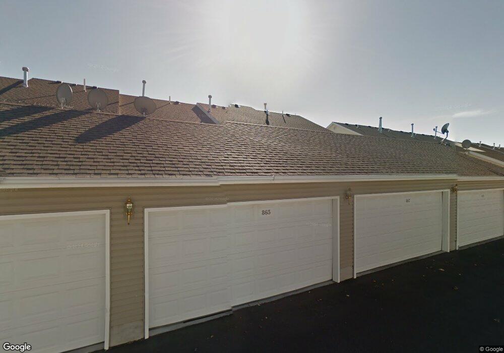
865 Liberty Ln Rexburg, ID 83440
Estimated Value: $268,000 - $282,000
3
Beds
2
Baths
1,270
Sq Ft
$216/Sq Ft
Est. Value
About This Home
This home is located at 865 Liberty Ln, Rexburg, ID 83440 and is currently estimated at $273,731, approximately $215 per square foot. 865 Liberty Ln is a home located in Madison County with nearby schools including Burton Elementary School, Kennedy Elementary School, and Madison Junior High School.
Ownership History
Date
Name
Owned For
Owner Type
Purchase Details
Closed on
Feb 12, 2021
Sold by
Parks Gary and Parks Jordan
Bought by
Parks Gary and Parks Jordan
Current Estimated Value
Home Financials for this Owner
Home Financials are based on the most recent Mortgage that was taken out on this home.
Original Mortgage
$82,229
Outstanding Balance
$67,353
Interest Rate
2.9%
Mortgage Type
FHA
Estimated Equity
$206,378
Purchase Details
Closed on
Oct 21, 2009
Sold by
The Bank Of New York Mellon
Bought by
Parks Gary L and Manning Jordan E
Create a Home Valuation Report for This Property
The Home Valuation Report is an in-depth analysis detailing your home's value as well as a comparison with similar homes in the area
Home Values in the Area
Average Home Value in this Area
Purchase History
| Date | Buyer | Sale Price | Title Company |
|---|---|---|---|
| Parks Gary | -- | Accommodation | |
| Parks Gary L | -- | -- |
Source: Public Records
Mortgage History
| Date | Status | Borrower | Loan Amount |
|---|---|---|---|
| Open | Parks Gary | $82,229 |
Source: Public Records
Tax History Compared to Growth
Tax History
| Year | Tax Paid | Tax Assessment Tax Assessment Total Assessment is a certain percentage of the fair market value that is determined by local assessors to be the total taxable value of land and additions on the property. | Land | Improvement |
|---|---|---|---|---|
| 2025 | $2,605 | $247,077 | $35,000 | $212,077 |
| 2024 | $2,605 | $257,734 | $35,000 | $222,734 |
| 2023 | $2,605 | $246,682 | $35,000 | $211,682 |
| 2022 | $3,065 | $244,459 | $35,000 | $209,459 |
| 2021 | $2,899 | $195,727 | $20,000 | $175,727 |
| 2020 | $2,416 | $172,215 | $20,000 | $152,215 |
| 2019 | $2,313 | $149,889 | $15,000 | $134,889 |
| 2018 | $2,190 | $125,139 | $15,000 | $110,139 |
| 2017 | $2,140 | $123,422 | $15,000 | $108,422 |
| 2016 | $2,081 | $123,422 | $15,000 | $108,422 |
| 2015 | $900 | $104,593 | $0 | $0 |
| 2013 | -- | $104,593 | $0 | $0 |
Source: Public Records
Map
Nearby Homes
- 880 Liberty Ln
- 871 Widdison Ln
- 758 Yost St
- 885 W Main St Unit Lot 2
- 354 Oaktrail Dr
- 410 Sunflower Rd
- TBD Titan Dr Unit LOT 9
- 576 Park St
- 571 Park St
- 562 Taurus Dr
- 616 Trejo St
- 530 Sunflower Rd
- 565 Pioneer Rd Unit 194
- 52 W Sunset Cir
- 575 Countryside Ave
- 596 Sunflower Rd Unit 596
- 517 W Main St
- 603 Countryside Ave
- 507 W Main St
- 2320 W 550 S
- 864 Georgetown Dr
- 863 Liberty Ln
- 867 Liberty Ln
- 876 Georgetown Dr
- 880 Georgetown Dr
- 884 Georgetown Dr
- 876 Georgetown Dr Unit 22
- 874 Georgetown Dr Unit 21
- 872 Georgetown Dr Unit 20
- 870 Georgetown Dr Unit 19
- 868 Georgetown Dr
- 860 Georgetown Dr
- 869 Liberty Ln
- 861 Liberty Ln
- 871 Liberty Ln
- 873 Liberty Ln
- 864 Liberty Ln
- 866 Liberty Ln
- 861 Parkside Dr
- 862 Liberty Ln