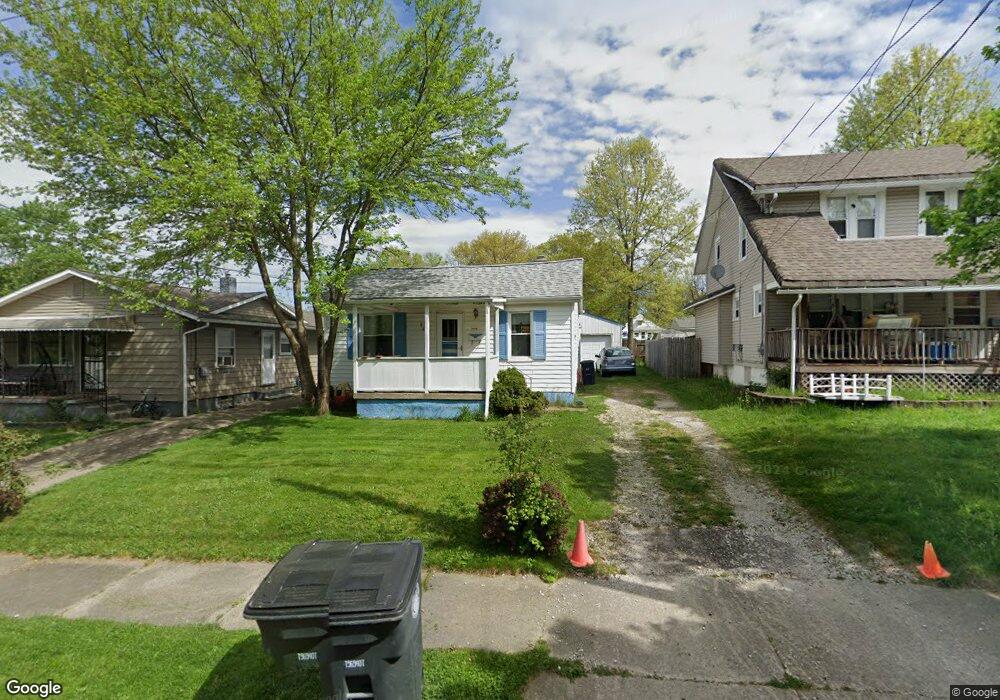
865 Reed Ave Akron, OH 44306
Firestone Park NeighborhoodEstimated Value: $84,998 - $109,000
About This Home
This home is located at 865 Reed Ave, Akron, OH 44306 and is currently estimated at $100,250, approximately $160 per square foot. 865 Reed Ave is a home located in Summit County with nearby schools including Glover Community Learning Center, Kenmore Garfield Community Learning Center, and Eagle Elementary.
Ownership History
We collect this data history from publicly available records. To have your information removed, we recommend requesting removal directly through your county’s website.
Purchase Details
Purchase Details
Purchase Details
Purchase Details
Purchase Details
Home Financials for this Owner
Home Financials are based on the most recent Mortgage that was taken out on this home.Home Values in the Area
Average Home Value in this Area
Purchase History
We collect this data history from publicly available records. To have your information removed, we recommend requesting removal directly through your county’s website.
| Date | Buyer | Sale Price | Title Company |
|---|---|---|---|
| $57,700 | Chicago Title Insurance Co | ||
| -- | Chicago Title Insurance Co | ||
| $9,450 | Chicago Title Insurance Co | ||
| $36,000 | Attorney | ||
| $41,397 | -- |
Mortgage History
We collect this data history from publicly available records. To have your information removed, we recommend requesting removal directly through your county’s website.
| Date | Status | Borrower | Loan Amount |
|---|---|---|---|
| Previous Owner | $41,397 |
Tax History
We collect this data history from publicly available records. To have your information removed, we recommend requesting removal directly through your county’s website.
| Year | Tax Paid | Tax Assessment Tax Assessment Total Assessment is a certain percentage of the fair market value that is determined by local assessors to be the total taxable value of land and additions on the property. | Land | Improvement |
|---|---|---|---|---|
| 2026 | $2,837 | $24,235 | $7,767 | $16,468 |
| 2024 | $1,350 | $24,235 | $7,767 | $16,468 |
| 2023 | $1,350 | $24,235 | $7,767 | $16,468 |
| 2021 | $1,092 | $15,177 | $4,568 | $10,609 |
| 2020 | $1,076 | $15,180 | $4,570 | $10,610 |
| 2019 | $1,102 | $14,150 | $4,300 | $9,850 |
| 2018 | $1,088 | $14,150 | $4,300 | $9,850 |
| 2017 | $1,247 | $14,150 | $4,300 | $9,850 |
| 2016 | $1,248 | $15,290 | $4,710 | $10,580 |
| 2015 | $1,247 | $15,290 | $4,710 | $10,580 |
| 2014 | $1,238 | $15,290 | $4,710 | $10,580 |
| 2013 | $1,413 | $18,090 | $4,710 | $13,380 |
Map
- 864 Lindsay Ave
- 833 Triplett Blvd
- 763 Lindsay Ave
- 942 E Archwood Ave
- 1169 Ada St
- 944 Donald Ave
- 961 Wyley Ave
- 1035 E Archwood Ave
- 1041 E Archwood Ave
- 1054 Merton Ave
- 1246 Allendale Ave
- 626 E Wilbeth Rd
- 682 Barbara Ave
- 910 Ardella Ave
- 970 Hunt St
- 844 Ardella Ave
- 887 Hunt St
- 715 E Catawba Ave
- 924 Concord Ave
- 687 E Catawba Ave
Ask me questions while you tour the home.