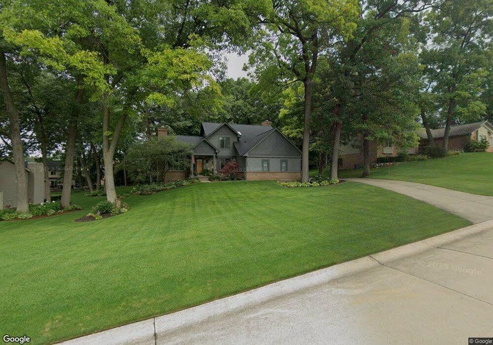
8652 Hancock Dr White Lake, MI 48386
Estimated Value: $463,613 - $507,000
3
Beds
3
Baths
2,350
Sq Ft
$204/Sq Ft
Est. Value
About This Home
This home is located at 8652 Hancock Dr, White Lake, MI 48386 and is currently estimated at $480,403, approximately $204 per square foot. 8652 Hancock Dr is a home located in Oakland County with nearby schools including Clifford H. Smart Middle School, Walled Lake Northern High School, and Lakecrest Baptist School.
Ownership History
Date
Name
Owned For
Owner Type
Purchase Details
Closed on
Jul 21, 2006
Sold by
Burns Douglas S and Burns Leslie A
Bought by
Randall Rodney R and Randall Amy A
Current Estimated Value
Home Financials for this Owner
Home Financials are based on the most recent Mortgage that was taken out on this home.
Original Mortgage
$65,800
Interest Rate
6.82%
Mortgage Type
Stand Alone Second
Create a Home Valuation Report for This Property
The Home Valuation Report is an in-depth analysis detailing your home's value as well as a comparison with similar homes in the area
Home Values in the Area
Average Home Value in this Area
Purchase History
| Date | Buyer | Sale Price | Title Company |
|---|---|---|---|
| Randall Rodney R | $329,000 | None Available |
Source: Public Records
Mortgage History
| Date | Status | Borrower | Loan Amount |
|---|---|---|---|
| Closed | Randall Rodney R | $65,800 | |
| Open | Randall Rodney R | $263,200 |
Source: Public Records
Tax History Compared to Growth
Tax History
| Year | Tax Paid | Tax Assessment Tax Assessment Total Assessment is a certain percentage of the fair market value that is determined by local assessors to be the total taxable value of land and additions on the property. | Land | Improvement |
|---|---|---|---|---|
| 2024 | $2,607 | $195,230 | $0 | $0 |
| 2023 | $2,458 | $177,170 | $0 | $0 |
| 2022 | $4,003 | $165,060 | $0 | $0 |
| 2021 | $4,515 | $156,180 | $0 | $0 |
| 2020 | $2,430 | $151,120 | $0 | $0 |
| 2019 | $4,376 | $146,120 | $0 | $0 |
| 2018 | $4,305 | $140,050 | $0 | $0 |
| 2017 | $4,293 | $140,050 | $0 | $0 |
| 2016 | $4,318 | $136,020 | $0 | $0 |
| 2015 | -- | $126,310 | $0 | $0 |
| 2014 | -- | $109,380 | $0 | $0 |
| 2011 | -- | $102,250 | $0 | $0 |
Source: Public Records
Map
Nearby Homes
- 427 Rosario Ln
- 8993 Haymarket St
- 785 Akehurst Ln
- 700 Ander Ln Unit 88
- 00 Union Lake Rd
- 8110 High Point Trail
- 837 Preserve Ln
- 8962 Glasgow Dr
- 8341 Sharon Dr
- 891 Preserve Ln
- 8165 Sequoia Ln Unit 92
- 915 Preserve Ln
- 193 Coppice Way
- 900 Preserve Ln
- 8637 Brazos Ct
- 8363 Capstone Dr
- 315 Tower Rd
- 165 Lisa Ct
- 9145 Mandon Rd
- 0000 Williams Lake Rd
- 8656 Hancock Dr
- 8648 Hancock Dr
- 441 Rosario Ln
- 437 Rosario Ln
- 449 Rosario Ln
- 8644 Hancock Dr
- 434 Newport Cir
- 433 Rosario Ln
- 8655 Hancock Dr
- 8647 Hancock Dr
- 8651 Hancock Dr
- 8659 Hancock Dr
- 430 Newport Cir
- 8641 Hancock Dr
- 8640 Hancock Dr
- 465 Rosario Ln
- 440 Rosario Ln
- 427 Newport Cir
- 436 Rosario Ln
- 423 Rosario Ln